Below is a complete listing of all Ohio Historical Markers. To find a detailed marker listing including text, photographs, and locations, click on a county below. Our listing is updated by the markers program as new markers are installed and older markers are reported damaged or missing.
ALERT: This marker was inadvertently given a non-Belmont County number, 15-17. It SHOULD be 15-7.
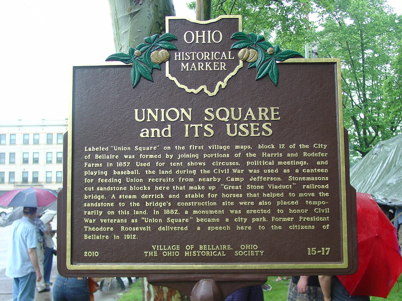
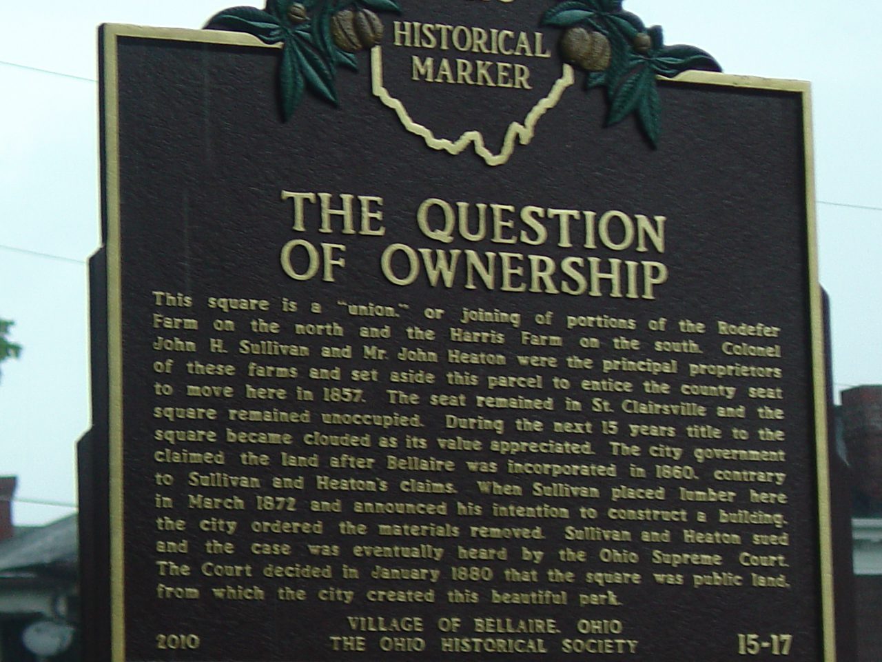
15-7 Union Square and Its Uses / The Question of Ownership
Side A: Labeled “Union Square” on the first village maps, block 12 of the City of Bellaire was formed by joining portions of the Harris and Rodefer Farms in 1857. Used for tent shows, circuses, political meetings, and playing baseball, the land during the Civil War was used as a canteen for feeding Union recruits from nearby Camp Jefferson. Stonemasons cut sandstone blocks here that make up “Great Stone Viaduct” railroad bridge. A steam derrick and stable for horses that helped to move the sandstone to the bridge’s construction site were also placed temporarily on this land. In 1882, a monument was erected to honor Civil War veterans as “Union Square” became a city park. Former President Theodore Roosevelt delivered a speech here to the citizens of Bellaire in 1912.
Side B: This square is a “union,” or joining of portions of the Rodefer Farm on the north and the Harris Farm on the south. Colonel John H. Sullivan and Mr. John Heaton were the principal proprietors of these farms and set aside this parcel to entice the county seat to move here in 1857. The seat remained in St. Clairsville and the square remained unoccupied. During the next 15 years title to the square became clouded as its value appreciated. The city government claimed the land after Bellaire was incorporated in 1860, contrary to Sullivan and Heaton’s claims. When Sullivan placed lumber here in March 1872 and announced his intention to construct a building, the city ordered the materials removed. Sullivan and Heaton sued and the case was eventually heard by the Ohio Supreme Court. The Court decided in January 1880 that the square was public land, from which the city created this beautiful park.