Below is a complete listing of all Ohio Historical Markers. To find a detailed marker listing including text, photographs, and locations, click on a county below. Our listing is updated by the markers program as new markers are installed and older markers are reported damaged or missing.
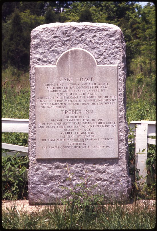
Side A: Fulfilling President George Washington’s desire to “open wide the gates of the West,” in 1796 Congress authorized the Zane brothers of Fort Henry (at present day Wheeling) to clear a path through the dense woods of Appalachian Ohio. Zane’s Trace cut through the forests of eleven counties, reaching the Ohio River at Aberdeen, across from Limestone (now Maysville), Kentucky. The trail roughly follows the routes of U.S. 22 and 40 to Lancaster, S. R. 159 to Chillicothe, U.S. 50 to Bainbridge, and S. R. 41 to Aberdeen.
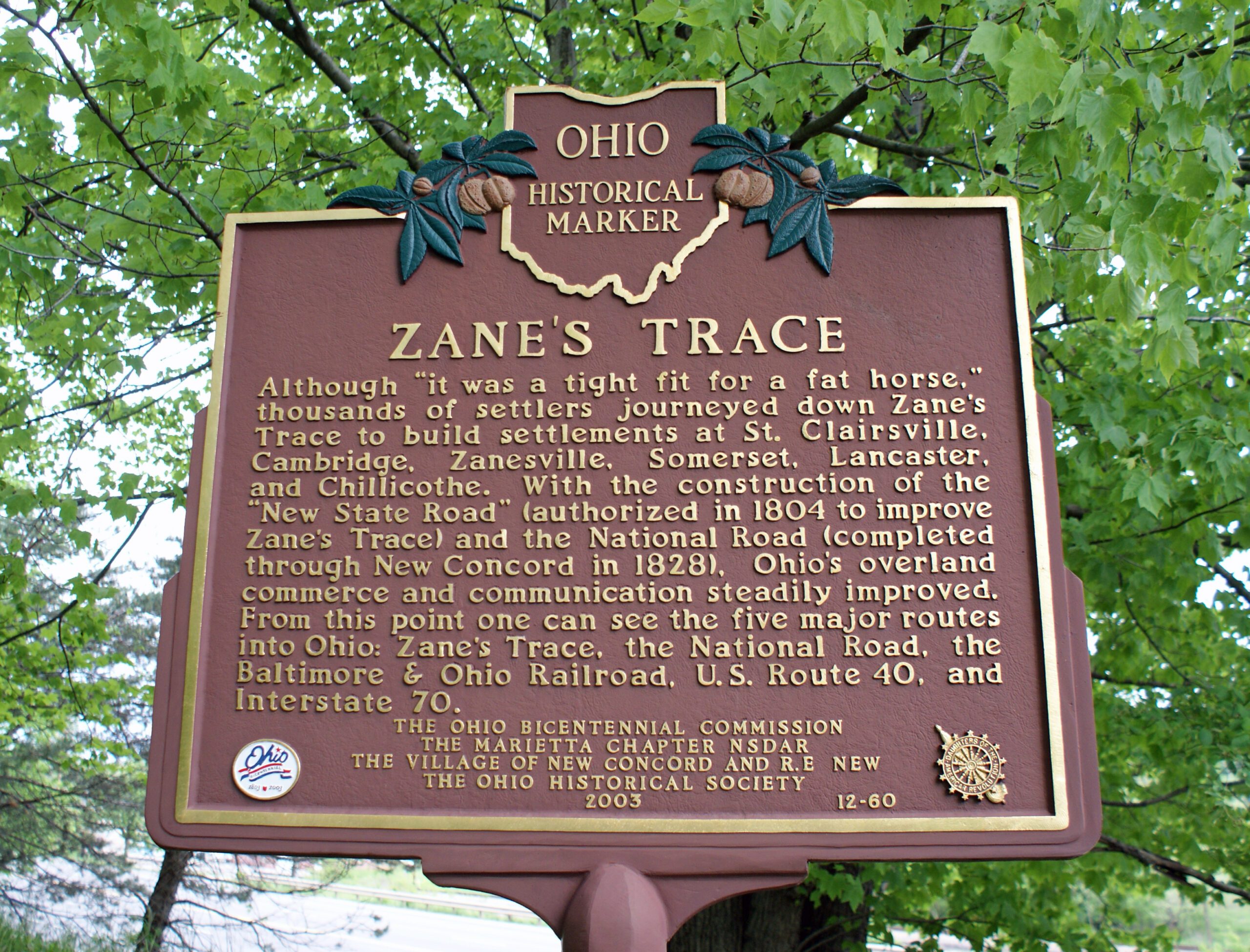
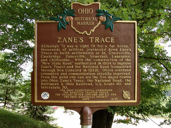
Side B: Although “it was a tight fit for a fat horse,” thousands of settlers journeyed down Zane’s Trace to build settlements at St. Clairsville, Cambridge, Zanesville, Somerset, Lancaster, and Chillicothe. With the construction of the “New State Road” (authorized in 1804 to improve Zane’s Trace) and the National Road (completed through New Concord in 1828), Ohio’s overland commerce and communication steadily improved. From this point one can see the five major routes into Ohio: Zane’s Trace, the National Road, the Baltimore & Ohio Railroad, U.S. Route 40, and Interstate 70.