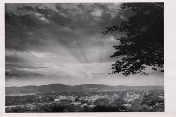
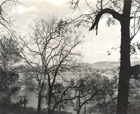
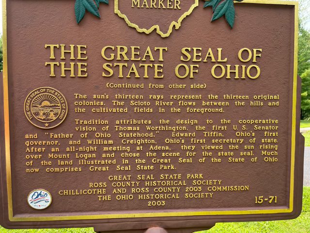
Side A: The hills before you were inspiration for the design of The Great Seal of the State of Ohio. The seal, first depicted in 1803, was often reconfigured until the present image was sanctioned by the Ohio General Assembly in 1967 and modified in 1996. In 1803 the law prescribed the sheaf of wheat to represent Ohio’s agricultural roots and the bundle of seventeen arrows to symbolize Ohio’s place as the seventeenth state in the Union. In the background is a range of hills, including Mount Logan, as viewed from Thomas Worthington’s estate, Adena, now a state memorial. (continued from other side)
Side B: (continued from other side) The sun’s thirteen rays represent the thirteen original colonies. The Scioto River flows between the hills and the cultivated fields in the foreground. Tradition attributes the design to the cooperative vision of Thomas Worthington, the first U.S. Senator and “Father of Ohio Statehood,” Edward Tiffin, Ohio’s first governor, and William Creighton, Ohio’s first secretary of state. After an all-night meeting at Adena, they viewed the sun rising over Mount Logan and chose the scene for the state seal. Much of the land illustrated in the Great Seal of the State of Ohio now comprises Great Seal State Park.
Sponsors: Great Seal State Park, Ross County Historical Society, Chillicothe and Ross County 2003 Commission, and The Ohio Historical Society