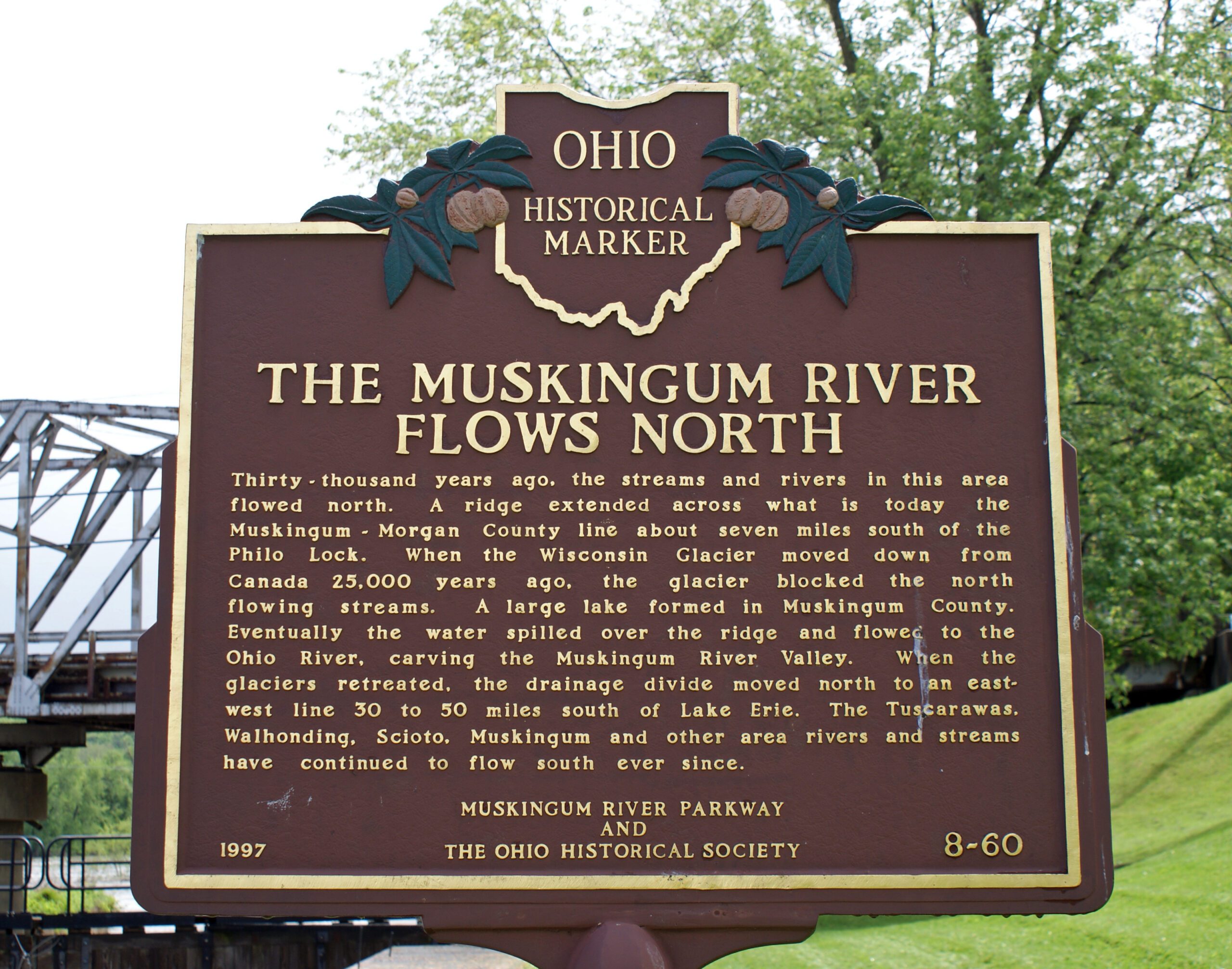
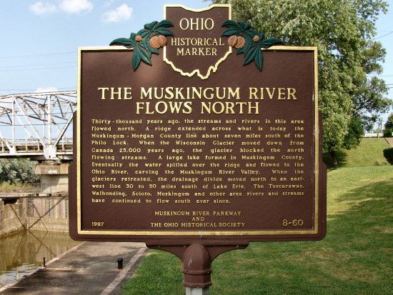
Side A: Thirty-thousand years ago, the streams and rivers in this area flowed north. A ridge extended across what is today the Muskingum-Morgan County line about seven miles south of the Philo Lock. When the Wisconsin Glacier moved down from Canada 25,000 years ago, the glacier blocked the north flowing streams. A large lake formed in Muskingum County. Eventually the water spilled over the ridge and flowed to the Ohio River, carving the Muskingum River Valley. When the glaciers retreated, the drainage divide moved north to an east-west line 30 to 50 miles south of Lake Erie. The Tuscarawas, Walhonding, Scioto, Muskingum and other area rivers and streams have continued to flow south ever since.