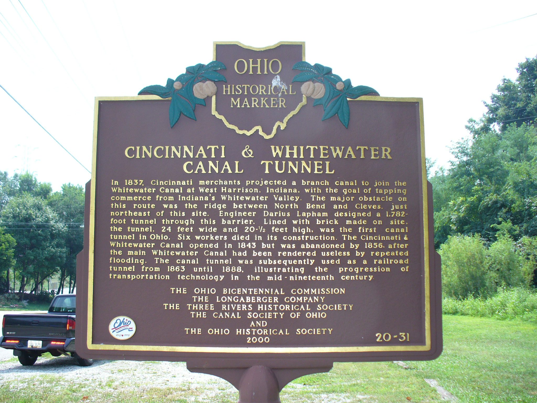
Side A: In 1837, Cincinnati merchants projected a branch canal to join the Whitewater Canal at West Harrison, Indiana, with the goal of tapping commerce from Indiana’s Whitewater Valley. The major obstacle on this route was the ridge between North Bend and Cleves, just northeast of this site. Engineer Darius Lapham designed a 1,782-foot tunnel though this barrier. Lined with brick made on site, the tunnel, 24 feet wide and 20 1/2 feet high, was the first canal tunnel in Ohio. Six workers died in its construction. The Cincinnati & Whitewater Canal opened in 1843 but was abandoned by 1856, after the main Whitewater Canal had been rendered useless by repeated flooding. The canal tunnel was subsequently used as a railroad tunnel from 1863 until 1888, illustrating the progression of transportation technology in the mid-nineteenth century.
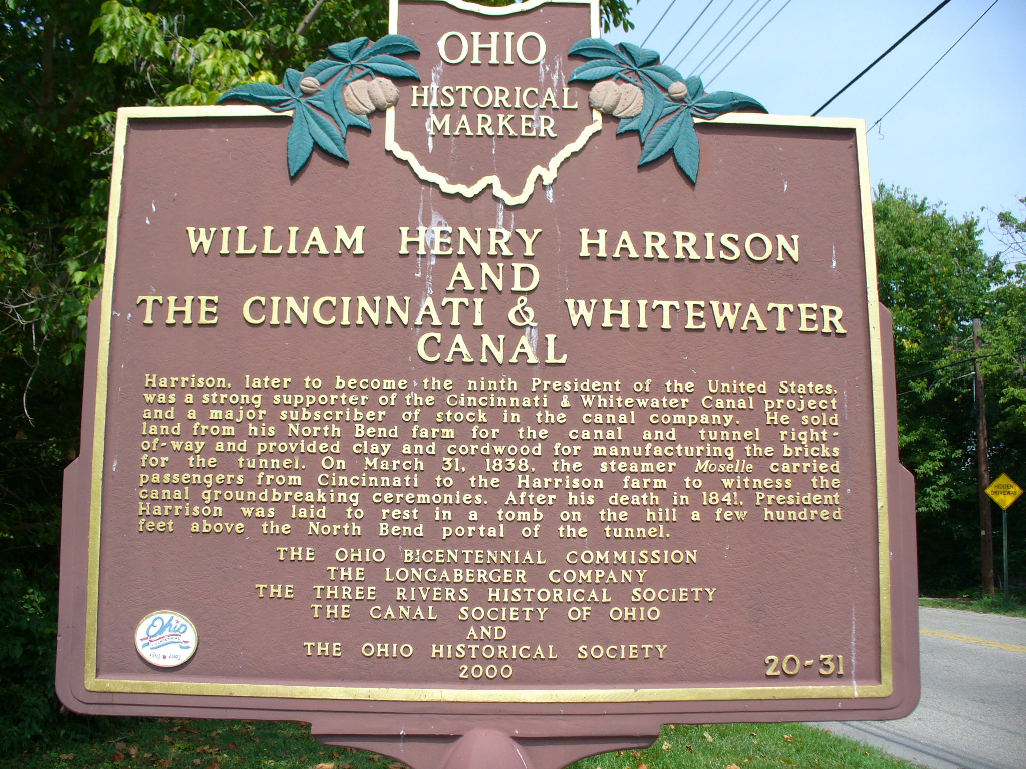
Side B: Harrison, later to become the ninth President of the United States, was a strong supporter of the Cincinnati & Whitewater Canal project and a major subscriber of stock in the canal company. He sold land from his North Bend farm for the canal and tunnel right-of-way and provided clay and cordwood for manufacturing the bricks for the tunnel. On March 31, 1838, the steamer Moselle carried passengers from Cincinnati to the Harrison farm to witness the canal groundbreaking ceremonies. After his death in 1841, President Harrison was laid to rest in a tomb on the hill a few hundred feet above the North Bend portal of the tunnel.
Sponsors: Ohio Bicentennial Commission, The Longaberger Company, Paulding County Board of Commissioners, and The Ohio Historical Society