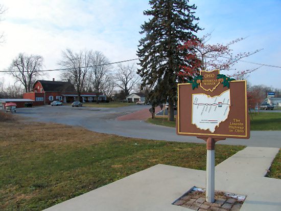
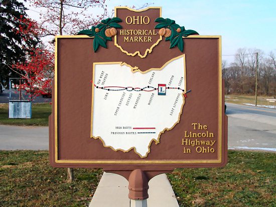
Side A: Conceived by leaders of the automobile industry to encourage the building of “good roads,” the Lincoln Highway was established in 1913 as the first transcontinental automobile route in the United States. It traversed twelve states and 3,389 miles from New York to San Francisco. The first route across Ohio connected Van Wert, Delphos, Lima, Ada, Upper Sandusky, Bucyrus, Galion, Mansfield, Ashland, Wooster, Massillon, Canton, Minerva, Lisbon, and East Liverpool. By the 1930s much of the original route had become part of the Federal Highway System and U.S. Route 30–many miles of which have, in turn, been bypassed by modern four-lane highways.
Sponsors: Ohio Bicentennial Commission, The Longaberger Company, The Ohio Lincoln Highway League, and The Ohio Historical Society