Below is a complete listing of all Ohio Historical Markers. To find a detailed marker listing including text, photographs, and locations, click on a county below. Our listing is updated by the markers program as new markers are installed and older markers are reported damaged or missing.
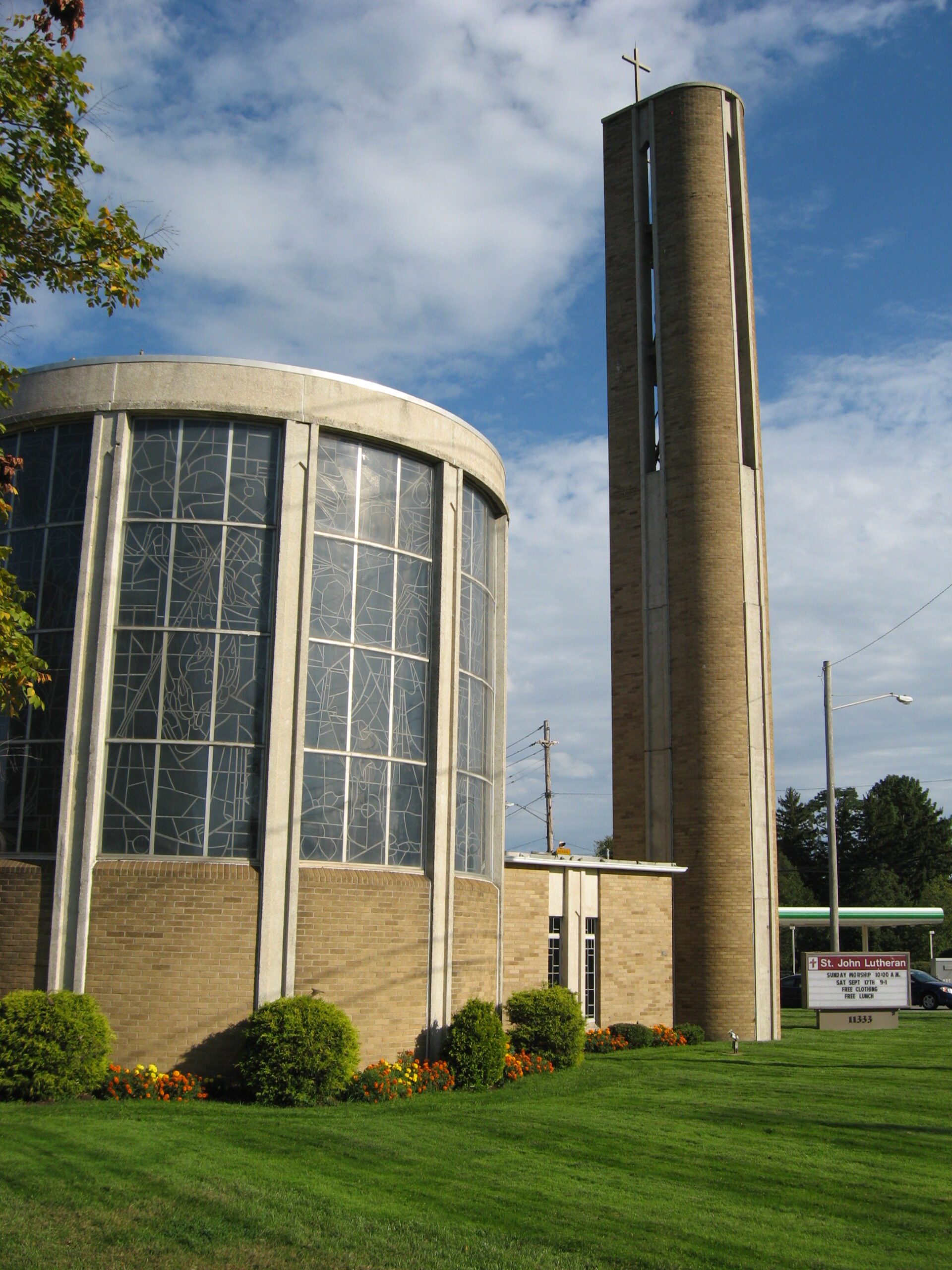
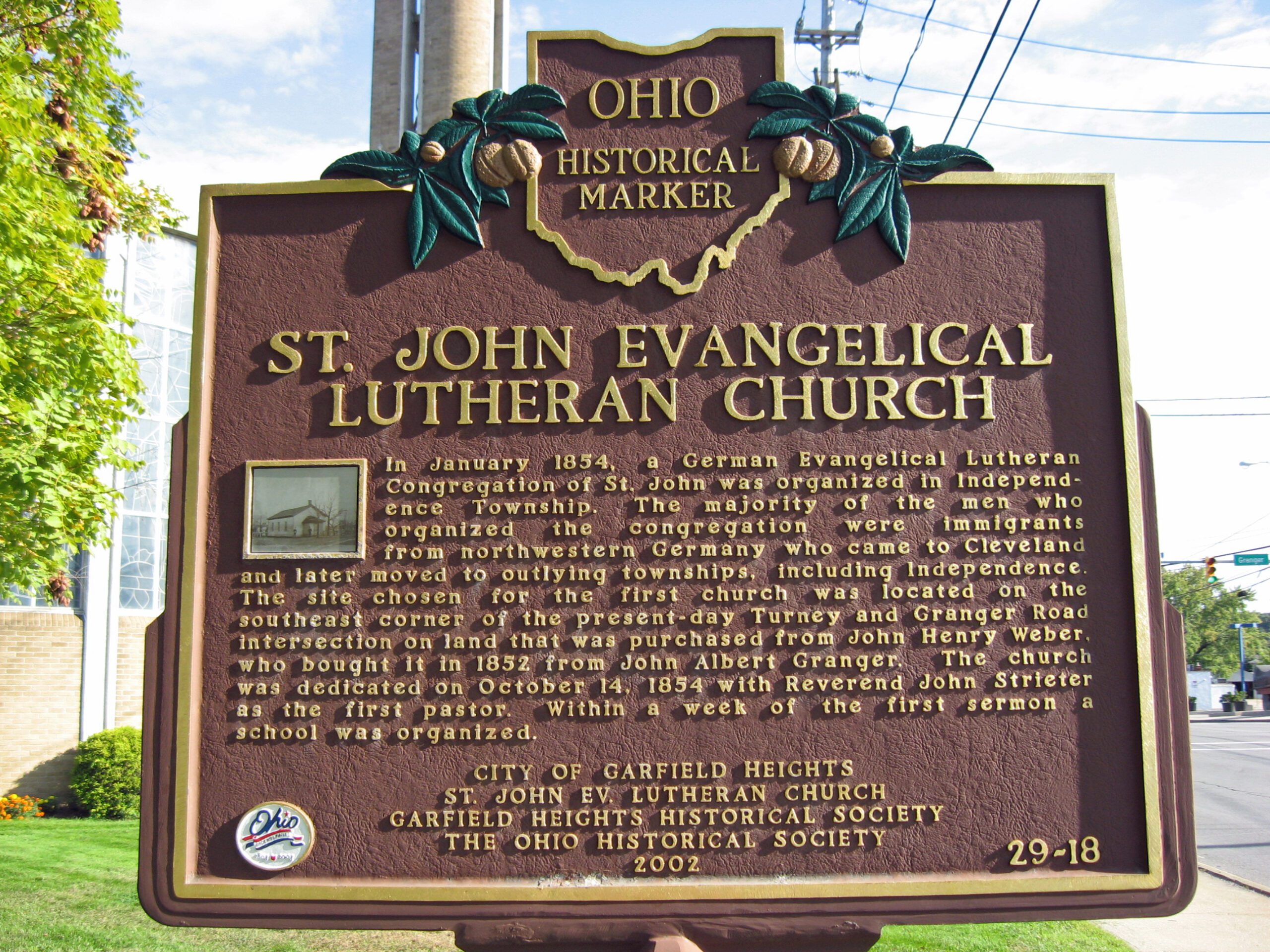
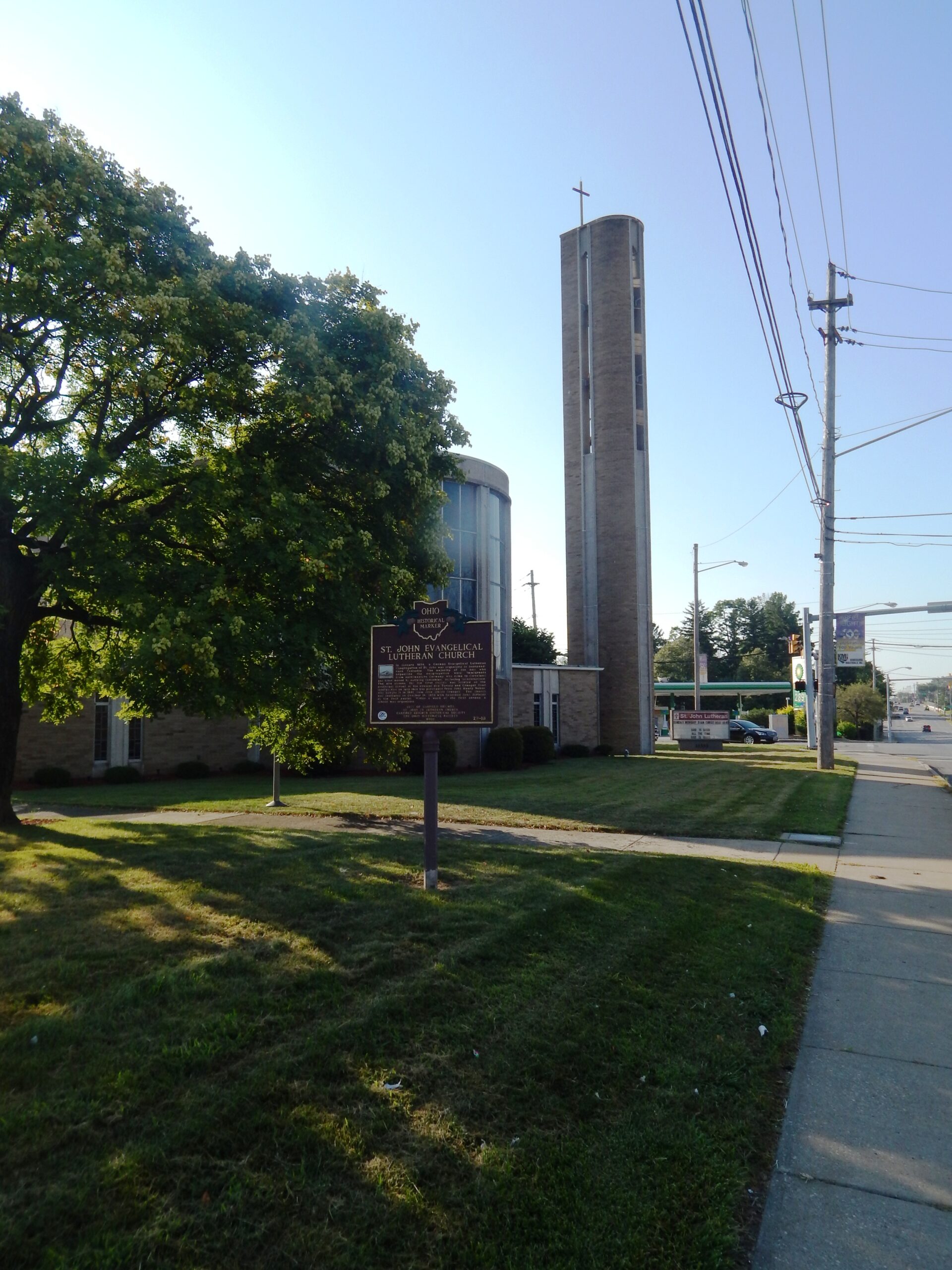
29-18 German Corners / St. John Evangelical Lutheran Church
Side A: The intersection of Turney and Granger Roads, called German Corners in the 1800s, later became known as South Newburgh Centre. At its earliest Turney Road was known as State Road and then Fisher Road. Finally, it was named for Joseph Turney, area resident and two-term treasurer of the state of Ohio. Granger Road was named after John Albert Granger, a major pioneer landowner in the area and the third son of Gideon Granger, an original investor in the Connecticut Land Company and U. S. Postmaster General under Presidents Thomas Jefferson and James Madison. Located here are St. John Lutheran Church, school and cemetery, established by German settlers that settled this farm community. Nearby is the Garfield Heights Historical Society Museum in a house built in 1890 for the German teachers.
Side B: In January 1854, a German Evangelical Lutheran Congregation of St. John was organized in Independence Township. The majority of the men who organized the congregation were immigrants from northwestern Germany who came to Cleveland and later moved to outlying townships, including Independence. The site chosen for the first church was located on the southeast corner of the present-day Turney and Granger Road intersection on land that was purchased from John Henry Weber, who bought it in 1852 from John Albert Granger. The church was dedicated on October 14, 1854 with Reverend John Strieter as the first pastor. Within a week of the first sermon a school was organized.