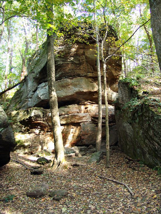
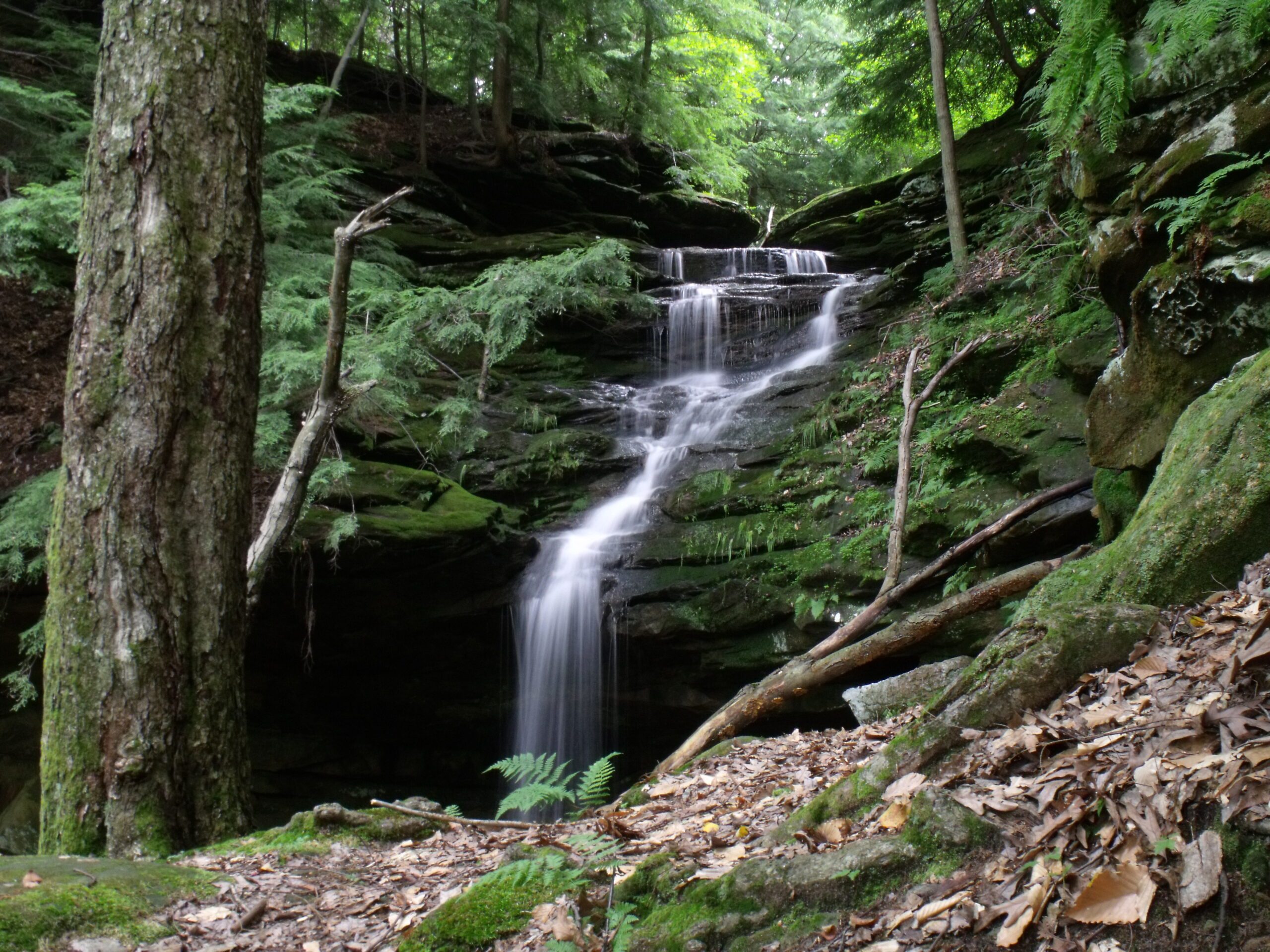
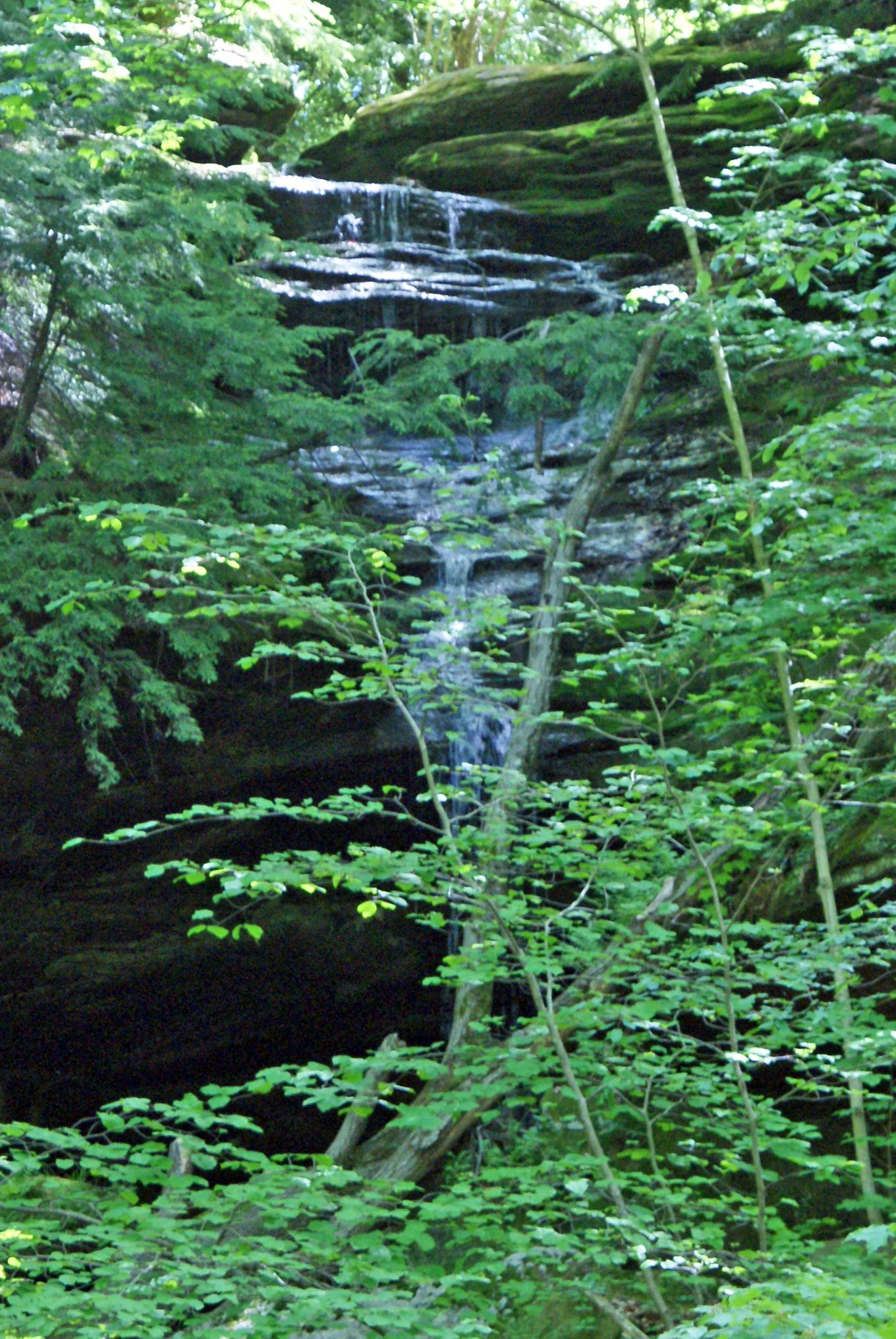
Side A: Hemlock Falls is located nearby. Two small streams cascade down the face of the massive sandstone cliff in the shade of tall hemlock trees. One of the falls drops about 60 feet and the other about 100 feet. The rock is Black Hand Sandstone deposited in the deltas along the great salt-water sea during the Mississippian Period about 350 million years ago. The cliffs were created later and were produced by erosion along the side of the valley of the ancient pre-glacial Groveport River. One large slump block, which has separated from the rock wall by weathering, may be the largest in Ohio. Plants more typical of the Appalachian Plateau and rare to Richland County can be found in this area. The ecosystem is typical of that found at the past edge of a glacier.
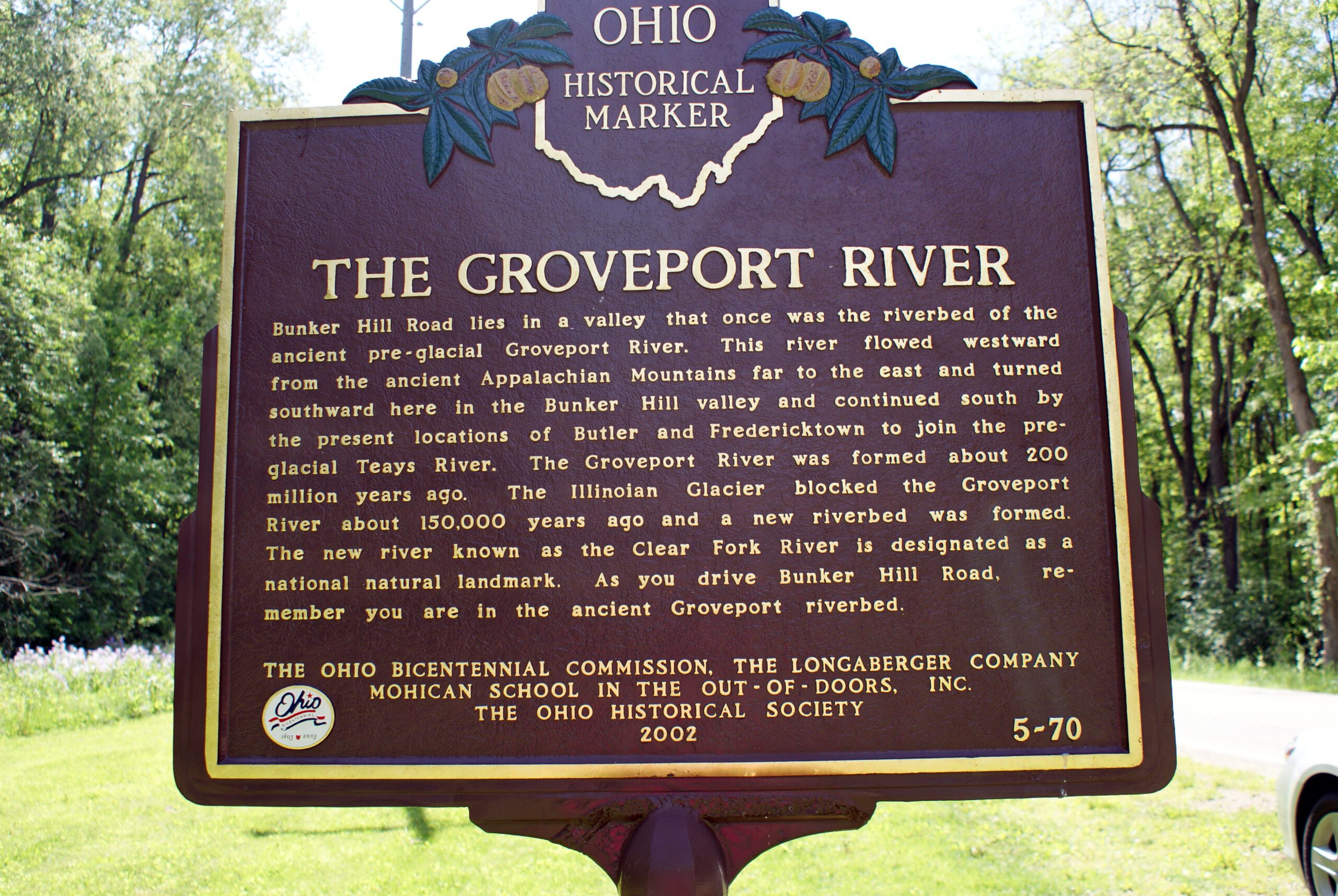
Side B: Bunker Hill Road lies in a valley that once was the riverbed of the ancient pre-glacial Groveport River. This river flowed westward from the ancient Appalachian Mountains far to the east and turned southward here in the Bunker Hill valley and continued south by the present locations of Butler and Fredericktown to join the pre-glacial Teays River. The Groveport River was formed about 200 million years ago. The Illinoian Glacier blocked the Groveport River about 150,000 years ago and a new riverbed was formed. The new river known as the Clear Fork River is designated as a national natural landmark. As you drive Bunker Hill Road, remember you are in the ancient Groveport riverbed.
Sponsors: Ohio Bicentennial Commission, The Longaberger Company, Mohican School in the Out-of-Doors, Inc., and The Ohio Historical Society