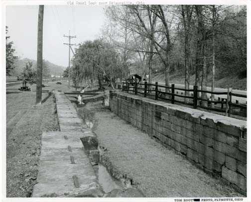
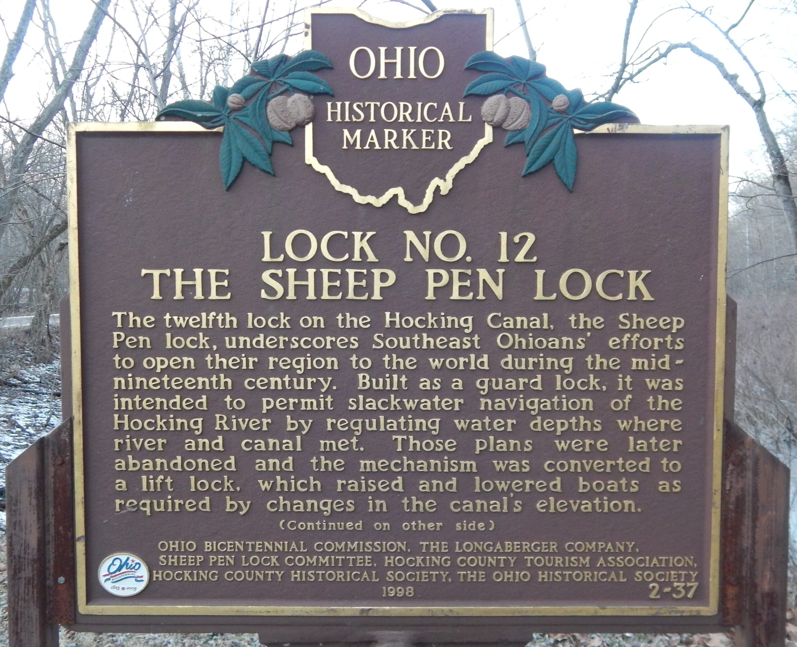
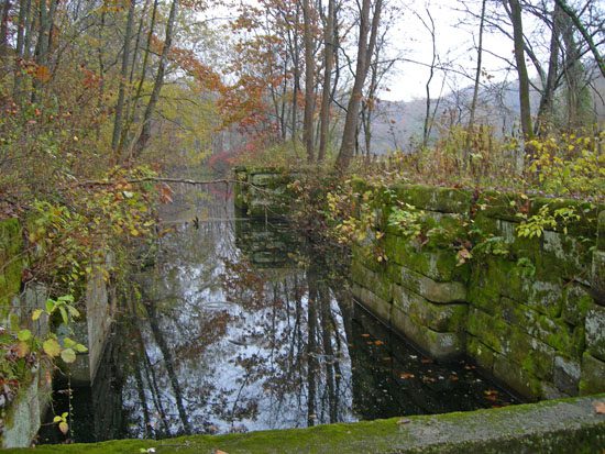
Side A: The twelfth lock on the Hocking Canal, the Sheep Pen lock underscores Southeast Ohioans’ efforts to open their region to the world during the mid-nineteenth century. Built as a guard lock, it was intended to permit slackwater navigation of the Hocking River by regulating water depths where river and canal met. Those plans were later abandoned and the mechanism was converted to a lift lock, which raised and lowered boats as required by changes in the canal’s elevation. (Continued on other side)
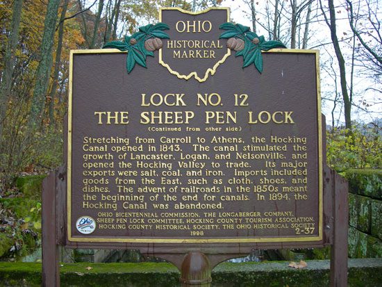
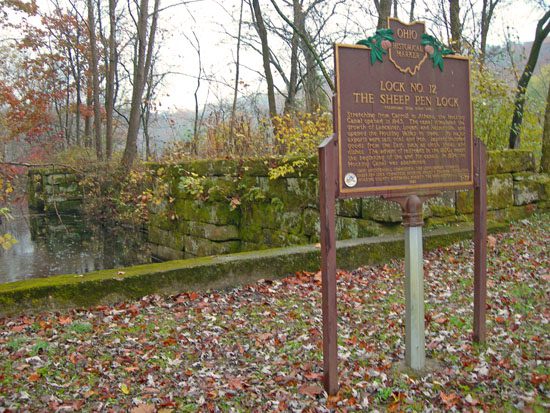
Side B: (Continued from other side) Stretching from Carroll to Athens, the Hocking Canal opened in 1843. The canal stimulated the growth of Lancaster, Logan, and Nelsonville, and opened the Hocking Valley to trade. Its major exports were salt, coal, and iron. Imports included goods from the East, such as cloth, shoes, and dishes. The advent of railroads in the 1850s meant the beginning of the end for canals. In 1894, the Hocking Canal was abandoned.
Sponsors: Ohio Bicentennial Commission, The Longaberger Company, Sheep Pen Lock Committee, Hocking County Tourism Association, Hocking County Historical Society, and The Ohio Historical Society