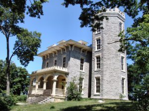
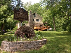
Completed in 1865, this home was the vacation retreat of Jay Cooke and his family. Known as the “financier” for the Union states during the Civil War, Cooke organized a program to sell millions of dollars worth of bonds to support the war effort. The house is of a high Victorian Italianate mode with a Gothic style tower topped with crenellations. Distinctive hood moldings outline windows and over-scaled and ornamental brackets support crowning cornices. The house, commonly known as Cooke Castle, hosted many notables of the time, including William T. Sherman, William Howard Taft, Rutherford B. Hayes, Salmon Chase, and John Brown, Jr. Born in Sandusky in 1821, Cooke, an avid fisherman, acquired the island for $3,001 in 1864. University trustee Julius Stone gave the island to The Ohio State University in 1925. The house was placed on the National Register of Historic Landmarks in 1966.
In 1795, at the age of 23, Jeremiah Morrow came to the Northwest Territory from Pennsylvania. He purchased land along the Little Miami River in Deerfield Township and in 1799 married Mary Parkhill of Pennsylvania. Around 1800 he built this barn which is one of Warren County’s oldest standing structures. In 1801, Morrow was sent to the Second Territorial Assembly and to the first Ohio Constitutional Convention in 1802. In 1803, he was elected the new state’s first U. S. Congressman and was Ohio’s only congressman for ten years. In 1813 the Ohio legislature elevated him to U.S. Senate. In 1822 he became Ohio’s ninth governor. He went on to serve in both the Ohio House and Senate and at age 69 returned to Congress. An extraordinary man, Jeremiah Morrow gave his country 43 years of public service.
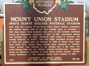
Built with the support of the Mount Union Alumni Athletic Association, the stadium played host to its first football game on November 1, 1913 when Mount Union defeated Case 7-0. It was formally dedicated during the graduation ceremony of 1914. In 1915, grandstand seating was erected and, in 1928, bleachers were added to increase the seating capacity to 5,000. The first night collegiate football game in Ohio was played here on October 3, 1930 as Mount Union beat Kent State 18-6. Mount Union athletes have competed in football, track, soccer, and lacrosse in the stadium and it has been the home playing field for the Alliance Aviators football team. Originally known as Hartshorn Stadium to honor Mount Union’s founder, Orville Nelson Hartshorn, it was renamed Mount Union Stadium in 1984.
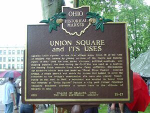
Labeled “Union Square” on the first village maps, block 12 of the City of Bellaire was formed by joining portions of the Harris and Rodefer Farms in 1857. Used for tent shows, circuses, political meetings, and playing baseball, the land during the Civil War was used as a canteen for feeding Union recruits from nearby Camp Jefferson. Stonemasons cut sandstone blocks here that make up “Great Stone Viaduct” railroad bridge. A steam derrick and stable for horses that helped to move the sandstone to the bridge’s construction site were also placed temporarily on this land. In 1882, a monument was erected to honor Civil War veterans as “Union Square” became a city park. Former President Theodore Roosevelt delivered a speech here to the citizens of Bellaire in 1912.
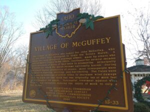
The Village of McGuffey was named for John McGuffey, who in the 1860s first attempted to drain the Scioto Marsh. A larger and more effective drainage effort, made by others who entered Hardin County in the 1880s, continued for several decades until thousands of acres of land were in production, principally of onions for which the marsh became nationally known. During the era of highest production of onions, most townspeople were involved in planting, weeding, and harvesting. The fields were bordered by windrows of willow trees to decrease wind damage over the black silt-like muck that was originally ten or more feet deep throughout the marsh. Successful treatment against wind erosion and oxidation reduced the depth of muck to only a few inches.
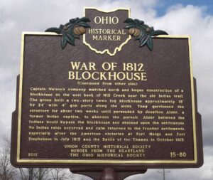
Following the American surrender of Fort Detroit in August 1812, panic spread along the Ohio frontier in fear of possible Indian attacks. The boundary of the Indian territory lay approximately 14 miles to the north at the Greenville Treaty line. Ohio Governor Return Jonathan Meigs, Jr. called out the Ohio Militia to defend the frontier and to construct blockhouses to guard against Indian attacks. A local militia company of 70 men was raised in present Union and Madison Counties to protect the settlements along Big Darby Creek. David Watson served as captain with Frederick Lloyd as first lieutenant.
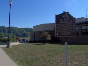
An influential American journalist of the late nineteenth century, Ambrose Bierce (1842 – c. 1914) was born in Meigs County and reared in Kosciusko County, Indiana. He fought in the Union Army during the Civil War, a formative experience related in his short stories “Chickamauga” and “An Occurrence at Owl Creek Bridge.” Moving to San Francisco in the years after the war, he began his career as a writer and newspaper columnist. His cynical wit and elaborate puns reached a wide audience during the last quarter of the nineteenth century through such papers as William Randolph Hearst’s San Francisco Examiner. Bierce’s best-known book, the Devil’s Dictionary (1911), is a lexicon of humorous definitions first published in his newspaper columns. In December 1913 or January 1914, Bierce vanished during travels in rebellion-torn Mexico.
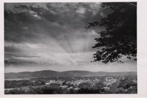
The hills before you were inspiration for the design of The Great Seal of the State of Ohio. The seal, first depicted in 1803, was often reconfigured until the present image was sanctioned by the Ohio General Assembly in 1967 and modified in 1996. In 1803 the law prescribed the sheaf of wheat to represent Ohio’s agricultural roots and the bundle of seventeen arrows to symbolize Ohio’s place as the seventeenth state in the Union. In the background is a range of hills, including Mount Logan, as viewed from Thomas Worthington’s estate, Adena, now a state memorial. (continued from other side)