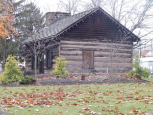
This log building was constructed in 1801 by David Hoge on the west side of Third Street. It served as his home and was the first Federal land office in that part of the Northwest Territory known as the Seven Ranges. In 1809 it was moved and 12 years later encased in a brick structure where it was discovered in 1940. It has been preserved by the citizens of Jefferson County.
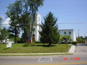
Founded in 1797 in the log cabin of the Reverend Francis McCormick, the Milford Methodist Church is the oldest of the denomination in the Northwest Territory and Ohio. Pioneer worshipers walked many miles through the wilderness to attend its circuit rider services. The present sanctuary was consecrated on Christmas Day, 1835. The bell tower and Sunday School rooms were 1870 additions.
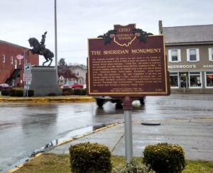
The Sheridan monument was erected by and given to the Village of Somerset by the State of Ohio in 1905 to honor the memory of Somerset’s General Phillip Henry Sheridan. “Little Phil” was raised in Somerset and graduated from the United States Military Academy in 1852. He rendered valuable service to the Federal Army in the Civil War at Stone’s River, Missionary Ridge, Yellow Tavern, Winchester, Cedar Creek, Five Forks, and Appomattox. He later commanded in the West and became General of the Army in 1883, received his fourth star, and died in 1888. The heroic sculpture, created by Carl Heber of New York, portrays “Sheridan’s Ride” to Winchester. Somerset citizens paid for the granite base through a children’s “penny fund.”
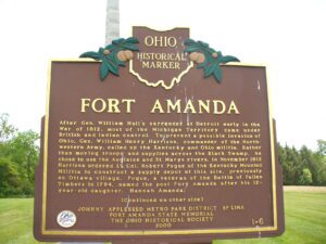
Fort Amanda State Memorial, OH 198, 1/4 mile S of Ft. Amanda Road, Lima
Lima
, OH
After Gen. William Hull’s surrender at Detroit early in the War of 1812, most of the Michigan Territory came under British and Indian control. To prevent a possible invasion of Ohio, Gen. William Henry Harrison, commander of the Northwestern Army, called up the Kentucky and Ohio militia. Rather than moving troops and supplies across the Black Swamp, he chose to use the Auglaize and St. Marys rivers. In November 1812 Harrison ordered Lt. Col. Robert Pogue of the Kentucky Mounted Militia to construct a supply depot at this site, previously an Ottawa village. Pogue, a veteran of the Battle of Fallen Timbers in 1794, named the post Fort Amanda after his 12-year-old daughter, Hannah Amanda. (continued on other side)
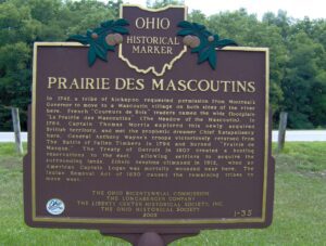
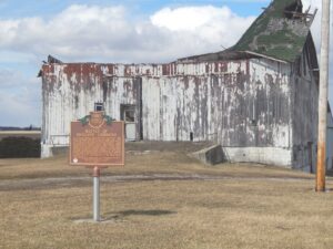
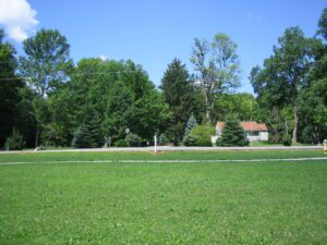
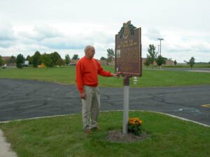
In 1742, a tribe of Kickapoo requested permission from Montreal’s Governor to move to a Mascoutin village on both sides of the river here. French “Coureurs de Bois” traders named the wide floodplain “La Prairie des Mascoutins” (The Meadow of the Mascoutin). In 1764, Captain Thomas Morris explored this newly acquired British territory, and met the prophetic dreamer Chief Katapelleecy here. General Anthony Wayne’s troops victoriously returned from The Battle of Fallen Timbers in 1794 and burned “Prairie de Masque.” The Treaty of Detroit in 1807 created a hunting reservation to the east, allowing settlers to acquire the surrounding lands. Ethnic tensions climaxed in 1812, when an American Captain Logan was mortally wounded near here. The Indian Removal Act of 1830 caused the remaining tribes to move west.
The Northwest Ordinance of 1787 defined the boundary of the northern and southern tier of states to be carved out of the Northwest Territory, as a line drawn east from the southernmost tip of Lake Michigan until it intersects Lake Erie. Controversy over the exact location of that line led to the 1834-1837 boundary dispute between the State of Ohio and Michigan Territory. Passions ran high as everyone on both sides of the boundary knew that a great port city (Toledo) would emerge in the disputed territory. President Andrew Jackson settled the dispute in 1836 when he signed an act that recognized the current border between Ohio and Michigan, giving Michigan 9,000 square miles of Upper Peninsula land and awarding the disputed strip of approximately 470 square miles to Ohio. Michigan then joined the nation as a state the following year.
Regular and militia troops under General James Wilkinson built this supply post and defensive fortification in March 1792 in preparation for Gen. “Mad Anthony” Wayne’s campaign against the Indians of the Northwest Territory, following disastrous expeditions in 1790 and 1791. Built near a “fine spring gushing out of the bank, ” the 120-foot square palisade fort had a four-sided bastion at each corner. Future U.S. president William Henry Harrison served in the detachment that built the fort. On November 6, 1792, Miami Chief Little Turtle and approximately 200 warriors attacked a force of Kentucky militia under Maj. John Adair camped outside the fort. Six Kentuckians and an unknown number of Indians died in the skirmish. The fallen soldiers were buried fifty paces west of the fort, beneath the “Whispering Oak.”
The landscape of northwest Ohio was formed by melting ice and the glacial lakes left behind in its wake. Because of the low gradient (3 feet fall per mile) to the northeast, the flat lacustrine plain evolved into a large swamp. A massive swamp forest with huge hardwoods, broken only sporadically with intermittent wet prairies and savannahs, dominated the landscape. Both prehistoric and historic Indians farmed the flood plains of the Maumee River and its tributaries: Auglaize, Tiffin, and Blanchard rivers. (continued on other side)