
, OH
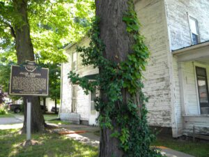
In 1805, for $1.50 an acre, Jacob Miller purchased this property in the Congressional Land Office in Chillicothe, capital of the new state of Ohio. He and Somerset co-founder John Finck then each built a tavern on either side of town along the Zane’s Trace, laid out along existing Indian trails in 1796-1797 and Ohio’s first major thoroughfare. Finck built his home and tavern in 1807 and Miller his shortly after. From 1800 to 1815, Zane’s Trace saw significant traffic between the established eastern states and the newly opened Northwest Territory. A perpetual stream of emigrants rolled westward, giving constant occupation to hundreds of tavern-keepers. Besides operating his tavern and farming, Jacob Miller was a public servant. In 1809, he was appointed Overseer of the Poor as there was a need to “bind out” poor children to families who could take care of them. [continued on other side]
, OH
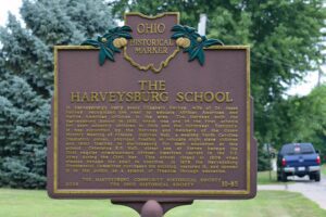
The Quaker village of Harveysburg was founded in 1829 on land originally a part of Colonel Abraham Buford’s Revolutionary War Land Grant. Levi Lukens, a Virginia Quaker, purchased the 1000 – acre survey in 1812 and sold a portion to Rhoden Ham in 1815. Ham then sold a portion of his holdings to William Harvey, a Quaker originally from North Carolina, who developed 47 lots for a village which thrived from its beginnings. Early businesses included grist mills, a tin shop, hardware store, blacksmith shop, a large pork packing plant, a bank, and a dry goods store owned by William Harvey. Its first post office opened in 1839. Harveysburg was incorporated in 1844. The village received its name from a merchant in Cincinnati who told William Harvey that he should add burg to his name and call the place Harveysburg.
, OH
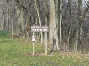
The Village of Tadmor is significant as being the location of one of the most important centers of transportation in early Ohio history. As early as 1809, keelboats were poled up river from Dayton to load and unload freight in the village. By 1837, the Miami and Erie Canal had reached Tadmor, connecting it to the Ohio River in the south and Lake Erie in the north. In the 1830s, the National Road was constructed through Tadmor, connecting it to points east and west. In 1851, the Dayton & Michigan Railroad established freight and passenger service to the growing town. Residents hoped that Tadmor’s strategic location would help it prosper, however, successive flooding on the Great Miami River stifled growth. Tadmor was finally abandoned when a dam constructed by the Miami Conservancy District in 1922 to retain water during flooding made the site uninhabitable.
, OH
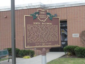
Located in southern Wood County, the village of New Baltimore was founded in 1860, with the first plat of twenty-nine acres recorded by B.L. Peters in 1873. Official incorporation occurred February 7, 1876, with the name being changed to North Baltimore in 1880. The town flourished owing to the construction of the Baltimore and Ohio Railroad in 1873, from which the town took its name, and the discovery of rich oil and gas deposits in 1886. First settlers included: Jacob Dirk, George Franks, Levi A. Tarr, and B.L. Peters. The population of the village grew from 700 in 1880 to 2,857 in 1890. One of the first buildings, which was erected in 1860, served as a school and meeting hall and was located on the northwest corner of Main and Broadway streets. This area, then known as “The Great Black Swamp,” had given birth to a thriving town.
, OH
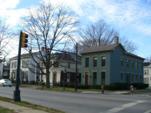
Rossville was settled in April 1801 shortly after the U.S. Government initiated land sales west of the Great Miami River. Its original proprietors–John Sutherland, Henry Brown, Jacob Burnet, James Smith and William Ruffin–named the town in honor of Pennsylvania Senator James Ross (1762-1847), who favored Ohio statehood and advocated free navigation of inland rivers. These founders envisioned Rossville as a shipping port for the rapidly growing population of farmers settling west of the Great Miami. The most practical outlet for their products was by flatboat down the Great Miami, Ohio, and Mississippi rivers to New Orleans. The town of Rossville was founded in 1804, the year after the Louisiana Purchase, which made the Mississippi River a United States possession. (Continued on other side)
, OH
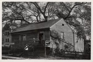
Following the establishment of the public land system in 1785, the Continental Congress appointed a committee, chaired by James Monroe, to establish government in the new territory north and west of the Ohio River. Drafted prior to the Constitution of the United States, the Ordinance of 1787 provided the mechanism by which prospective states would enter the Union on an equal basis with existing states. It also prohibited slavery in the new territory and pledged good faith in dealing with Native American tribes. According to this plan, the Northwest Territory became the states of Ohio, Indiana, Illinois, Michigan, Wisconsin, and part of Minnesota in due course.
, OH
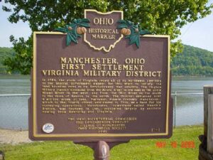
In 1784, the state of Virginia ceded all of its Northwest Territory to the federal government except for this tract to satisfy the land bounties owed to its Revolutionary War soldiers. The Virginia Military District extended from the Scioto River in the east to the Little Miami River in the west, and from the Ohio River on the south to the town of Kenton in the north. The District contained over 4 million acres of land. Nathaniel Massie founded Manchester, which is the fourth oldest settlement in Ohio, as a base for his surveying operations. Manchester, sometimes called Massie’s Station, was founded in 1791, populated largely by settlers coming from Kentucky and Virginia.
, OH
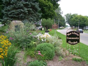
From the 1770s until 1832, the Logan County area was the homeland to much of the Shawnee Nation. Ten villages known as the Upper Mad River towns included the homes of influential leaders Moluntha, Black Hoof, and Blue Jacket. The West Liberty area contained three villages: Moluntha’s Town, Wapakoneta, and Mackachack. To the northeast stood Wapatomica, the Shawnee’s political center and site of several intertribal councils. To the north sat Blue Jacket’s Town, Kispoktha Town, and Reed Town. To the west were Pigeon Town and Stony Creek, site of one of Tecumseh’s first pan-Indian confederacy councils. From 1817 to 1832, many Shawnees were relocated to Indian Territory, which in 1907 became the state of Oklahoma. These Shawnees are now the Eastern Shawnee of Oklahoma.