
, OH
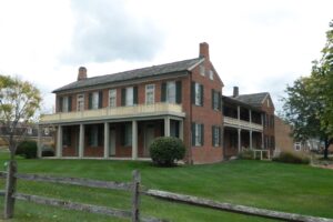
David Snively built the Federal-style Pennsylvania House in 1839 along the newly constructed National Road. This tavern and inn was an important stopover for livestock drovers and pioneers traveling by foot, on horseback, or in Conestoga wagons during the westward expansion of the United States in the nineteenth century. Dr. Isaac K. Funk, of Funk & Wagnalls fame, lived in the house in the 1840s while his father served as its tavern keeper. Closed as an inn after the Civil War, it then served as a doctor’s clinic, boarding house, and secondhand shop before falling into total disrepair. The Lagonda Chapter of the Daughters of the American Revolution saved it from demolition and has owned and operated it as a museum since 1941. The Pennsylvania House was put on the National Register of Historic Places in 1972.
, OH
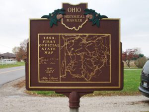
With the signing of the Treaty of Paris in 1783, England lost the American Revolution and ceded to its former colonies land from the Atlantic Ocean to the Mississippi River. By this time, pioneer settlers had reached the eastern bank of the Ohio River, but the Ohio Country, located west and north of the river, was still considered Indian Territory. The Indian tribes desperately defended their hold on this land. On August 20, 1794, United States forces led by Major General Anthony Wayne defeated an Indian alliance at the Battle of Fallen Timbers fought near modern-day Toledo. One year later, on August 3, 1795, the largest assemblage of northwestern Indian representatives at a peace settlement signed the Treaty of Greene Ville, which effectively ceded all land south of the Greene Ville Treaty line to the Americans. The Fort Laurens site was a reference point in the Treaty line. The Ohio Country was then rapidly settled, and in 1808, Tuscarawas County was organized.
, OH
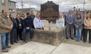
The Caldwell Downtown Historic District is the historic commercial and governmental core of the Village of Caldwell, which was founded in 1857 on farmland owned by Joseph and Samuel Caldwell. Caldwell serves as the county seat of Noble County, the last of Ohio’s 88 counties to be organized. The agricultural community prospered and by 1873 was the second-largest producer of tobacco in Ohio. The Pennsylvania Railroad arrived in 1872, and the development of salt, oil, coal, and natural gas extraction companies followed during the 1880s. Two separate fires in 1897 devastated portions of the north and south quadrants of the district. As a result, Caldwell formed a volunteer fire department and the Village Council introduced legislation prohibiting construction of wood buildings within a block of the public square. (Continued on other side)
, OH
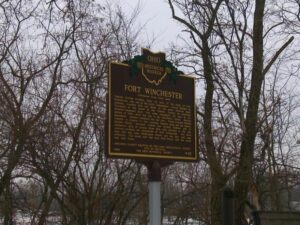
General William Henry Harrison ordered the construction of Fort Winchester at the beginning of October 1812 and it was completed October 15. The fort served as a forward observation post and supply depot for the American army during the War of 1812. Until Fort Meigs was completed in 1813, Fort Winchester was the front line against the British and their Indian allies. During the siege of Fort Meigs, Fort Winchester was a rendezvous point for the troops of General Green Clay and those of Colonel William Dudley. Fort Winchester outlined the shape of a parallelogram, measuring 600 by 300 feet in size. Blockhouses anchored the four corners of the fort and within its stockade were storehouses and a hospital.
, OH
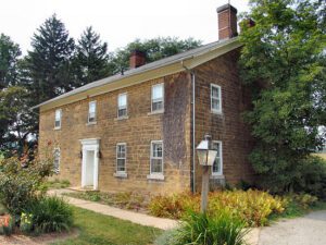
Frederick Rice was born on September 29, 1753, near Bethlehem, Northampton County, Pennsylvania and moved to Westmoreland County, Pennsylvania around 1766. During the American Revolution he served under George Washington at Valley Forge and fought in the Battle of Trenton on December 26, 1776, in which American forces surprised and captured 1,000 Hessian mercenaries. He served for two more years as a spy working against Native American tribes in western Pennsylvania. After his service he married Catherine Lauffer, and they raised eleven children to adulthood. Rice chose this 320-acre site, transferred to him in a deed signed by President James Monroe on May 21, 1821, because it offered excellent springs. He assigned the west half to son Simon and the east half to son Barnhart in 1822. Ownership remained in the Rice family until acquired for the Ohio Agricultural Experiment Station in 1891, renamed the Ohio Agricultural Research and Development Center in 1965.
, OH
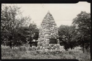
During the Indian Wars of 1790-1795, the United States built a chain of forts in the contested area of what is today western Ohio. These forts were built as a result of various tribes of the region attacking the encroaching American population as they moved north of the Ohio River. In October 1791, General Arthur St. Clair, governor of the Northwest Territory, set out on a mission to punish the tribes and on October 12, ordered his forces to build Fort Jefferson, the fourth link in that chain of forts stretching north from Fort Washington (Cincinnati) to Fort Deposit (Waterville). Each fort was generally a hard day’s march of each other, and the site was chosen because of nearness to a supply of fresh water. The fort was named in honor of Secretary of State Thomas Jefferson.
, OH
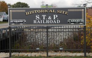
Asa Bushnell, former Governor of Ohio, encouraged by the light grade of the land, decided to establish the Springfield, Troy, and Piqua Railway (ST&P) in July 1904. The interurban traction line utilized sixty-pound rail and traveled over only one bridge. With direct current electricity generated in Springfield, the ST&P used four double-ended fifty-foot cars, each with a railroad roof, arch windows, GE-57 engines, and fifty-horsepower motors. The ST&P traveled from Springfield’s Fountain Square to Maitland, Hill Top, Lawrenceville, Bushnell, North Hampton, Dialton, Thackery, Proctors, Christiansburg, Brights, and Casstown and ended at Troy’s North Market Street Bridge. Later rights were granted to travel over the Great Miami River into Troy in conjunction with the Cincinnati, Hamilton, and Dayton Railway. The northwest right-of-way from Casstown to Piqua was secured but never built.
, OH
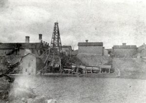
In 1885, 800 feet north of this marker, Benjamin Faurot struck oil after drilling into the Trenton Rock Limestone formation at a depth of 1,251 feet. This event marked the beginning of the great Oil Boom of northwest Ohio. The ensuing rush brought speculators who drilled hundreds of wells in the Trenton Rock (Lima) Oil Field that stretched from Mercer County north through Wood County in Ohio and west to Indiana. By 1886, the Lima field was the nation’s leading producer of oil, and by the following year it was considered to be the largest in the world. Production from the Ohio portion of the Lima-Indiana field reached its peak in 1896, when more than 20 million barrels were brought out of the ground. Though short-lived, the oil rush brought an influx of people, pipelines, refineries, and businesses, giving a powerful impetus to the growth of northwest Ohio.