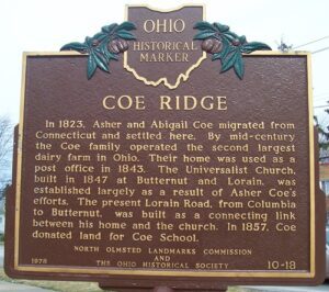
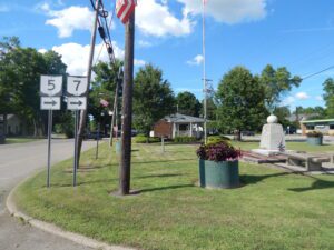
In 1823, Asher and Abigail Coe migrated from Connecticut and settled here. By mid-century the Coe family operated the second largest dairy farm in Ohio. Their home was used as a post office in 1843. The Universalist Church, built in 1847 at Butternut and Lorain, was established largely as a result of Asher Coe’s efforts. The present Lorain Road, from Columbia to Butternut, was built as a connecting link between his home and the church. In 1857, Coe donated land for Coe School.
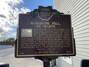
Established in 1823, the pioneer settlement of St. Marys became a thriving 19th century milling center following completion of the Miami & Erie Canal in 1845. The Reservoir Mill, built by Scott, Linzee & Co. in 1847, led this period of industrial growth as the first mill in St. Marys powered by the canal’s water. Robert B. Gordon purchased it in 1855 and in 1896 the mill passed to his son, Robert B. Gordon Jr., who formed the firm Gordon, Hauss & Folk. Producing “Purity” and “Pride of St. Marys” flour, Gordon, Hauss & Folk owned the mill until 1955. The mill was used as a grain elevator until 1972, then as a storage facility for the next 40 years. (Continued on other side)
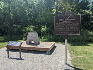
The Ohio Standard Baseline (OSB) was a geodetic baseline that provided highly accurate measurements of the earth and made possible extremely fine calibrations of surveying equipment. Several such baselines were established in Europe and South America during the mid-twentieth century, specifically designed to use a measurement device called the Vaisala Comparator, a precursor of modern laser light measurement systems. In 1953, Dr. T.J. Kukkamaki, then a professor in the Department of Geodetic Science at The Ohio State University, proposed establishing a baseline in Ohio that would be part of the worldwide efforts to accurately understand how the size and shape of the earth change over time. Built between 1965 and 1966, the resulting OSB consisted of a series of eight concrete pillars supporting mirrors and instruments, spaced along a 500 meter distance. (Continued on other side)
J. W. Denver Williams Memorial Park, 1100 Rombach Avenue
Wilmington
, OH
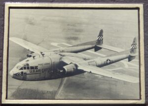
On April 18, 1964, reservists from the 302nd Troop Carrier Wing at the Clinton County Air Force Base (CCAFB) and 2nd Special Forces Group (Green Berets) of Fort Hayes, Columbus were to undergo an Operational Readiness Inspection. In a flight of nine C-119 “Flying Boxcars,” the men were to execute a routine night formation paratroop drop. Airborne, the flight encountered worsening weather conditions and the lead plane called off the mission. Returning to CCAFB, two C-119s collided in mid-air and crashed about five miles northeast of the base, near the intersection of Stone and Melvin roads. Tragically, 17 of the 19 men aboard were killed.(Continued on other side)
The township of Kinsman was purchased by John Kinsman of Lisbon, Connecticut, in 1799 from the Connecticut Land Company. Kinsman has been the home of many notable citizens, some of whom include: Philip P. Bliss (1838-1876) and James McGrannahan (1840-1907) were hymn composers and religious musical directors for the nationally-known evangelical Dwight L. Moody Revival Meetings held in Kinsman for thirty years in the late 1800s. Clarence Darrow (1857-1938) was a famous labor and criminal lawyer who grew up in Farmdale and in the “octagon house” in Kinsman. Darrow in probably best known for his work as a defense attorney in the Scopes Trial. (continued on reverse side)
In the early 1800s, Jabez Wright, an early Huron County judge, purchased a large tract of lakeside land on the north side of what is now Cleveland Road. There Wright built an eight-room farmhouse that later served as a “station” on the fabled Underground Railroad, playing a vital role in aiding fugitive African-American slaves to freedom. Beneath Wright’s farmhouse was a sixteen foot-wide and ninety foot-long tunnel. Escaped slaves entered the passage through a trap door in the home’s basement and exited into a corn crib located a mere one hundred feet from Lake Erie. There the slaves awaited the arrival of rowboats transporting them to vessels heading north to Canada. (Continued on side two)
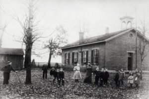
In 1854, Samuel and Rebecca McClellan Collins deeded 1.28 acres to Beavercreek Township, Greene County, for the purpose of building a schoolhouse. The first two schoolhouses were constructed of stone with fireplaces for heat. Collins neighborhood children in first through eighth grade were educated in the present red brick building until 1944, when decreased enrollment forced Xenia Township to close the school. Virgil and Helen Bryson Brantley, great-granddaughter of Samuel and Rebecca Collins, purchased the school property in 1982 and began the restoration of the vandalized and deteriorated schoolhouse. The pony/coal shed and privies were rebuilt on their foundations. (Continued on other side)
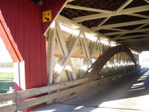
Constructed in 1873, the Bigelow Bridge spans approximately 100 feet across Little Darby Creek. Reuben Partridge built the superstructure at a cost of $12.50 per linear foot ($1,500). Bercupile & Snell built the masonry foundation at a cost of $7.00 per perch (a perch is approximately 25 cubic feet). Partridge built bridges throughout Union County and the surrounding area from 1866 until his death in 1900. The covered bridge is named for Eliphas Bigelow, an early resident of Union County, who built the nearby Bigelow House on the south side of Post Road (SR 161) in 1846. Union County Engineer employees rehabilitated the bridge from 1989 to 1991 by installing a new support system. The Partridge trusses currently carry only the weight of the original bridge. The rehabilitation project received the 1992 Engineered Timber Bridge Award from the National Forest Products Association.