
, OH
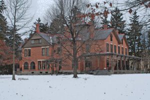
The twenty-five acre estate Spiegel Grove was the home of Rutherford Birchard Hayes, the 19th president of the United States. Spiegel Grove received its name from the German word “spiegel,” meaning mirror, describing pools that collect beneath the trees after a rainstorm. Hayes’s uncle, Sardis Birchard, a Fremont merchant, built the home on this site in 1863. The Hayeses moved to Spiegel Grove after Hayes’s second term as Ohio governor ended in 1873. They inherited the estate in 1874. The family left Fremont after Hayes’s election as Ohio governor in 1875, and U.S. president in 1876. They returned to Spiegel Grove in 1881. The Hayeses expanded the home in 1880 and 1889. Lucy and Rutherford Hayes died at Spiegel Grove in 1889 and 1893 respectively. They were reburied at Spiegel Grove in 1915. Their children donated the property to the state of Ohio in 1909 in order to establish the nation’s first presidential library.
, OH
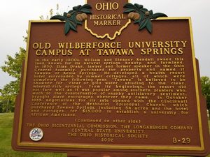
In the early 1800s, William and Eleanor Kendall owned this land, known for its natural springs, beauty, and farmland. In 1850, Elias Drake, lawyer and former speaker in the Ohio General Assembly, purchased the property and named it Tawana or Xenia Springs. He developed a health resort hotel surrounded by summer cottages, all of which were completed the following year. “Tawana” is believed to be Shawnee for “clear or gold water,” alluding to the clear, mineral-rich springs. From its beginnings, the resort did not fare well as it was popular among southern planters who, much to the consternation of nearby antislavery sentiment, brought slave entourages whenever they came. In October 1855, negotiations for its sale opened with the Cincinnati Conference of the Methodist Episcopal Church, which purchased Tawana Springs, including 54 acres and the hotel and cottages, for $13,000 to establish a university for African Americans. (Continued on other side)
, OH
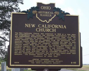
The New California Church was organized in 1826 at a time when the congregation was called the Associate Congregation of Darby and represented Presbyterians whose ancestors came from the “Seceder” tradition of Scotland. Seceder Presbyterians were so named because they left or “seceded from” the mainstream Presbyterian Church when the English Crown claimed the right to name ministers. Their desire for religious freedom brought them to America where they were one of the earliest denominations to condemn slavery. The congregation met at members’ homes until building its first church in 1833, a log structure. The first minister to serve this congregation, the Reverend James Wallace, who served from 1832-1841, was an outspoken opponent of slavery, and this congregation maintained that anti-slavery stance under later ministers. The present church was built in 1904. (continued on other side)
, OH
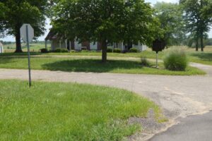
Agricultural development and cultivation on steep lands led to severe soil erosion in the nation in the 1920s and 1930s. In response, the United States Department of Agriculture established the Soil Conservation Service (SCS) in 1935. The SCS established the North Appalachian Experimental Watershed (NAEW) in the hills of Coshocton County to study and develop methods of conserving soil and water resources. The Federal government and Coshocton County purchased 1,047 acres of land for the program and, in 1936, field research equipment was installed and buildings constructed. The Works Progress Administration (WPA) and Civilian Conservation Corps (CCC) provided labor near the program’s inception, as did the Civilian Public Service Agency during World War II. (Continued on other side)
, OH
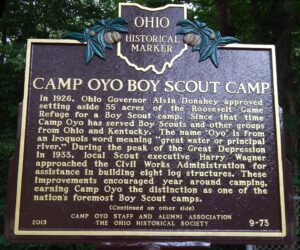
In 1926, Ohio Governor Alvin Donahey approved setting aside 55 acres of the Roosevelt Game Refuge for a Boy Scout camp. Since that time Camp Oyo has served Boy Scouts and other groups from Ohio and Kentucky. The name ‘Oyo’ is from an Iroquois word meaning “great water or principal river.” During the peak of the Great Depression in 1933, local Scout executive Harry Wagner approached the Civil Works Administration for assistance in building eight log structures. These improvements encouraged year around camping, earning Camp Oyo the distinction as one of the nation’s foremost Boy Scout camps. (Continued on other side)
, OH
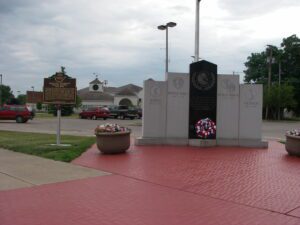
From 1942 until 1946, members of local churches and two railroad auxiliaries operated a community-based free canteen for passing troops on the platform of the Pennsylvania Railroad station. A grateful region honored approximately 1.2 million of the nation’s sons and daughters with welcoming words, sandwiches, pies, cakes, cookies, fruits, drinks, and other sundries. Staffed and funded entirely by volunteers, donations came from many communities in eight counties. Crestline’s children donated their pennies to pay for construction of a larger canteen in 1943. Volunteers met as many as 25 trains daily. They served troops on passenger trains, troop trains, and hospital trains and new recruits and returning veterans as well as troops from allied countries on their trips to and from Europe or the Pacific. Throughout World War II, many other canteens were created across the nation, including many in Ohio. The Crestline region’s reputation was enhanced immeasurably by the volunteer’s service.
, OH
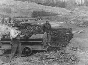
Agriculture dominated the economy of southeastern Ohio’s Morgan County until the 1940s when harvests dwindled, the population declined, and land values dropped. Surface mining the area’s rich underground coal deposits replaced agriculture as the major industry and revitalized the declining local economy. As the nation’s demand for electricity grew over the next half-century, so did the demand for coal as fuel for nearby power generation plants. During mining’s heyday in the 1960s to the late 1980s, American Electric Power’s former Central Ohio Coal Company subsidiary employed nearly 1,000 people. Nearby communities-such as Cumberland, Caldwell and Chandlersville-thrived. As time passed, however, the robust coal industry was hit hard by environmental regulations that reduced the market for the area’s high-sulfur coal. In turn, mine work forces shrank considerably and local businesses closed. (continued on other side)
, OH
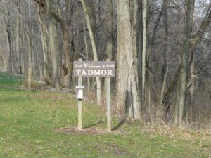
The Village of Tadmor is significant as being the location of one of the most important centers of transportation in early Ohio history. As early as 1809, keelboats were poled up river from Dayton to load and unload freight in the village. By 1837, the Miami and Erie Canal had reached Tadmor, connecting it to the Ohio River in the south and Lake Erie in the north. In the 1830s, the National Road was constructed through Tadmor, connecting it to points east and west. In 1851, the Dayton & Michigan Railroad established freight and passenger service to the growing town. Residents hoped that Tadmor’s strategic location would help it prosper, however, successive flooding on the Great Miami River stifled growth. Tadmor was finally abandoned when a dam constructed by the Miami Conservancy District in 1922 to retain water during flooding made the site uninhabitable.