, OH
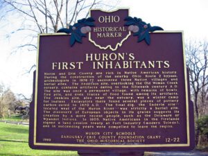
Huron and Erie County are rich in Native American history. During the construction of the nearby Ohio Route 2 bypass, archeologists in 1976-77 uncovered three Native villages and burial sites. The Anderson site, overlooking the Old Woman Creek estuary, contains artifacts dating to the fifteenth century A.D. The site was once a permanent village, with remains of bowls, fire pits, and even traces of food found among its artifacts. The Jenkins site, also near the estuary, was a winter camp for Indians. Excavators there found several pieces of pottery carbon-dated to 1470 A.D. The final dig, the Enderle site — located west of the Huron River — was strictly a burial site. The discovery of European objects in its graves suggests its creation by a more recent people, such as the Delaware or Wyandot Indians. In 1805, Native Americans in the Firelands signed a land cession treaty at Fort Industry (modern Toledo), and in succeeding years were compelled to leave the region.
, OH
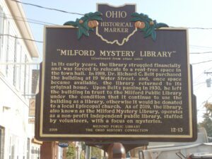
The Milford Public Library, Clermont County’s oldest continuously operating library, was founded in 1900 by a local civic organization, the Milford Village Improvement Society. It was preceded by a circulating library–one that charges patrons for renting books–that was chartered in 1822. At the time of the Milford Public Library’s founding, circulating libraries were in decline and public libraries were increasing in number as an inexpensive alternative. To obtain support for their proposed “reading room,” the Society’s Literary Committee travelled door-to-door, soliciting members and books. To become a member of the library, adults paid 25 cents and children paid 10 cents in annual dues. The library’s first–and current–home is the stone building at 19 Water Street. (Continued on other side)
, OH
Company E of the 30th Ohio Volunteer Infantry was the only full infantry company formed in Jerome Township. Capt. Elijah Warner organized the unit in the village of Jerome and it was mustered into the Union Army at Camp Chase in Columbus on August 29, 1861. A total of 102 men from the township fought in the regiment throughout the war, while approximately 25% of the total population of the Jerome Township served. Company E performed outstanding service, participating in the Antietam, Vicksburg, and Atlanta Campaigns, Sherman’s March to the Sea and the March through the Carolinas, and the in the Grand Review in Washington, D.C. Of the 102 Jerome Township men in Company E, 32 perished during the war. The regiment was mustered out of service August 13, 1865.
, OH
A group of concerned Cincinnati women organized, in 1855, The Protestant Home for the Friendless and Female Guardian Society as a private, not-for-profit maternity home for destitute women and children. These public minded social leaders were aware that Cincinnati had grown beyond the time when the poor or unfortunate were cared for by their neighbors. The Home, which was funded through bequests and personal donations, was founded to care for poor mothers and babies, unmarried pregnant women, wanderers and strangers in the city, and to promote adoptions. (Continued on other side)
, OH
Entrepreneur and philanthropist Joseph (Jose) de Rivera was born in Barcelona, Spain, and built an import business in New York City. In 1854, he bought six Lake Erie Islands and had South Bass Island surveyed and subdivided into ten-acre lots. De Rivera traveled between New York and South Bass Island, initially turning Put-in-Bay into a sheep farm. He encouraged settlement on the island and its wine industry by helping German immigrants purchase land to plant vineyards. He donated five acres for this waterfront park, the site for the first school, and the land for the first church. To promote travel to the island, de Rivera opened the island’s largest cave as a tourist attraction. He is buried in the island’s cemetery, which is on land he donated for that purpose.
, OH
First surveyed in 1849, Powhatan Point was laid out by Franklin Knox. The “point” is the confluence of Captina Creek and the Ohio River. The small but thriving river and farming community served York Township and the rich Captina Valley as a shipping center for its first 75 years. Given impetus by the construction of the Powhatan Enterprise Flouring Mill and Woolen Factory in 1850, local businesses shipped grain, fruit, lumber, cheese, whiskey, livestock, wool, and tobacco to northern and southern ports. There were three boat landings: Boger’s, Hornbrook’s and Dorsey’s, each equipped with an incline car track from the warehouses to the river’s edge. With the opening of North American Coal Corporation’s Powhatan No. 1 Mine in 1922, the village became a mining community that continued to rely on the river. A disastrous mine fire took the lives of 66 men on July 5, 1944.
, OH
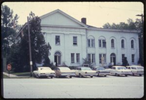
Mahoning County was created in 1846 by combining townships from southern Trumbull and northern Columbiana counties. Canfield engaged in competition with several surrounding communities for the new county seat, and its success was attributed to its central location along with the state and local political influence of Judge Eben Newton and Elisha Whittlesey, Esq., Comptroller of the United States Treasury from 1849-1857. To become the county seat, the State of Ohio required “a suitable lot and $5,000 toward public buildings” Judge Newton donated the land and spearheaded the subscription of the state required bond. Once attained, construction progressed rapidly on the Classical Revival style courthouse, completed in June 1848. The Italianate style West wing was added in 1862, but its government status was challenged when in the early 1870s, Youngstown, by now a city, resumed its earlier challenge for the county seat. (continued on other side)
, OH
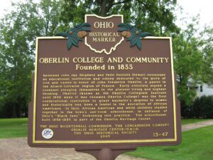
Reverend John Jay Shipherd and Philo Penfield Stewart envisioned an educational institution and colony dedicated to the glory of God and named in honor of John Frederick Oberlin, a pastor in the Alsace-Lorraine region of France. Early colonists signed a covenant pledging themselves to the plainest living and highest thinking. Oberlin (known as the Oberlin Collegiate Institute until 1850 when it was renamed Oberlin College) was the first coeducational institution to grant bachelor’s degrees to women and historically has been a leader in the education of African Americans. In fact, African American and white children studied together in the town’s one-room schoolhouse, in defiance of Ohio’s “Black laws” forbidding this practice. The schoolhouse, built 1836-1837, is part of the Oberlin Heritage Center.


