, OH
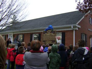
The history of New Knoxville provides one of the best examples of chain migration to America. After the Shawnee were removed from what would become Auglaize County, James Knox Lytle, cousin to James Knox Polk, purchased land in Washington Township. Lytle platted a village of 102 lots in 1836, calling it Knoxville to honor his mother’s family. Meanwhile, newly married Wilhelm and Elisabeth Fledderjohann Kuckhermann (later Kuck) immigrated from Ladbergen in northwest Germany. Having missed their boat to St. Louis, the couple lived briefly in Stallostown (Minster) and Bremen (New Bremen). They wrote home, encouraging others to emigrate; in the summer of 1835 the Fledderjohanns (Elisabeth’s family), Meckstroths, and Lutterbecks arrived. The families bought land near the site of Knoxville. (continued on other side)
, OH
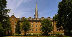
The state’s oldest private institution of higher education, Kenyon College was founded in 1824 in Worthington by Philander Chase, first Episcopal bishop of Ohio, and relocated to Gambier four years later. Both college and village are named for British benefactors, statesman Lord Kenyon and naval hero Lord Gambier. Throughout its history, Kenyon has prepared men and women for leading roles in society, including nineteenth-century graduates Edwin M. Stanton, Abraham Lincoln’s secretary of war, and Rutherford B. Hayes, Ohio governor and U.S. president. In the twentieth century, Kenyon educated such literary luminaries as poet Robert Lowell and novelist E.L. Doctorow. Kenyon has also been an innovator in education-the Advanced Placement Program began as the Kenyon Plan in the 1950s.
, OH
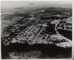
Ground was broken for Mariemont by Mary M. Emery, the village’s founder, on April 23, 1923. This planned community was designed by eminent town planner John Nolen and twenty-five of America’s leading architects. As part of the “garden city movement,” Mariemont was influenced by English models. Mariemont was incorporated July 12, 1941, and was listed on the National Register of Historic Places on July 24, 1979.
, OH
In 1847, after completion of the Miami & Erie Canal, 66 residents were recorded in Liberty Township. Construction of Wabash Railway in 1854 encouraged trade at the half way point between Washington Station and Napoleon. Proprietors such as George W. Buchanan, Frank Prey, Alexander Cooper, and Benjamin Penncock began business around 1860. On June 4, 1863, Alphaeus Buchanan registered a plot of 12 lots, which became Liberty Center. On April 9, 1874, the Village of Liberty Center was incorporated and became a prosperous town along the Wabash Railway. (Continued on other side)
, OH
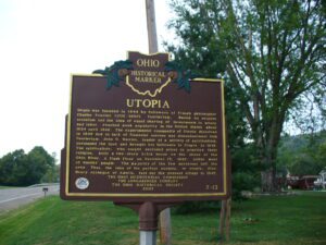
Utopia was founded in 1844 by followers of French philosopher Charles Fourier (1772-1837). Fourierism, based on utopian socialism and the idea of equal sharing of investments in money and labor, reached peak popularity in the United States about 1824 until 1846. The experimental community of Utopia dissolved in 1846 due to lack of financial success and disenchantment with Fourierism. John O. Wattles, leader of a society of spiritualists, purchased the land and brought his followers to Utopia in 1847. The spiritualists, who sought secluded areas to practice their religion, built a two-story brick house on the shore of the Ohio River. A flash flood on December 13, 1847, killed most of Wattles’ people. The majority of the few survivors left the area. Thus, the idea of the perfect society, or utopia, died. Henry Jernegan of Amelia, laid out the present village in 1847.
, OH
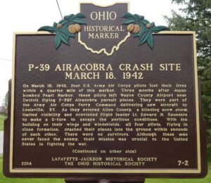
On March 18, 1942, four U.S. Army Air Corps pilots lost their lives within a quarter mile of this marker. Three months after Japan bombed Pearl Harbor, these pilots left Wayne County Airport near Detroit flying P-39F Airacobra pursuit planes. They were part of the Army Air Corps Ferry Command delivering new aircraft to Louisville, KY. As they entered Allen County, a blinding snow storm limited visibility and convinced flight leader Lt. Edward H. Saunders to make a U-turn to escape the perilous conditions. With ice building on their wings and windshields, all four pilots, flying in close formation, crashed their planes into the ground within seconds of each other. There were no survivors. Although these men never faced the enemy, their mission was crucial to the United States in fighting the war.
, OH
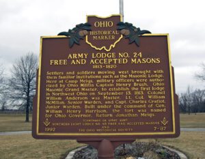
Settlers and soldiers moving west brought with them familiar institutions such as the Masonic Lodge. Here at Camp Meigs, military officers were authorized by Ohio Militia Captain Henry Brush, Ohio Masonic Grand Master, to establish the first lodge in Northwest Ohio on September 13, 1813. Colonel William Anderson was Master, Lt. Col. William McMillan, Senior Warden, and Capt. Charles Gratiot, Junior Warden. Built under the command of Gen. William Henry Harrison, the fort was named for Ohio Governor, Return Jonathan Meigs.
, OH
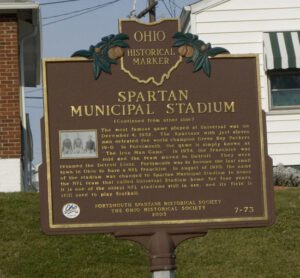
Opened in the fall of 1930, Universal Stadium became the home of the Portsmouth Spartans professional football team. Earlier that summer, the Spartans had just become a member of the National Football League (NFL). Led by a few local businessmen, the Portsmouth National Football League Corporation raised money to help build the permanent stadium for the Spartans. The stadium opened on September 14, 1930 as the Spartans defeated the Newark (New Jersey) Tornadoes for their first NFL victory. Ten days later the Spartans played one of the NFL’ s first night games against the Brooklyn Dodgers. The Portsmouth Times said, “Night football has come to stay, at least in Portsmouth.” From 1930 to 1933, the Spartans compiled a record of 19 wins 2 losses and 4 ties at Universal Stadium. (continued on other side)


