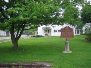
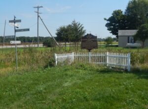
Intersection of Main Street and Township Road 39 (High Street)
Roundhead
, OH
Upon this site, in the late 18th and early 19th centuries, stood Chief Roundhead’s Wyandot Indian village. This flourishing agricultural community later gave way to white settlement and Hardin County’s first town was laid out here in 1832. Roundhead, or Stiahta, was celebrated for his capture of American General James Winchester during the War of 1812. Roundhead is believed to be buried in this vicinity.
Conceived by leaders of the automobile industry to encourage the building of “good roads,” the Lincoln Highway was established in 1913 as the first transcontinental automobile route in the United States. It traversed twelve states and 3,389 miles from New York to San Francisco. The first route across Ohio connected Van Wert, Delphos, Lima, Ada, Upper Sandusky, Bucyrus, Galion, Mansfield, Ashland, Wooster, Massillon, Canton, Minerva, Lisbon, and East Liverpool. By the 1930s much of the original route had become part of the Federal Highway System and U.S. Route 30–many miles of which have, in turn, been bypassed by modern four-lane highways.
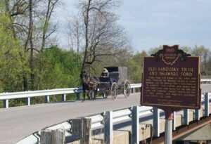
County Road 265 follows an old Indian trail which connected the Wyandot villages at Upper Sandusky with the Shawnee Mac-o-chee towns to the southwest. Many wigwams were pitched near this Scioto River ford during the late 18th and early 19th centuries. Soldiers (during the War of 1812), settlers, and stagecoach passengers later followed this route.
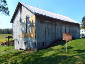
A migration of Indians throughout Ohio began due to unstable conditions created by the American Revolution. The massacre of Christian Indians at the Moravian mission of Gnadenhutten in 1782 and Colonel William Crawford’s expedition against Wyandot and Delaware towns along the Sandusky fueled insecurities. Delaware, including a small group of Mingo Indians, abandoned the village of Helltown, five miles southwest of this site, and settled Greentown as early as 1783. Greentown, situated on an elevation on the Black Fork beyond the clearing behind this site, was presumably named for British loyalist, Thomas Green. John Chapman (Johnny Appleseed) had an amicable relationship with the Delaware, owned land throughout the Black Fork Valley, and was known to visit Greentown on his travels throughout Ohio. Other visitors to the village included the Shawnee Prophet; Munsee Delaware leader, Captain Pipe; and local preacher, James Copus.
Indian Trail Caverns, first opened in 1927, is one of many caves that occur on the dolomite ridge traversed by State Route 568 in Wyandot and Hancock counties. Sheriden Cave, a karst sinkhole associated with the caverns, was discovered in 1989. It has collected a remarkable record of Ice Age animal and human activity in its sediments. Excavations have revealed remains of many extinct Late Pleistocene Epoch animals-giant beaver, stag moose, flat-headed and long-nosed peccary, and short-faced bear, among many others-that were sealed in the cave by glacial deposits more than ten thousand years ago. Paleo-Indian tools, including projectile points and scrapers, are evidence of the earliest-known human activity in this region.
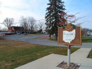
On this site, the Miami and Erie Canal, that came north from Cincinnati and the Ohio River, intersected with the Wabash and Erie Canal that came from Fort Wayne and Evansville, Indiana. From this point, which became the town of Junction, the canals proceeded as one to Defiance, Toledo, and Lake Erie. From the 1830s to the 1870s, the canals played a key role in the settling of Paulding County, an area that was once a part of the Great Black Swamp. They held the promise of easier and quicker passenger transportation and commodity shipping and Junction became a landmark for fugitive slaves escaping to Canada. Once a thriving and growing community, the village of Junction became a forgotten historical note with the passing of the canal era and the coming of the railroads. Today, the Buckeye Trail and North County Trail follow the canal path through Paulding County.
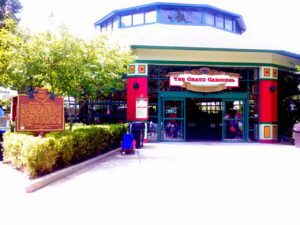
This “Grand Carousel,” manufactured in 1914 by the William I. Mangels Company with wood horses carved by the Marcus Illions Company, was first located at Olentangy Park, an interurban-era amusement park in Clintonville. In 1938, the Mangels-Illions carousel was relocated to the Scioto Ranch Park (also known as the Zoo Amusement Park and Wyandot Lake). On June 17, 2000, the restored carousel, with the original 52 horses and 2 chariots, began “spinning its magic” at this location. Of the nearly 5000 “Grand Carousels” that were operational in the early 1900s, fewer than 200 remain.
SW corner of W Main Street and S Broadway Street (Public Square)
Greenville
, OH
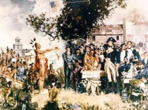
Following General Anthony Wayne’s victory at Fallen Timbers, members of the western tribes assembled at Fort Greene Ville to settle on terms of peace. Representatives of the Wyandot, Delaware, Shawnee, Ottawas, Chippewa, Ottawa, Patawatimi, Miami, Eel River, Wea, Piankeshaw, Kickapoo, and Kaskaskia signed the treaty on August 3, and agreed to cede claims to lands east of the Cuyahoga River to Fort Laurens in Tuscarawas County and south of a line running west to Fort Recovery. In return, the United States offered payment and annuities in the form of goods and ceded claim to most land north and west of the treaty line. This treaty marked the end of the Indian Wars in the Ohio Country, forsaking boundary violations by both parties, and established the official western border of the United States, opening much of Ohio for settlement.