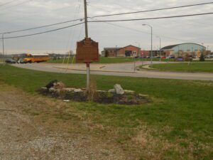
W side of intersection of Riverside Drive and Busenbark Road
Trenton
, OH
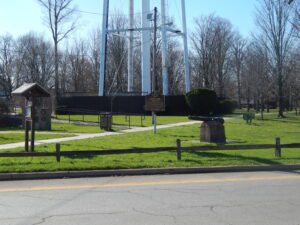
In 1833, Robert Busenbark deeded land to the directors of School District No. 6 for Busenbark School. Twenty years later, Robert and son David granted a right-of-way on their property for a station on the Cincinnati, Hamilton & Dayton Railroad (CH&D). One of eleven depots in Butler County, Busenbark station attracted the Kinsinger-Augspurger Warehouse and the Kennel Grain Elevator to the area in the 1860s. The railroad also enabled the cross-roads settlement to host an American championship prize fight in 1867. Fighting with bare knuckles in an outdoor ring, Mike McCoole bested Aaron Jones in a match seen by thousands. The Busenbark generating station supplied power to interurban lines until 1912 and later furnished electricity to local residents. Farmers and the Miami Poultry Yards depended on the trains and interurban to ship produce. The railroad depot disappeared between 1914 and 1916; the school closed after 1937; interurban service ended in 1939. All that remains of Busenbark is Busenbark Road, which was established in 1858.
Augustus West, an African American, was born in Madison County, Virginia on March 20, 1814, and moved to Ohio in 1837. Legend has it that West was a runaway slave and worked as a farm laborer before designing a scheme to purchase his own farm. West, with abolitionist Alexander Beatty, traveled into slave territory no fewer than three times where the pair would sell West, help him escape, and split the profits. After splitting the profits, West used his portion of the money to purchase 177 acres of land in Fayette County where he built his “mansion.” To remain inconspicuous and secure, West built the “mansion” as far from the main road as possible. (continued on other side)
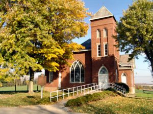
Zion (Ribel’s) Church was built on this site in 1808. The log structure was located in the Zion Ridge Cemetery, adjacent to the first school in Thorn Township. The congregation of Zion Reformed Church is the oldest in Perry County still in existence. The church was officially organized in 1806 when the German Reformed and Lutheran congregations joined together in building the first church in Perry County. They purchased this land on June 30, 1806, and shared the building, alternating Sundays, until 1911. In 1803, Reverend Johannes Christian Koenig (John King) became the first minister to settle in Perry County and became the founding minister for the German Reformed congregation. In 1805, Reverend Wilhelm Georg Forster (William Foster) was the first Lutheran minister to settle in Perry County and was the founding minister for the Lutherans. The present Zion Reformed Church was built across the street from the original church in 1910.
Originally belonging to the William Henry Harrison family, this cemetery was known as “The Pasture Graveyard” until the Civil War era. It became the final resting place of many members of the Harrison and Symmes families as well as other early settlers to the North Bend area. It was in use until 1884 when Maple Grove Cemetery opened as the official township cemetery.
In 1796, surveyors for the Connecticut Land Company designated an area five miles square surrounding this place as Range 7, Township 7 of the Connecticut Western Reserve. A landowner’s expedition on June 15, 1798, arrived at the northwest corner of the township. One of its members, Thomas Umberfield (Umberville) brought his family to the center of the township (now Burton Village) on June 21, 1798. Here they built the first home, a simple log cabin located southwest of the spring at the end of Spring Street. The owner of the largest parcel of land in the township, Titus Street, was given the honor of naming the township. He named it after his son, Burton.
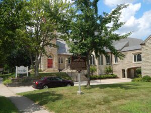
On March 11, 1817, Rev. Roger Searle of Connecticut met with a group of settlers at the home of Zenas Hamilton in Medina Township and founded St. Paul’s Episcopal Church. On April 10, 1817, the congregants cleared land near Weymouth and built a log church, which served as a school, place of worship for other dominations, and meeting house. The congregation eventually moved to Medina to serve the village’s growing population. Around 1883, noted Detroit architect Gordon W. Lloyd designed a new church in the Victorian Gothic style, thereafter described as “incomparably the finest Episcopal church in any country town at the time.” The first service was held on December 19, 1884. St. Paul’s was listed on the National Register of Historic Places in 1982 and is the oldest congregation in Medina County still in existence.
David Stearns, the first permanent settler, built a log cabin near this site on the “ridge” (Lorain Road) in 1816. Stearns was given this land by his father, Elijah, who had bought 1,002 acres from the Olmsted family. This area of North Olmsted was first called Kingston, renamed Lennox in 1823, and Olmsted in 1829. In 1827, Stearns donated his cabin to the community to be used as the first schoolhouse. In 1852 the cabin was moved to Butternut and Dover Center and continued to serve as a school.
During the early months of World War II, ordinary citizens as well as soldiers made enormous sacrifices for the war effort. In March 1942 the War Department announced plans to build a 13,000-acre munitions manufacturing complex northeast of Marion. Using the power of eminent domain, the U.S. Government purchased the homes and farms of 126 families in the Likens Chapel community. Given only two months to vacate their property, many displaced farmers found the government-appraised values for their land inadequate for buying similar farms elsewhere and the growing season too advanced to plant new crops. (continued on other side)