, OH
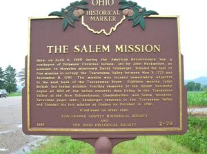
Here, on April 6, 1780 during the American Revolutionary War, a contingent of Delaware Christian Indians, led by John Heckwelder, an assistant to Moravian missionary David Zeisberger, founded the last of five missions to occupy the Tuscarawas Valley between May 3, 1772 and September 8, 1781. The mission was located immediately adjacent to the west bank of the Tuscarawas River. Eighteen months later, British led Indian soldiers forcibly removed to the Upper Sandusky region all 400 of the Indian converts then living in the Tuscarawas Valley at the New Schoenbrunn, Gnadenhutten, and Salem missions. Seventeen years later, Zeisberger returned to the Tuscarawas Valley and founded his last mission at Goshen on October 4, 1798.
, OH
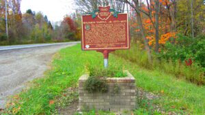
The founder of Ravenna Township in 1799, Benjamin Tappan Jr. led a distinguished life of public service. An aggressive force in local politics, he served in the Ohio Senate from 1803 to 1805, as judge of the fifth circuit court of common pleas from 1816 to 1823, and as federal district judge from 1826 to 1833. Tappan served as aide-de-camp to Major General Elijah Wadsworth following the surrender of Detroit in the War of 1812, provisioning and arming local militia units defending the northwestern frontier against a possible British invasion. (continued on other side)
, OH
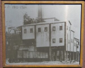
Approximately 150 feet east stood the Hisylvania Coal Company Mine No. 22 tipple, in use from 1912 to 1925. The company name was derived from combining “Ohio” and “Pennsylvania,” home states of its founders. Coal came from the mine portal in small railcars, was cleaned and sized in the tipple, and loaded into gondolas for shipment. The Mine No. 22 tipple had a brick and concrete frame, likely the only one of this type in Ohio. When demolished in 2000, it was one of the last tipples still standing as a reminder of Ohio’s 1880-1920 coal boom and the Hocking Valley coal field’s contribution during this era.
, OH
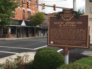
The Ottawa, or “Tawa” Indians had inhabited the Maumee Valley since the middle of the 1700s. By the 1790s, Ottawa settlements included villages along the Blanchard River at the present-day Village of Ottawa. During the War of 1812, Colonel James Findlay destroyed these villages because the Ottawa aided British forces. In 1817, the United States government established a reserve for the Ottawa in exchange for their lands in Northwest Ohio. The reserve encompassed a five-mile square area; its center was the intersection of the Blanchard River and an Indian trace near what is now Old State Route 65. (Continued on other side)
, OH
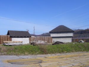
In 1787, the construction of Fort Steuben was completed by Captain John Francis Hamtramck and soldiers of the 1st American Regiment, who were sent to the frontier by the United States government to remove illegal squatters and protect government surveyors from American Indian raids. The surveyors were platting the First Seven Ranges of the Northwest Territory. The surveyed land was sold for settlement or offered to soldiers as payment for military service during the Revolutionary War. Consequently, the states of Ohio, Illinois, Indiana, Michigan, and Wisconsin were formed from the settlement of the Northwest Territory. Fort Steuben was named after Baron Frederich Wilhelm Augustus Steuben, who had served in the Revolutionary War and from which the town derived its name. Captain Hamtramck abandoned the fort in 1787 by order of Colonel Josiah Harmar, and by 1790 the remains of the fort had disappeared. Fort Steuben has been reconstructed on its original location.
, OH
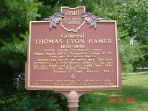
Teacher — Lawyer — Congressman — Soldier. Master Mason (1824). Georgetown Lodge No. 72.Free and Accepted Masons. ” . . . Hamer was one of the ablest men Ohio ever produced . . . I have always believed that had his life been spared, he would have been President of the United States . . .” Ulysses S. Grant. Memoirs, Vol. 1. [Masonic Emblem]
, OH
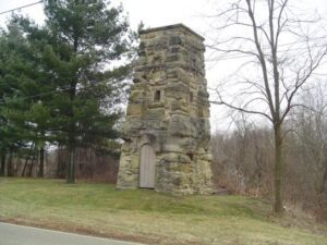
These three stone water towers were erected by local craftsmen in 1892 and serviced the Ohio Hospital for Epileptics until 1950. The sandstone of the uncoursed masonry walls was quarried from the surrounding hills. The hospital facility, a former Union Hospital site during the Civil War, was the first of its kind in the United States. The towers were restored in 1981-1982.
, OH
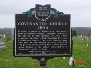
In 1804, a group of Scotch-Irish Covenanters from Rockbridge County, Virginia, erected a log church on this location. In 1805, they organized the Cherry Fork Associate Reformed Presbyterian Church. Two brick churches were also built on this location, in 1832 and 1854. The present (1976) Cherry Fork United Presbyterian Church is the oldest congregation of Covenanter origin in Ohio.


