, OH
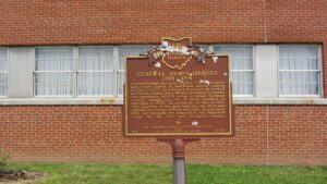
General Hedges was born in Ohio County, Virginia, and taught school in that state before coming to Ohio in 1803. As a Deputy Surveyor, he worked in Ashland, Holmes, Knox, Medina and Wayne Counties, and purchased 19,000 acres in future Richland County. Hedges was one of three founders of Mansfield in 1808. He served in the War of 1812. This unselfish Mason gave land for the Methodist Church, and Hedges School and Park. In February, 1818, he obtained the Deposition for Mansfield Lodge #35, Free and Accepted Masons. [Masonic Emblem]
, OH
As a member of the Connecticut Land Company, Judge Samuel Hinckley of North Hampton, Massachusetts purchased township 4N Range 13W of the Western Reserve in 1795 for a sum equivalent to 23 cents an acre. The township remained unsettled until Abraham Freeze was commissioned by Judge Hinckley in 1819 to survey the township into 100 plots of 160 acres each. In return for having the township, founded in 1825, named “Hinckley,” the judge gave land for two burying grounds and one-half acre for a public square. In 1919, upon the 101st anniversary of the “Great Hinckley Hunt,” where men from surrounding counties gathered on Christmas Eve to rid the township of wild animals, Judge Amos Webber spoke for the deceased Judge Hinckley: “When I last saw this country, it was a howling wilderness – by industry and frugality you and your ancestors have made these ever lasting hills and pleasant valleys blossom as the rose.”
, OH
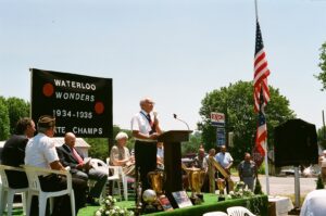
Waterloo was home to the legendary Waterloo Wonders. Coach Magellan Hariston and his Wonder Five captured consecutive Ohio state high school Class B basketball championships in 1934 & 1935, winning 94 out of 97 games, and defeating many Class A and college teams. The 91st Ohio House of Representatives honored the Waterloo Wonders with a resolution following their second Class B State Championship win. The Wonders, known for their colorful passing show, entertained fans with their scoring ability, defense, trick passes, and hardwood antics. Hailing from a small village with a school male enrollment of only 26, the Waterloo Wonders were considered one of the greatest basketball teams ever assembled on the Ohio high school athletic scene. After high school, four of the Wonder Five played professionally as the Waterloo Wonders, ranking among the best basketball squads in the country.
, OH
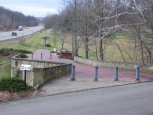
Coaches, Conestoga wagons, herds of livestock, pioneers on horseback, peddlers, soldiers, beggers–these and many others have crossed this bridge on the National Road since 1830. Escaping slaves sought shelter beneath it. Like many others on the road, the bridge was built with well-cut stone and good mortar in the shape of an “S” because it was easier to erect than one thrown straight across an oblique stream.
, OH
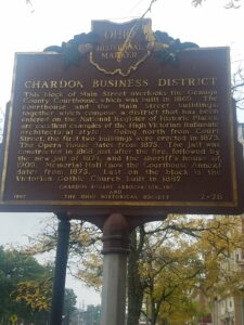
This block of Main Street overlooks the Geauga County Courthouse, which was built in 1869. The courthouse and the Main Street buildings, together which compose a district that has been entered on the National Register of Historic Places, are excellent examples of the High Victorian Italianate architectural style. Going north from Court Street, the first two buildings were erected in 1873. The Opera House dates from 1875. The jail was constructed in 1868 just after the fire, followed by the new jail of 1874, and the sheriff’s house of 1909. Memorial Hall (now the Courthouse Annex) dates from 1875. Last on the block is the Victorian Gothic Church built in 1882.
, OH
The Northwest Ordinance of 1787 defined the boundary of the northern and southern tier of states to be carved out of the Northwest Territory, as a line drawn east from the southernmost tip of Lake Michigan until it intersects Lake Erie. Controversy over the exact location of that line led to the 1834-1837 boundary dispute between the State of Ohio and Michigan Territory. Passions ran high as everyone on both sides of the boundary knew that a great port city (Toledo) would emerge in the disputed territory. President Andrew Jackson settled the dispute in 1836 when he signed an act that recognized the current border between Ohio and Michigan, giving Michigan 9,000 square miles of Upper Peninsula land and awarding the disputed strip of approximately 470 square miles to Ohio. Michigan then joined the nation as a state the following year.
, OH
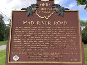
The first overland route between Dayton and Cincinnati was cut by Daniel Cooper in 1795 to provide access to the new town of Dayton, located at the mouth of the Mad River in the Symmes Purchase. The survey, entered into the record by Cooper and Dr. John Hole, extended Harmer’s Trace north from near Cunningham’s Station on the Mill Creek to the mouth of the Mad River, establishing the earliest road between Cincinnati and Dayton. This five-mile segment between David Road and State Route 725 is the last remaining traceable portion retaining this name. Cooper, a miller, was instrumental in the early settlement of Dayton, and Dr. Hole, the first physician in Montgomery County, established his cabin in 1796 on this part of Mad River Road.
, OH
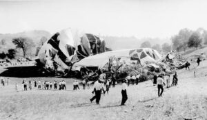
On a stormy autumn morning in 1925, the giant Navy airship, christened Shenandoah, crashed near this site. Initially, the Shenandoah was commissioned to perform scouting missions for the Navy; however, she would soon be flying promotional missions. The Shenandoah had recently begun a six-day publicity tour across the Midwest when she crashed. The turbulent weather of late summer created strong winds, which ripped the 680-feet long Shenandoah in two and tore the control car from the keel. A majority of the 14 crewmen who died in the crash, including the captain, Lt. Commander Zachary Lansdowne of Greenville, Ohio, were killed when the control car plummeted to the ground. The stern section fell in a valley near Ava and the bow was carried southwest nearly twelve miles before landing near Sharon, Ohio. The Ohio National Guard was called in to control the crowds of spectators who traveled to the crash sites.


