, OH
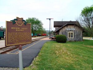
The arrival of the Columbus and Hocking Valley Railroad in 1869 led to the decline of the Hocking Canal and assured Nelsonville’s prominence as a major shipping point of coal and industrial products. The portion of the railway from Logan in Nelsonville was listed on the National Register of Historic Places in 1988, along with steam locomotive #33 and caboose #90704.
, OH
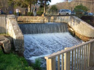
Sounds of boat horns and brawling packet crews resounded for many years at this lock and 142 others on the Ohio and Erie Canal. The canal was a 308-mile water toll road built between 1825 and 1832 from Lake Erie at Cleveland to the Ohio River at Portsmouth. The early growth of Akron and Massillon was due to the canal. Railroads caused its decline and the flood of 1913 destroyed its usefulness.
, OH
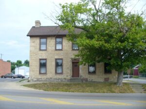
The Smith Tannery is the oldest original structure remaining in Greenfield. Built in 1821 by Revolutionary War veteran William Smith and his son Samuel, the tannery became a noted station on the fabled “Underground Railroad.” The structure, which also served as the family residence, was the birthplace of Dr. Samuel M. Smith, Surgeon General of Ohio during the Civil War, and Dr. William R. Smith, who personally notified Abraham Lincoln of his nomination to the presidency in 1864. The Smiths were active members of the Abolition Society of Paint Valley, which was established in 1833 in Greenfield and reorganized in 1836 as the Greenfield Anti-Slavery Society. In 1844, the Society assisted the efforts of Frederick Douglass, one of the nation’s leading abolitionists. The Society provided an important junction on the Underground Railroad, assisting many fugitive slaves to gain freedom, including, it is said, Eliza Jane Harris of Uncle Tom’s Cabin fame. The Smith Tannery was named to the National Register of Historic Places in 1978.
, OH
This building was a center of community life from the time of its construction in 1886 to the late 1930s. Once common, such combinations of governmental offices and commercial and entertainment space are today rare. The second floor opera house retains many original features, including stage backdrops, dressing rooms, and seats. Vaudeville, theater companies, and entertainment of all kinds were hosted here and many performers signed the backstage walls: Buffalo Bill dated his signature October 28, 1888. Along with village offices, first floor tenants have included the Vermillion Township Trustees, the Eddie Stover Hat Shop, and the F.L. Smith Watch Repair and Jewelry Store. Hayesville’s citizens approved the hall’s construction on April 18, 1884 by a vote of 100 to 13. Contractor Samuel Craig completed the building two years later at a cost of $4,852.20. Located on the Lincoln Highway, this building was listed on the National Register of Historic Places in 1976.
, OH
You are standing on the famous portage, carrying-place between the Cuyahoga and Tuscarawas rivers. The two streams and the portage across the watershed formed an early route between Lake Erie and the Ohio River. First the Indians, then French and English traders and trappers, and finally American settlers and travelers carried their canoes and packs across this narrow strip of land in passing, by way of the rivers, between northern and southern Ohio. The portage was a part of the defined boundaries in the treaties with the Indians made at Fort McIntosh (1785), Fort Harmar (1789), and Green Ville (1795). Use of the portage was discontinued in 1827 when the Ohio and Erie Canal was built along the old trail. Today, modern Akron streets–Portage Path and Manchester Road–follow the approximate route of the original portage.
, OH
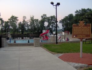
The construction of Putnam County’s first public swimming pool helped Columbus Grove weather the Great Depression of the 1930s. President Franklin D. Roosevelt’s Works Progress Administration (WPA) and the Village of Columbus Grove planned the pool to provide much-needed jobs and recreational facilities for the residents of Putnam County. Between the fall of 1935 and 1936, local men (and two women) built the pool and shelter house by hand from rock quarried on site. The workers were not trained stone masons or cutters. Befitting their limited skills, the pool was built in a simplified Norman Revival/Rustic architectural style. Wages ranged from $.33 to $.55 per hour. The pool’s grand opening was July 1, 1937. That first year, adults paid $.25 to swim, and children were charged $.10. The Columbus Grove Municipal Pool was listed on the National Register of Historic Places in 1997.
, OH
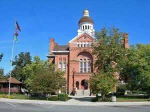
Named for John Paulding, a Revolutionary War soldier whose capture of a British spy implicated Benedict Arnold in treason, Paulding County was formed in 1820 from the last remaining unorganized area of Ohio. Sparsely settled, it remained under the jurisdiction of Wood County until 1824 and then Williams County until 1839. Paulding’s first county seat was established at New Rochester in 1839, then moved to Charloe in 1841. Neither village exists today. Centrally-located Paulding Center became the county seat in 1851, and a courthouse was built the following year. The present courthouse, built during the region’s timber boom of the late 19th century, was designed by architect Edward Oscar Fallis and patterned after his Lenawee County courthouse in Adrian, Michigan. The four-faced Romanesque style building was completed in 1888 at a cost of $40,000. It was listed on the National Register of Historic Places in 1974.
, OH
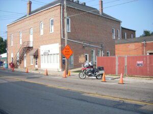
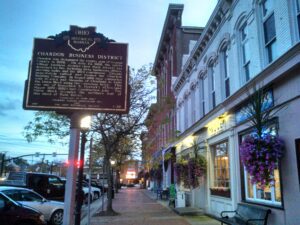
Chardon was designated the county seat of Geauga County in 1808. On July 25, 1868, the entire village business district (now Main Street) was destroyed by fire, including forty businesses, offices, meeting halls, and the 1824 courthouse. Citizens immediately rallied and formed the Chardon Building Company. In August 1868 they contracted with Herrick and Simmons of Cleveland to build the Union Block using fire-resistant brick. This was one of Rensselaer R. Herrick’s (Cleveland Mayor 1879-1882) last construction jobs. The Union Block occupies the northern half of this block of Main Street. (Continued on other side)


