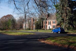
Youngstown’s earliest automobile suburb, Forest Glen Estates was developed in the 1920s during a period of change in urban transportation patterns and rapid expansion in the regional steel economy. A composite of design work by leading northeastern Ohio landscape and residential architects, the park-like suburb integrates period revival architecture into the natural landscape and blends gracefully with adjacent Mill Creek Park. Gently curving streets with low curbs and landscaped islands were a novel departure from traditional grid patterns. Attached garages and walkways that connect to driveways rather than the street reflect the influence of the personal automobile in the suburban landscape during this era. In 1998, the Forest Glen Estates Historic District was listed on the National Register of Historic Places.
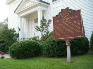
This congregation was organized January 9, 1820 by 11 charter members. In 1837 the structure was completed on land reserved for religious purposes on the first Maumee plat. A British gun battery stood on the site in the War of 1812. Additions to the building were made in 1922, 1951, and 1968. Dr. Horatio Conant, pioneer teacher, merchant, physician, and politician, was for 59 years a member and officer.
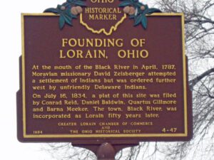
At the mouth of the Black River in April, 1787, Moravian missionary David Zeisberger attempted a settlement of Indians but was ordered further west by unfriendly Delaware Indians. On July 16, 1834, a plat of this site was filed by Conrad Reid, Daniel Baldwin, Quartus Gillmore and Barna Meeker. The town, Black River, was incorporated as Lorain fifty years later.
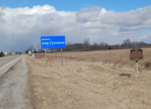
After the War of 1812, the United States Congress proposed two million acres of military bounty land for the Michigan Territory. To survey the land, the meridian had to first be established. U.S. Surveyor General Edward Tiffin created the meridian based on the western line of the Treaty of Detroit (1807). He contracted with Deputy Surveyor Benjamin Hough in April 1815 to begin the survey for $3 per mile. Taking a reading from Polaris (the North Star), Hough, Alexander Holmes, and 11 crew members surveyed the line due north from Fort Defiance. The difficult terrain they encountered temporarily halted all surveys in the territory and ultimately led to the bounty land being transferred to the Illinois and Missouri Territories.
On this site the Ohio & Erie Canal flowed south and down-level under the Market Street Bridge. Nearby Pawpaw Creek and the canal culturally divided the Swiss settlers to the west in Basil and the Virginia pioneers to the east in New Market (Baltimore by 1833). In March 1825, the “Twin Cities” were “dedicated” one day apart and energized a feud that often erupted at the bridge where “the boys of one village entered the other at their peril and where the worst of the intervillage fights were held.” The rivalry stretched well into the twentieth century and was arguably terminated with an uneasy consolidation of the two towns in 1947.
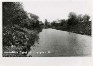
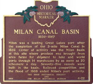
Milan was a leading Great Lakes port after the completion of the 3 mile Milan Canal in 1839. Center of activity was the Milan Basin at this site where produce was brought from area farms for shipment to lake and world ports through 14 warehouses by as many as 20 schooners a day. Seventy-five vessels were built in the basin. Railroad competition and the flood of 1868 ended Milan’s port activity.
Colonel Ebenezer Zane, one of the founders of Wheeling, laid out the village that became Bridgeport in 1806 on the site of Fort Kirkwood (1789). Originally named Canton, it acquired its present name after the bridge to Wheeling Island was built. The arrival of the National Road in 1818 made the growing town a major portal into the state of Ohio for westbound emigrants, adding to its importance as a port for Ohio River traffic. With the advent of railroads and, later, transcontinental highways, Bridgeport continues to serve as Ohio’s “Gateway to the West.”
Massie’s Station, built in 1791, was the fourth permanent settlement center in Ohio and the last stockade settlement built in Ohio. It provided protection from the Indians for Manchester’s settlers until 1794. Manchester was the first settlement in the Virginia Military District and the site of the first court held in Adams County, September, 1797.