, OH
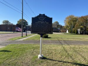
Orrville was founded in 1852 at the railroad crossing that would later serve the Pittsburgh, Fort Wayne and Chicago and the Columbus, Mount Vernon and Cleveland railroads. The town was named in honor of Judge Smith Orr, who was instrumental in bringing the railroad to Wayne County. Orr persuaded landowner Robert Taggart to partition ten acres into town lots. After buying out the land owned by fellow settlers Christian Horst, David Rudy, and Peter Perrine, Orr engaged Jesse Straughan to create the first plat map that centered the newly-formed town on the railroad crossing. Incorporated on May 9, 1864, Orrville prospered and attracted manufactories of all kinds. Orrville was the largest manufacturing town in Wayne County by 1873.
, OH
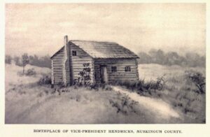
Vice President Thomas A. Hendricks was born at this site on September 7, 1819. While still a baby, Thomas’ family moved to Indiana and he grew up and rose to prominence in the Hoosier State. Hendricks served consecutively in the Indiana State Legislature and the U.S. House of Representatives during the late 1840s and the 1850s. From 1863 to1869, he was one of Indiana’s U.S. Senators. Hoosiers elected Hendricks to serve as Indiana’s sixteenth governor in 1872, making him the first Democrat to win that office in a northern state after the Civil War. In 1876, vice-presidential candidate Hendricks and his running mate, Samuel Tilden, lost the presidential election to Ohioan Rutherford B. Hayes. Hendricks joined Grover Cleveland on the Democratic party’s presidential ticket in 1884 and won. Hendricks died in 1885, after serving only eight months as vice president.
, OH
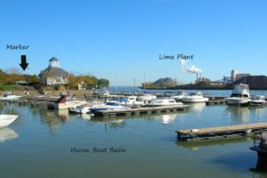
In the early 1800s, Jabez Wright, an early Huron County judge, purchased a large tract of lakeside land on the north side of what is now Cleveland Road. There Wright built an eight-room farmhouse that later served as a “station” on the fabled Underground Railroad, playing a vital role in aiding fugitive African-American slaves to freedom. Beneath Wright’s farmhouse was a sixteen foot-wide and ninety foot-long tunnel. Escaped slaves entered the passage through a trap door in the home’s basement and exited into a corn crib located a mere one hundred feet from Lake Erie. There the slaves awaited the arrival of rowboats transporting them to vessels heading north to Canada. (Continued on side two)
, OH
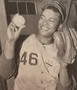
Ulysses Brooks Lawrence was born in Springfield on January 30, 1925. Nicknamed “The Bull,” he broke numerous color barriers throughout his baseball career. In 1976, Lawrence was the first Black player inducted into the Cincinnati Reds Hall of Fame. An all-around athlete at Springfield High School, Lawrence lettered in basketball, track, and football (the school’s first Black starting quarterback). After graduation in 1943, he was drafted into the U.S. Army and earned a Bronze Star in Guam during World War II. Lawrence enrolled at Ohio’s Miami University, becoming that school’s first Black baseball player (1947-1949), before signing with the Cleveland Indians. Acquired by the St. Louis Cardinals (1954), he was assigned to the Columbus Red Birds Triple-A farm team, breaking another team’s color barrier. (Continued on other side)
, OH
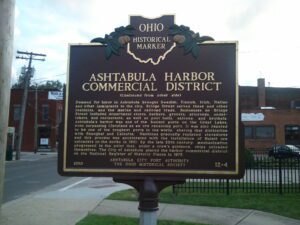
When the Pittsburgh, Youngstown and Ashtabula Railroad was finished in 1873, Ashtabula’s harbor became a direct route to ship iron ore to the booming steel mills of Youngstown and Pittsburgh. On the west side of the Ashtabula River, a brush-filled gulley became Bridge Street. New buildings and bridges attest to the harbor’s importance as a commercial and shipping hub from the late 19th through mid 20th centuries. Fires destroyed wood-frame buildings on the block closest to the river. A fire in 1886 nearly cleared the north side of Bridge Street. Another fire swept over the south side in 1900. Fire resistant brick buildings replaced frame structures and over the course of rebuilding, the level of the street rose approximately eight feet. In 1889, a swing-span bridge replaced the original pontoon bridge over the river. A bascule lift (draw) bridge replaced the swing bridge in 1925.
, OH
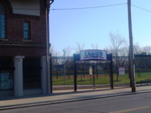
League Park opened on May 1, 1891, with the legendary Cy Young pitching for the Cleveland Spiders in their win over the Cincinnati Redlegs. The park remained the home of Cleveland’s professional baseball and football teams until 1946. In 1920 the Cleveland Indians’ Elmer Smith hit the first grand slam home run, and Bill Wamby executed the only unassisted triple play, in World Series history. Babe Ruth hit his 500th home run over the park’s short right field wall in 1929. With the park as home field, the Cleveland Buckeyes won the Negro World Series in 1945.
, OH
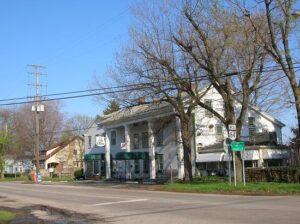
First known as the Webster House, later as the New England House, and finally as the Old Tavern, this inn has served travelers on the old Cleveland-Buffalo Road (now State Route 84) since before Ohio became a state. As traffic on the old Indian trail increased and it became a post and stage road, the two original log cabins, built in 1798 and later, were converted to this two-and-a-half story inn between 1815 and 1820. While the tavern was the scene of Civil War-era parties and dances in the second-floor ballroom, local tradition suggests it offered much more clandestine hospitality to escaping slaves as a station on the Underground Railroad. The Unionville Tavern was added to the National Register of Historical Places in 1973.
, OH
Construction of the Ohio and Erie Canal, beginning in Cleveland and running south to Portsmouth, began in 1825. As a means to pay for debts on the community’s 5,500 acres of Tuscarawas County land, members of the Society of Separatists of Zoar contracted to construct this portion of the canal. They received $21,000 for this work, which was completed in 1827. Surplus goods were transported on Society owned and operated canal boats to outside markets via the Ohio and Erie Canal, which also brought manufactured items into Zoar. (continued on other side)


