, OH
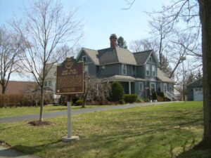
Harold Hart Crane was born at this site on July 21, 1899, to Grace Hart Crane and Clarence A. Crane, the inventor of Lifesaver Candies, and lived here until the age of three. “A born poet,” according to e.e. cummings, Crane dropped out of high school in 1916 and moved from Cleveland to New York City to focus on a literary career. Mainly self-educated, Crane drew his influence from the writings of Walt Whitman and Emily Dickinson. His major work, The Bridge (1930), uses the Brooklyn Bridge as the perfect metaphor to celebrate contemporary urban life. Uniquely lyrical in structure and full of imagery, it is considered one of the three major poetic sequences of the first half of the twentieth century along with T.S. Eliot’s The Waste Land and William Carlos Williams’ Paterson. Crane died on April 26, 1932.
, OH
Zenas King (1818-1892) was a 19th century bridge builder whose iron bridges received wide acceptance throughout the country. He developed his tubular bowstring bridge in 1859, patented the design in 1861, renewed the patent in 1867, and founded King Iron Bridge & Manufacturing Company in 1871. Based on an arch’s inherent strength, King’s design used less raw materials than wooden bridges and the square tubes were simple to fabricate and ship for on-site assembly. His Cleveland-based company soon built so many patent bowstrings across Ohio that it set a design standard. (Continued on other side)
, OH
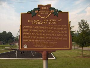
The Pittsburgh No. 8 coal seam, located 100 feet below river level at Powhatan Point, extends across much of eastern Ohio, western Pennsylvania, and northern West Virginia. The Cleveland and Western Coal Company, founded by Cleveland industrialist Frank E. Taplin, opened the Powhatan No. 1 mine here in 1922 to take advantage of both river and rail transportation. It became the largest deep mine in Ohio and was the first mine in the state to be completely mechanized. Reorganized as the North American Coal Corporation in 1925, the company operated seven shaft mines in this area during the twentieth century. Four of these mines closed between 1980 and 1984 as clean air standards made locally mined high-sulfur coal difficult to market.
, OH
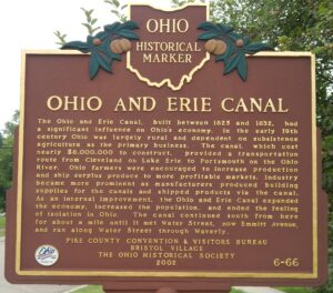
The Ohio and Erie Canal, built between 1825 and 1832, had a significant influence on Ohio’s economy. In the early 19th century Ohio was largely rural and dependent on subsistence agriculture as the primary business. The canal, which cost nearly $8,000,000 to construct, provided a transportation route from Cleveland on Lake Erie to Portsmouth on the Ohio River. Ohio farmers were encouraged to increase production and ship surplus produce to more profitable markets. Industry became more prominent as manufacturers produced building supplies for the canals and shipped products via the canal. As an internal improvement, the Ohio and Erie Canal expanded the economy, increased the population, and ended the feeling of isolation in Ohio. The canal continued south from here for about a mile until it met Water Street, now Emmitt Avenue, and ran along Water Street through Waverly.
, OH
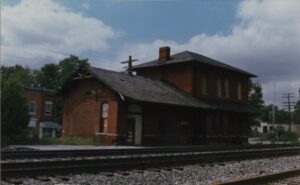
By the mid 1830s, Ohio had developed a canal system that linked Lake Erie in the north to the Ohio River in the south. Despite the success of the canals, transportation companies searched for other methods to traverse the state. They found their answer in the railroad industry, which proved to be much faster, cheaper, and more reliable than canals. Located on Lake Erie, Sandusky, Ohio was a major trading depot in the area. Plans were made to connect Sandusky to Cincinnati’s port on the Ohio River. On September 4, 1835, construction began in Sandusky on the Mad River and Lake Erie Railroad line, forming the first railroad line located entirely in Ohio. The railroad reached Tiffin by 1841 and Springfield by 1848, where it merged with the Little Miami Railroad line, connecting Lake Erie to the Ohio River.
, OH
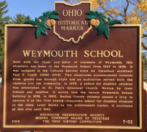
Built with the funds and labor of residents of Weymouth, this structure was home to the Weymouth School from 1925 to 1956. It was designed in the Colonial Revival style by Cleveland architect Paul T. Cahill (1888-1954). Two classrooms accommodated students from grades one through eight and an auditorium served both the children and the community. In 1953, a school for disabled children was established in St. Paul’s Episcopal Church, Medina by their friends and families. It moved into the vacant Weymouth School building in 1956. In 1960, Medina County citizens passed a levy to operate it as the first county-supported school for disabled students in the state. Later known as the Achievement Center, it continued at this site until 1992.
, OH
Robert C. Henry, the first African-American mayor of an Ohio city, was born in Springfield, Ohio, on July 16, 1921. He attended Springfield High School and graduated in 1939. After high school, he attended Wittenberg University and the Cleveland College of Mortuary Science. He also received an honorary Doctorate of Law degree from Central State University. In 1961, Springfield citizens elected him to the City Commission, where he served until being appointed mayor by his fellow commissioners in 1966. Henry was among the first African-American mayors of a U.S. city, and is especially notable due to Springfield’s majority white population at the time. After his tenure as mayor ended in 1968, Henry was chosen by presidents Lyndon B. Johnson and Richard M. Nixon for fact- finding missions in Vietnam. Robert C. Henry died on September 8, 1981.
, OH
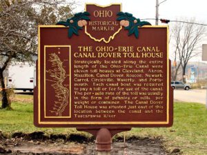
Strategically located along the entire length of the Ohio-Erie Canal were eleven toll houses at Cleveland, Akron, Massillon, Canal Dover, Roscoe, Newark, Carrol, Circleville, Waverly, and Portsmouth. Each canal boat was required to pay a toll or fee for use of the canal. The per-mile rate of the toll was usually in the form of pennies or mills, per weight or container. The Canal Dover Toll House was situated just east of this location between the canal and the Tuscarawas River.


