

, OH
Begun in 1833, the Miami Extension Canal linked the Miami Canal in Dayton to the Wabash & Erie Canal at Junction. Engineering difficulties, epidemics, and the Panic of 1837 delayed completion of the Extension until June 1845, when the packet boat Banner first navigated the almost 250 miles distance from Cincinnati to Toledo in three days. New Bremen was the northern terminus for a period while work continued northward on the Extension. Designated the Miami & Erie Canal in 1849, it served as the primary avenue of commerce and military transport, and as a “post road” before the railroad era. The Miami & Erie remained in use until 1913, long after the canal era had passed. Along the course of the canal, New Bremen was the approximate midway point between Cincinnati and Toledo.
, OH
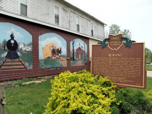
The village of Albany was established in 1838 as a market center for the surrounding agricultural area, which saw its first white settlement in the early years of the nineteenth century. Education was always a major concern of Albany’s citizens. Since public schooling was minimal, private academies provided the community various levels of education from the 1840s to the 1880s. Anti-slavery sentiment also was strong in Albany, and many of its citizens participated in the “Underground Railroad.” Because of educational opportunities and sympathetic white neighbors, free African-Americans came to Albany, but most had moved away by the 1930s. After World War Two, the village lost its status as a center for commerce and business.
, OH
Here, on September 6, 1918, Bryan’s Air Mail Field began operations as one of Ohio’s first official airfields with the arrival of a survey flight to establish air mail service between New York and Chicago. Scheduled service began on July 1, 1919, and stretched west to San Francisco on September 8, 1920, completing the 2,666 mile U.S transcontinental air mail route. Flying the Curtiss JN-4H “Jenny,” R-4, Standard JR-1B, and later, the De Havilland DH-4, aviators pioneered cross continental flight in open cockpit biplanes without radios or electronic navigational aids and reduced coast to coast mail delivery from 87 hours by rail to 33 hours by air.
, OH
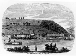
Ripley was incorporated as the village of Staunton in 1812. Its name was changed in 1816 to honor General Eleazer Wheelock Ripley, a hero of the War of 1812. In the years before railroads, Ripley was a principal Ohio River shipping center. Also important were its extensive boat-building, tobacco, pork, and timber industries. Ripley too was the home of saw and planing mills, iron foundries, and a piano factory. Such varied commerce enabled Ripley to remain vibrant throughout the nineteenth century. Although noted as a port, Ripley is best remembered as an abolitionist stronghold. Many of its citizens, including Rev. John Rankin and John P. Parker, served as conductors on the famed “Underground Railroad.” The notoriety of Ripley’s anti-slavery network perhaps eclipsed that of nearby Cincinnati, earning the town a reputation as the “Black Hole of Abolitionism.” (Continued on side two)
, OH
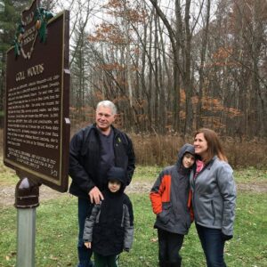
Two Deputy U.S. General Land Office Surveyors traversed Goll Woods: Benjamin Hough in 1815 and Captain James Riley in 1821. Hough (1772-1819) established the Michigan Meridian in 1815 and was county and state office holder in Ohio. Riley’s life was more tumultuous. Riley (1777-1840) captained the merchant ship Commerce, which wrecked off the Saharan coast in 1815. Riley and crew were enslaved for four months until ransomed by British diplomat William Willshire. In 1817, Riley published a famous account of his time in North Africa, and, in 1819, was appointed a surveyor by Surveyor General Edward Tiffin. Moving to Northwest Ohio, Riley named the village he founded in 1822, Willshire, for his deliverer. Riley returned to New York in 1826 and to the sea, where he died. Riley’s book went through more than twenty editions by 1860 and Abraham Lincoln credited the account as one that influenced him deeply.
, OH
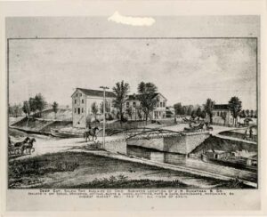
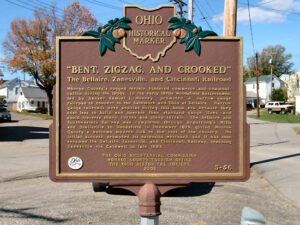
Monroe County’s rugged terrain hindered commerce and communication during the 1800s. In the early 1870s Woodsfield businessmen, led by banker Samuel L. Mooney, promoted a narrow-gauge railroad to connect to the Baltimore and Ohio at Bellaire. Narrow gauge railroads were popular during this boom era because they cost less to build and operate than standard-gauge lines and could traverse sharp curves and steep terrain. The Bellaire and Southwestern Railway was completed through Armstrong’s Mills and Beallsville to Woodsfield in December 1879, giving Monroe County a welcome modern link to the rest of the country. Its initial success prompted its extension westward, and it was soon renamed the Bellaire, Zanesville, and Cincinnati Railway, reaching Zanesville via Caldwell in late 1883.
, OH
Evansport is named after brothers Amos and Albert G. Evans who, with Jacob Coy, had the village surveyed next to the Tiffin River on December 14, 1835. The “port” suffix in Evansport’s name reflects the river’s significance as a transportation thoroughfare. Evansport’s early growth was spurred by its mills powered by the Tiffin River. The mills provided settlers with lumber for buildings and supplied flour and cornmeal for sustenance and commerce. Settlers who poured into Williams County’s northern townships in the 1830s agitated debate about moving the county seat to a more centralized location. Evansport was platted as a possible site for the county seat. The Williams County seat was moved to Bryan in 1840 and in 1845 Defiance County was created, leaving Evansport on the Williams-Defiance county line.
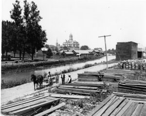
, OH
Miami & Erie Canal and Napoleon’s First Cemetery. The Miami & Erie Canal stretched approximately 250 miles from Cincinnati to Toledo. Napoleon and other towns on the Maumee River’s banks were on a slackwater section of the canal. Between 1825 and 1845, laborers constructed the canal using shovels, picks, wheelbarrows, and horse and mule-drawn carts. In Henry County, Napoleon, and elsewhere, German and Irish immigrants and area farmers did the work and were paid around 30 cents a day. As the canal brought more people and business to the area, villages such as Florida, Damascus, and Texas flourished and the county seat of Napoleon boomed. The canal and consequent growth took their tolls, however. Sickness and disease such as “ague” (malaria) and cholera spread and carried off many. Napoleon’s first cemetery was located in the vicinity of 500 East Clinton Street, near the route of the canal.