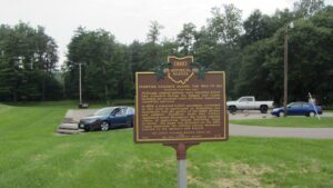
Tensions between Native Americans and Euro-American settlers remained high on the Ohio frontier during the War of 1812. Grievances mounted rapidly following the forced removal of the Greentown Delawares to Piqua in the late summer of 1812. On September 10, British-allied Indians attacked and killed the Frederick Zimmer family and neighbor Martin Ruffner one mile north of here. Five days later, on September 15, Reverend James Copus and three militiamen–George Shipley, John Tedrick, and Robert Warnock–were killed while defending Copus’ family from a raiding party one mile south of this site. (continued on other side)
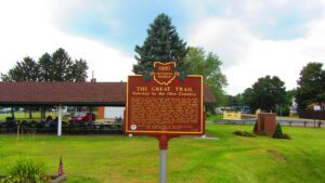
The ancient trail that passed near this spot was the major overland route entering the Ohio Country from the east through the 1700s. Also known as the Tuscarawas Path, the Great Trail was used by Native Americans, European explorers, fur traders, missionaries, military expeditions, land agents-and settlers after Ohio became a state. In January 1761, during the French and Indian War, Major Robert Rogers and thirty-eight rangers passed en route to Fort Pitt after taking Fort Detroit from the French. In 1764, during “Pontiac’s Conspiracy,” Colonel Henry Bouquet crossed here with an army of 1,500 men on his way to Goshachgunk (Coshocton), where he treated with the Delaware and freed captives. During the American Revolution, the Continental Army under General Lachlan McIntosh camped here for two days in November 1778.
Intersection of S. Sandusky Street & Olentangy Avenue
Delaware
, OH
Near this site, the Union army established two camps on either side of the Olentangy River during the Civil War. Both were known as Camp Delaware. The first camp, situated on the west side of the river in the summer of 1862, was where the white recruits of the 96th and 121st regiments of Ohio Volunteer Infantry were mustered into service. A second camp, on the east side of the Olentangy, was established in the summer of 1863 and became the rendezvous point for most African-American Ohioans joining the army. The 127th Regiment of Ohio Volunteer Infantry-later renamed the 5th Regiment United States Colored Troops, the 27th U.S. Colored Troops, and members of other African-American units were mustered into service at Camp Delaware.
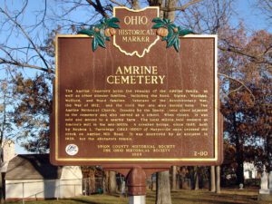
The first permanent settlement in the Marysville area, was founded in 1817 by Revolutionary War veteran Abraham Amrine (1761-1849) and his sons. The Amrines emigrated from Switzerland to Pennsylvania in the early 1700s and, after living in Belmont County, Ohio for 16 years, Abraham purchased 1000 acres here along Mill Creek circa 1817, paying $2 an acre. When Paris Township was organized in 1821, the township officers were elected in Amrine’s home on Newton Pike (now Raymond Road). All seven of his sons, John, Andrew, Moses, Frederick, Jeremiah, Abraham, Jr., and Henry, settled here. Andrew was a Justice of the Peace and leader in the church. Near this site, Henry built a sawmill in 1822 and a gristmill in 1825, which were operated by the family for more than 50 years.
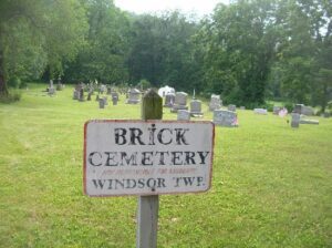
The Windsor Township Baptist Association was organized January 11, 1818 by Elder William Davis with 35 members who met in homes, barns and schoolhouses. At the death of the six-year-old granddaughter of Samuel and Tabitha Davis Henery, this plot by the river was laid out of a church yard and deeded by John Henery in 1837. In 1838 a brick church was built at the cost of $1,000. It served this community until the road and church were destroyed by the flood of 1913. More than 50 men from this area served in the Civil War. Twenty-six War of 1812 veterans are buried here as well as William Davis, veteran of the American Revolution; Obadiah Brokaw, founder of Big Bottom State Memorial; and Captain Isaac Newton Hook, river pilot at the age of ten and U.S. master of inland navigation, 1860-1873, who ran supplies on the Tennessee and Cumberland rivers for the Union Army. At Captain Hook’s death in 1906, the steamers Valley Gem, Zanesville, and Sonoma from Marietta in his honor landed passengers at the church here for his funeral, “largest ever held in the Muskingum Valley.” “The Lord and the River giveth and then taketh away.”
In Greenwood Cemetery, at the end of Greenwood Road
Racine
, OH
Born at Oak Grove, prospected in the California goldfields in 1849. During the Civil War he raised a militia company at Racine, and was later promoted Captain of Co. K, 18th O.V.I. After the war, he served on the Racine Village council, Sheriff of Meigs County, and was a member of the Ohio General Assembly. He was Secretary-Treasurer of the Ohio Commission for the Chichamauga Battleground National Park, and served 14 years as Postmaster of the U.S. House of Representatives.
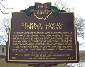
In September 1786, Captain Benjamin Logan of Kentucky captured a young Indian boy during a raid across the Ohio River on the Machachac tribe towns of the Shawnee nation. Upon returning to Kentucky, Captain Logan made the 14 year old boy part of his family until he was forced by treaty to return him to his native people. From the period of residence in Kentucky to the time of his death, Johnny Logan, as he was named, was a friend of the United States. Following the declaration of war against England in 1812, he joined the American service. He was employed by the Indian Agent John Johnston at Piqua to help evacuate Ohio women and children living near Fort Wayne. The siege of that fort was later lifted by the combined force of Kentucky and Ohio troops under the command of General William Henry Harrison. [continued on other side]
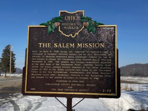
Here, on April 6, 1780 during the American Revolutionary War, a contingent of Delaware Christian Indians, led by John Heckwelder, an assistant to Moravian missionary David Zeisberger, founded the last of five missions to occupy the Tuscarawas Valley between May 3, 1772 and September 8, 1781. The mission was located immediately adjacent to the west bank of the Tuscarawas River. Eighteen months later, British led Indian soldiers forcibly removed to the Upper Sandusky region all 400 of the Indian converts then living in the Tuscarawas Valley at the New Schoenbrunn, Gnadenhutten, and Salem missions. Seventeen years later, Zeisberger returned to the Tuscarawas Valley and founded his last mission at Goshen on October 4, 1798.