Constitution Park-Just N of Intersection of OH 725 and US 42
Spring Valley
, OH
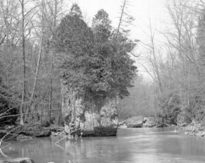
In 1779 John Bowman’s forces followed the east bank to Glady Run, then north to the Indian village of Old Chillicothe. In 1780 and 1782 militia commanded by George Rogers Clark, and guided by Simon Kenton and Daniel Boone, crossed the river and camped two miles north of Caesar’s Creek, then marched on the villages near Springfield, Piqua, and Bellefontaine.
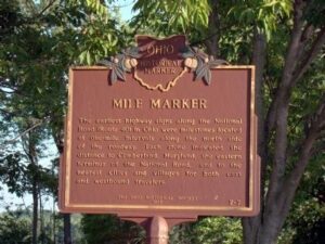
The earliest highway signs along the National Road (Route 40) in Ohio were milestones located at one-mile intervals along the north side of the roadway. Each stone indicated the distance to Cumberland, Maryland, the eastern terminus of the National Road, and to the nearest cities and villages for both east and westbound travelers.
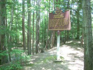
The prehistoric Erie Indians built a fortification across this neck of land sometime before 1650. A low wall is all that remains today of a stockade where earth had been piled at the base of posts. The stockade and the naturally steep embankments of the ridge provided a safe location for an Indian village.
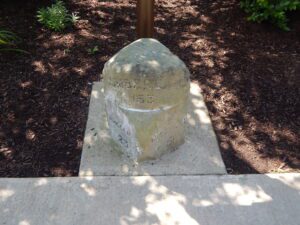
The earliest highway signs along the National Road (Route 40) in Ohio were milestones located at one-mile intervals along the north side of the roadway. Each stone indicated the distance to Cumberland, Maryland, the eastern terminus of the National Road, and to the nearest cities and villages for both east and westbound travelers.
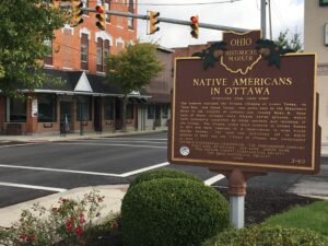
The Ottawa, or “Tawa” Indians had inhabited the Maumee Valley since the middle of the 1700s. By the 1790s, Ottawa settlements included villages along the Blanchard River at the present-day Village of Ottawa. During the War of 1812, Colonel James Findlay destroyed these villages because the Ottawa aided British forces. In 1817, the United States government established a reserve for the Ottawa in exchange for their lands in Northwest Ohio. The reserve encompassed a five-mile square area; its center was the intersection of the Blanchard River and an Indian trace near what is now Old State Route 65. (Continued on other side)
The West Liberty area, in the Mad River Valley, was the location of at least seven Shawnee Indian villages. This elevated site was the location of one of those villages. Several septs or divisions of the Shawnee nation lived in this area after being forced from their homes in southern Ohio. In 1786, together with Simon Kenton, Colonel Benjamin Logan’s army destroyed all the Shawnee villages in retaliation for the Indian raids in southern Ohio and Kentucky. Consequently, the remaining Shawnees moved to northwest Ohio near the present-day site of Maumee.
The Richwood Opera House and Town Hall was erected in 1890 as a community center designed to house the town council chambers, fire department, jail and opera house. The Richardsonian Romanesque styled building served Richwood in all these capacities for nearly 75 years. The Opera House was the site of minstrel shows, concerts, movies, lecture courses, revivals, farmers’ institutes, commencements, and community meetings. The second floor gymnasium was used for a men’s independent basketball league, dance classes, and as a teen center after World War II. Construction of an interurban railway running between Richwood and the resort town of Magnetic Springs in 1906 provided an expanded audience for the Opera House. (continued on other side)
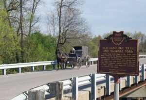
County Road 265 follows an old Indian trail which connected the Wyandot villages at Upper Sandusky with the Shawnee Mac-o-chee towns to the southwest. Many wigwams were pitched near this Scioto River ford during the late 18th and early 19th centuries. Soldiers (during the War of 1812), settlers, and stagecoach passengers later followed this route.