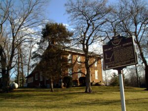
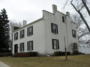
The Sharp family homes and their locations on N. State Street and Africa Road mark an important route through Westerville on the Underground Railroad. The family patriarch, Garrit Sharp, was an original settler of Sharp’s Settlement, now Westerville, and donated land for and helped organize the first Methodist church. He is also associated with the founding of Blendon Young Men’s Seminary, which was acquired by Otterbein College, an institution with enrollment open to African Americans and women from its inception in 1847. He and his sons were all noted abolitionists who, along with Bishop William Hanby and Otterbein president Lewis Davis, assisted southern slaves on their road to freedom. From the Sharp homes, slaves would have proceeded north to the house of Samuel Patterson on Africa Road and along Alum Creek to the Quaker settlement near Marengo in Morrow County.
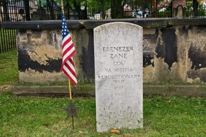
The Walnut Grove Cemetery is the burial place of members of the Zane and Martin families. Their graves lie within the brick enclosure. The cemetery is also the resting-place of many early Martins Ferry residents, including veterans of the Revolutionary War, the War of 1812, the Mexican War, and the Civil War. The Zane and Martin families were significant in the pioneer history of the region. Betty Zane’s legendary heroism at Fort Henry (now Wheeling, West Virginia) helped settlers resist an attack by the British and their Native American allies in September 1782. (Continued on other side)
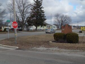
Here, on September 6, 1918, Bryan’s Air Mail Field began operations as one of Ohio’s first official airfields with the arrival of a survey flight to establish air mail service between New York and Chicago. Scheduled service began on July 1, 1919, and stretched west to San Francisco on September 8, 1920, completing the 2,666 mile U.S transcontinental air mail route. Flying the Curtiss JN-4H “Jenny,” R-4, Standard JR-1B, and later, the De Havilland DH-4, aviators pioneered cross continental flight in open cockpit biplanes without radios or electronic navigational aids and reduced coast to coast mail delivery from 87 hours by rail to 33 hours by air.
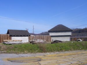
In 1787, the construction of Fort Steuben was completed by Captain John Francis Hamtramck and soldiers of the 1st American Regiment, who were sent to the frontier by the United States government to remove illegal squatters and protect government surveyors from American Indian raids. The surveyors were platting the First Seven Ranges of the Northwest Territory. The surveyed land was sold for settlement or offered to soldiers as payment for military service during the Revolutionary War. Consequently, the states of Ohio, Illinois, Indiana, Michigan, and Wisconsin were formed from the settlement of the Northwest Territory. Fort Steuben was named after Baron Frederich Wilhelm Augustus Steuben, who had served in the Revolutionary War and from which the town derived its name. Captain Hamtramck abandoned the fort in 1787 by order of Colonel Josiah Harmar, and by 1790 the remains of the fort had disappeared. Fort Steuben has been reconstructed on its original location.
Old Wood County Jail 1847-1870. Built in 1847, during the Presidency of Polk, when Perrysburg was the County Seat, and used as the Jail and Infirmary until 1870. Continued to serve as the Perrysburg Jail until 1899, sold by the town in 1918. Acquired and restored by Mr. and Mrs. Charles W. Hoffmann in 1954. Listed in the Historic American Building Survey and National Register of Historical Landmarks, Library of Congress.
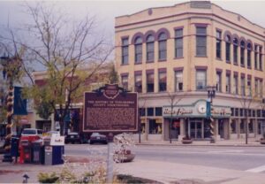
When David Knisely, the founder of New Philadelphia, first arrived in the Tuscarawas Valley on August 27, 1803, he found a sparsely populated, pristine wilderness. Five years later the state legislature approved a bill organizing Tuscarawas County effective March 15, 1808. Shortly thereafter, New Philadelphia was chosen as the county seat, and on April 16, 1808, the first commissioners met at Leininger’s tavern. By August, the tavern proved to be an inappropriate location for the county’s official business, and the commissioners approved the construction of a two-story, combination jail and county office building on land donated by John Knisely on the northeast corner of the square. By 1818 a new, larger brick courthouse was authorized by the commissioners. This building was occupied in 1825 and served as the courthouse until 1882 when the present structure was approved. Occupied in 1888, the building continues to be the center of the county’s business. The beautiful, state-of-the-art annex was dedicated on October 27, 1990.
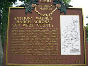
To the right is the route taken by the U.S. Legion under Major General Anthony Wayne as it marched across what would become Van Wert County. The army of 2,800 men camped west of this marker near the present cemetery on the night of August 4, 1794. Wayne’s orders were to subdue Native American tribes and his destination was a major village at the junction of the Auglaize and Maumee Rivers (now Defiance). Finding it abandoned, Wayne marched down the Maumee River and was attacked by a force of Indians on August 20. Wayne’s victory at the Battle of Fallen Timbers ended the Indian Wars of the 1790s. The Treaty of Greene Ville, signed by Wayne and the representatives of twelve tribes, opened much of Ohio to American settlement. Side one includes a map on the right hand side of the marker showing the route of Wayne’s army through the eastern third of Van Wert County.
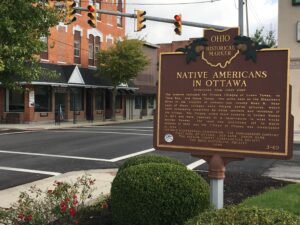
The Ottawa, or “Tawa” Indians had inhabited the Maumee Valley since the middle of the 1700s. By the 1790s, Ottawa settlements included villages along the Blanchard River at the present-day Village of Ottawa. During the War of 1812, Colonel James Findlay destroyed these villages because the Ottawa aided British forces. In 1817, the United States government established a reserve for the Ottawa in exchange for their lands in Northwest Ohio. The reserve encompassed a five-mile square area; its center was the intersection of the Blanchard River and an Indian trace near what is now Old State Route 65. (Continued on other side)