

, OH
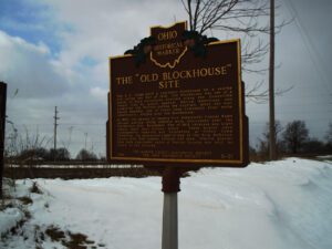
The U.S. Army built a two-story blockhouse on a nearby hill during the War of 1812. The blockhouse was one of a series of such structures erected along the Greenville Treaty line to guard against Native Americans who supported the British during the conflict. After the war, Daniel Markley, one of Green Camp Township’s first white inhabitants, settled near the blockhouse. In 1963, the graves of twenty-five prehistoric Glacial Kame Indians and six white settlers were discovered near the blockhouse site. Seventeen War of 1812 veterans and eight others were also buried there. These bodies were subsequently removed and reinterred at Green Camp Cemetery. An abandoned right-of-way of the Erie Railroad, Dayton line, also passes through the area. Prairie grasses that once dominated parts of Marion County can still be found in the vicinity.
, OH
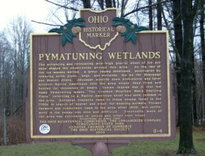
The advancing and retreating mile-high glacial sheet of ice and snow shaped the countryside around this area. As the last of the ice masses melted, a great swamp developed, punctuated by towering white pines, bogs, and wetlands, fed by the Shenango and Beaver rivers. Abundant wildlife drew prehistoric and later historic Native Americans into the area where they lived and hunted for thousands of years. Indian legend has it that the name Pymatuning means “The Crooked-Mouthed Man’s Dwelling Place,” referring to a Native American chief who once resided in the area. European trappers came to these swamp lands in the 1700s in search of beaver and other fur-bearing animals. Pioneer farmers and lumbermen came to the area after 1800, but settlement in the swamp was slow and difficult. Eventually much of the area was cultivated in onions and other root crops. (continued on other side)
, OH
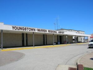
Born on April 18, 1913, in Barrea, Province L’Aquila Abruzzi, Italy to Salvatore and Maria (Lombardozzi) Campana, Mary Ann Campana immigrated to the United States with her parents at age eight. Raised in Youngstown and educated in the Youngstown Public Schools and Youngstown College, Ms. Campana was a pioneer in Ohio, National, and international aviation. In 1932, at age eighteen, she achieved the distinction of being the first licensed woman pilot in Ohio. On June 4, 1933, with only 44 hours of prior flying time, Mary Ann established the world’s endurance record in the Light plane class for a non-refueled flight. Flying above Youngstown in a 500-pound Taylor Cub Plane with a 40-horsepower engine and loaded with 40 gallons of gasoline, she flew for 12 hours and 27 minutes without a parachute, breaking the old record by one hour and ten minutes before electrical storms forced her down. (Continued on other side)
, OH
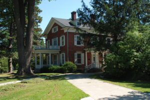
Jabez Lyman Burrell (1806-1900), originally from Massachusetts, built this house in 1852. Burrell made his living as a cattleman and farmer, but devoted much of his time serving the cause of abolitionism, helping slaves, who had escaped the South, get to Sheffield and from there to Lorain and across Lake Erie to Canada. He was also devoted to equal education for all, providing funding to a freedmen’s school in Selma, Alabama, and serving as a trustee of the Oberlin Collegiate Institute, well known for educating African Americans and women. From 1884 to 1934, this was the home of Henry Churchill King (1858-1934), who was the president of Oberlin College from 1902-1927. The Kings added the porches and rear wing and made their home a social center for the college and community. The house is listed on the National Register of Historic Places and is a City of Oberlin Historic Landmark.
, OH
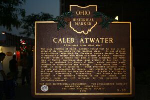
Born in North Adams, Massachusetts on December 23, 1778, Caleb Atwater graduated from Williams College in 1804. He moved to Circleville in about 1814 where he organized the city’s first school board and served as postmaster and prosecuting attorney. His life and work as a teacher, minister, lawyer, legislator, and scholar greatly influenced early 19th-century Ohio. Upon arriving in Circleville, he became interested in local history and the nearby earthworks and in 1820 published his book Descriptions of the Antiquities Discovered in the State of Ohio and Other Western States, the first compilation of prehistoric remains in the Ohio and Mississippi valleys. Elected to the Ohio State Legislature in 1821, Atwater fervently supported canal construction. He also chaired Ohio’s first board of school commissioners and was instrumental in passage of Ohio’s Public School Law. For this, he has been called the “Father of Ohio’s Common Schools.” (continued on other side)
, OH
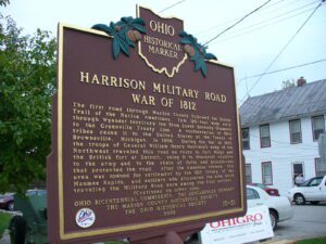
The first road through Marion County followed the Scioto Trail of the Native Americans. This 120-foot wide strip through Wyandot territory led from Lower Sandusky (Fremont) to the Greenville Treaty Line. A confederation of Ohio tribes ceded it to the United States at the Treaty of Brownsville, Michigan, in 1808. During the War of 1812, the troops of General William Henry Harrison’s Army of the Northwest traveled this road en route to Fort Meigs and the British fort at Detroit, using it to transport supplies to the army and to the chain of forts and blockhouses that protected the road. After the American victory, this area was opened for settlement by the 1817 Treaty of the Maumee Rapids, and soldiers who discovered the area while traveling the Military Road were among the first settlers. (continued on other side)
, OH
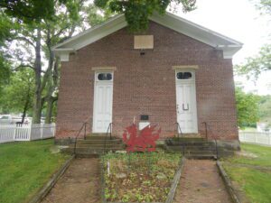
In 1972 a group of Welsh-Americans chartered the Welsh-American Heritage Museum to preserve Welsh history and culture, and to preserve the Welsh Congregational Church. The old brick church was where songs of praises rang, as the Welsh gathered and sang beloved hymns of their homeland in four-part harmony. The church is a link in a long, unbroken chain of memories and still serves the community as a center of Welsh-American activities and a keeper of the community’s heritage. The red dragon and daffodil are symbols of Wales.
, OH
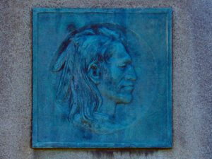
Tah-gah-jute, the Mingo chief named Logan, was a native of Pennsylvania. Logan moved to Ohio in 1770, and settled at the Pickaway Plains. Logan and his father, Shikellimus, had long supported friendships between Native Americans and white men; however, in the spring of 1774, his tribesmen and family were murdered at Yellow Creek, along the Ohio River. Once an advocate of peace, Logan went on the warpath and raided frontier settlements. These and similar raids along the Ohio frontier precipitated Lord Dunmore’s War in October 1774. After the Shawnees and their allies were defeated at Point Pleasant, Virginia governor Lord Dunmore marched up the Hocking River to the Pickaway Plains. Dunmore asked his interpreter, Colonel John Gibson, to assist in negotiations with Cornstalk and other Indian leaders, including Logan. Logan declined to attend the conference, but spoke to Gibson about his anger and betrayal.