

, OH
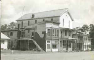
The commercial building that stood at 305 Main Street for over a century was built by Justus S. Law in 1897. On April 1, 1897, Law leased the Odd Fellows and Knights of Pythias joint-use of the third floor, rent-free, for 99 years after they completed its construction and added a slate roof to the building. Although the Pythians purchased the remainder of the building in 1921, they continued to share their “Castle Hall” with the Odd Fellows until 1965. In July 1974, the Pythians assigned their Pleasant City property to the Ohio Knights of Pythias Home in Springfield. From 1974 to 2012 the property exchanged private ownership multiple times until forfeited to the state in 2020. After the dilapidated Victorian building was demolished in 2021 the land was donated to the Village of Pleasant City.
, OH
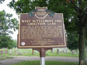
Augustus West, an African American, was born in Madison County, Virginia on March 20, 1814, and moved to Ohio in 1837. Legend has it that West was a runaway slave and worked as a farm laborer before designing a scheme to purchase his own farm. West, with abolitionist Alexander Beatty, traveled into slave territory no fewer than three times where the pair would sell West, help him escape, and split the profits. After splitting the profits, West used his portion of the money to purchase 177 acres of land in Fayette County where he built his “mansion.” To remain inconspicuous and secure, West built the “mansion” as far from the main road as possible. (continued on other side)
, OH
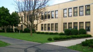
Colonel Ebenezer Zane played a major role in the development of Ohio, a role that helped place it on the path to statehood. A veteran of the Revolutionary War and experienced road builder, he received permission from Congress in 1796 to build a road into the Northwest Territory, which would be called Zane’s Trace. In exchange for his work, Zane received land grants where the trace would cross the Muskingum, Hocking, and Scioto rivers. The trace began in Wheeling, West Virginia (then Virginia) and ended at Limestone, Kentucky (present-day Maysville) on the Ohio River. Opening in 1797, it brought settlement into Ohio, including Lancaster. Its route crossed the playground area of East Elementary from the northeast corner of today’s playground to the southwest corner, lot #18, East Addition, as recorded on an 1897 map of Lancaster.
, OH
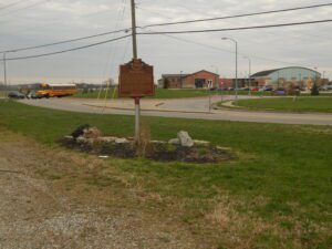
In 1833, Robert Busenbark deeded land to the directors of School District No. 6 for Busenbark School. Twenty years later, Robert and son David granted a right-of-way on their property for a station on the Cincinnati, Hamilton & Dayton Railroad (CH&D). One of eleven depots in Butler County, Busenbark station attracted the Kinsinger-Augspurger Warehouse and the Kennel Grain Elevator to the area in the 1860s. The railroad also enabled the cross-roads settlement to host an American championship prize fight in 1867. Fighting with bare knuckles in an outdoor ring, Mike McCoole bested Aaron Jones in a match seen by thousands. The Busenbark generating station supplied power to interurban lines until 1912 and later furnished electricity to local residents. Farmers and the Miami Poultry Yards depended on the trains and interurban to ship produce. The railroad depot disappeared between 1914 and 1916; the school closed after 1937; interurban service ended in 1939. All that remains of Busenbark is Busenbark Road, which was established in 1858.
, OH
Augustus West, an African American, was born in Madison County, Virginia on March 20, 1814, and moved to Ohio in 1837. Legend has it that West was a runaway slave and worked as a farm laborer before designing a scheme to purchase his own farm. West, with abolitionist Alexander Beatty, traveled into slave territory no fewer than three times where the pair would sell West, help him escape, and split the profits. After splitting the profits, West used his portion of the money to purchase 177 acres of land in Fayette County where he built his “mansion.” To remain inconspicuous and secure, West built the “mansion” as far from the main road as possible. (continued on other side)
, OH
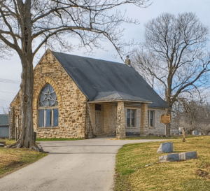
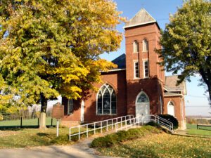
Zion (Ribel’s) Church was built on this site in 1808. The log structure was located in the Zion Ridge Cemetery, adjacent to the first school in Thorn Township. The congregation of Zion Reformed Church is the oldest in Perry County still in existence. The church was officially organized in 1806 when the German Reformed and Lutheran congregations joined together in building the first church in Perry County. They purchased this land on June 30, 1806, and shared the building, alternating Sundays, until 1911. In 1803, Reverend Johannes Christian Koenig (John King) became the first minister to settle in Perry County and became the founding minister for the German Reformed congregation. In 1805, Reverend Wilhelm Georg Forster (William Foster) was the first Lutheran minister to settle in Perry County and was the founding minister for the Lutherans. The present Zion Reformed Church was built across the street from the original church in 1910.
, OH
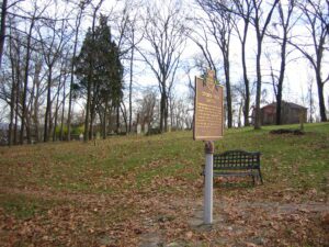
Originally belonging to the William Henry Harrison family, this cemetery was known as “The Pasture Graveyard” until the Civil War era. It became the final resting place of many members of the Harrison and Symmes families as well as other early settlers to the North Bend area. It was in use until 1884 when Maple Grove Cemetery opened as the official township cemetery.
, OH
Born on April 18, 1913, in Barrea, Province L’Aquila Abruzzi, Italy to Salvatore and Maria (Lombardozzi) Campana, Mary Ann Campana immigrated to the United States with her parents at age eight. Raised in Youngstown and educated in the Youngstown Public Schools and Youngstown College, Ms. Campana was a pioneer in Ohio, National, and international aviation. In 1932, at age eighteen, she achieved the distinction of being the first licensed woman pilot in Ohio. On June 4, 1933, with only 44 hours of prior flying time, Mary Ann established the world’s endurance record in the Light plane class for a non-refueled flight. Flying above Youngstown in a 500-pound Taylor Cub Plane with a 40-horsepower engine and loaded with 40 gallons of gasoline, she flew for 12 hours and 27 minutes without a parachute, breaking the old record by one hour and ten minutes before electrical storms forced her down. (Continued on other side)