, OH
During the 9-month Hocking Valley Coal Strike beginning in June 1884, tensions between the Columbus & Hocking Coal and Iron Company and striking miners led to violence and destruction. Starting October 11, 1884, unknown men pushed burning mine cars into six mines located around New Straitsville to protest being replaced by “scab” workers. Mine operators attempted to plug all fissures to no avail. As years passed, ground collapsed under buildings and roadbeds, and mine gases seeped into schools and homes. Residents were evicted and homes demolished. Potatoes baked in the heated soil and roses bloomed in the winter. At times, the fire soared 100 feet in the air and could be seen for five miles. (Continued on other side).
, OH
On July 3, 1872, 16 men and a 9-year old boy descended the 170 foot shaft in the Atwater Coal Company Mine located in Atwater Township south of Route 224 and East of Route 225. The mine was situated on the property known as the S.G. Shaffer Farm. By mid-day, 7 miners survived the brutal fire in the mine. Richard Roberts, Robert Roberts, William Roberts, Thomas Maines, Joseph Otey, John Williams, John Howells, John Jones and 9-year old George Hufford gave their lives to the first Mining Disaster in Ohio and the 19th mining disaster in the United States since 1839 with more than 5 fatalities. In 1873, Ohio was the second State to pass a law for the safety of Miners.
, OH
First surveyed in 1849, Powhatan Point was laid out by Franklin Knox. The “point” is the confluence of Captina Creek and the Ohio River. The small but thriving river and farming community served York Township and the rich Captina Valley as a shipping center for its first 75 years. Given impetus by the construction of the Powhatan Enterprise Flouring Mill and Woolen Factory in 1850, local businesses shipped grain, fruit, lumber, cheese, whiskey, livestock, wool, and tobacco to northern and southern ports. There were three boat landings: Boger’s, Hornbrook’s and Dorsey’s, each equipped with an incline car track from the warehouses to the river’s edge. With the opening of North American Coal Corporation’s Powhatan No. 1 Mine in 1922, the village became a mining community that continued to rely on the river. A disastrous mine fire took the lives of 66 men on July 5, 1944.
, OH
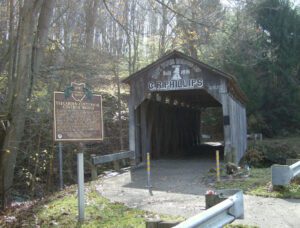
The Teegarden-Centennial Covered Bridge, constructed primarily of white oak is of Multiple King Post design spanning 67 feet. It was built nearly 100 years after the birth of the nation. Located on Eagleton Road, just off Teegarden Road, it is still at its original location, spanning the Middle Fork of the Little Beaver Creek in Eagleton’s Glen Park. It remained in use until 1992 when it was bypassed by a new concrete structure. The official contract for the construction of the bridge was awarded to Jeremiah C. Mountz in June of 1875. The stonework for the abutments was awarded to David Reese and painting of the original structure to George W. Akin in 1876. Members of Highland Christian Church came here to be baptized by immersion. There were over 250 covered bridges in Columbiana County, including at least 16 railroad covered bridges. The Teegarden-Centennial Covered Bridge is one of only five still remaining.
, OH
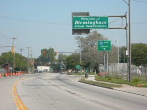
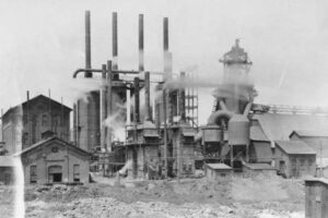
The Birmingham and Ironville neighborhoods were so named because of their early iron industries located along Front Street and the Maumee River. This became Toledo’s first area of heavy industrial development with iron manufacturing, coal shipping, oil refining, shipbuilding, and flour milling operations. In 1864 the Manhattan Iron Company built a charcoal blast furnace near the river’s mouth, securing fuel from nearby forests.
, OH
Since it was formed in 1819, Meigs County was fostered by its location on 57 miles of the Ohio River, named by the Indians”Oyo,” meaning beautiful river. Pomeroy, the county seat, was named for Samuel Wyllys Pomeroy, an early landholder. His company, Pomeroy, Sons & Company, and his son-in-law, Valentine B. Horton (1802-1888), were influential in developing the coal, salt, and iron industries of the region. Horton pioneered the transportation of coal by river, building the world’s first coal barges and, in 1835, the first coal-fueled towboat, the Condor. Coal, salt, and iron, in addition to other local products, were shipped from Pomeroy’s 125′ x 40′ wharf to ports from Pittsburgh to Cincinnati. Excursion, passenger, shanty and showboats also visited Pomeroy’s port. Today, the Ohio River continues to be a busy waterway carrying commodities such as coal, petroleum, chemicals, steel, sand, and gravel. It is also a busy haven for recreational crafts as well as stern wheel boats.
, OH
Believed to have been constructed in 1866, this facility is one of the largest of its kind in the nation. The complex of 200 ovens was erected by the Leetonia Iron and Coal Company, later known as the Cherry Valley Iron Works, to supply fuel for pig-iron producing blast furnaces that stood south of this site. The man-made “beehive” ovens were used to transform hard coal into coke. The “coking” process burnt impurities out of the coal. The end product — coke — was the best fuel source for the furnaces that were used to manufacture iron and steel. The facility discontinued operations in the early 1930s at the height of the Great Depression.
, OH
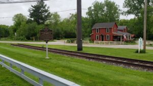
The Randall Secondary rail line dates to the 1850s when the independent Cleveland & Mahoning Railroad (C&M) laid tracks through Aurora, Ohio. C&M, chartered in 1848, linked the Mahoning Valley coal and iron ore fields to the industries and lake port at Cleveland. For over a century, the Randall Secondary contributed to Aurora’s economic life ? fueling the region’s rapid growth during the late 19th and early 20th centuries. In its heyday, the line was an important route for commuter transport and freight service along the 67 miles between Cleveland and Youngstown. Although passenger service into Aurora Train Station stopped in the 1960s, freight service continued into the 1990s. The last remaining track of the Randall Secondary in Aurora stands near the station it served.


