This covered bridge, spanning Salt Creek in Perry Township, Muskingum County was erected in the 1870s. It is a splendid example of an Ohio covered bridge built with Warren type trusses. It is being preserved as an important illustration of the sound, fine craftsmanship of the early bridge builders of Ohio. This plaque has been erected to give these men the honor they greatly deserve.
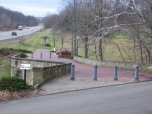
Coaches, Conestoga wagons, herds of livestock, pioneers on horseback, peddlers, soldiers, beggers–these and many others have crossed this bridge on the National Road since 1830. Escaping slaves sought shelter beneath it. Like many others on the road, the bridge was built with well-cut stone and good mortar in the shape of an “S” because it was easier to erect than one thrown straight across an oblique stream.
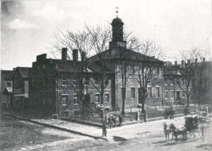
In 1809 the citizens of Zanesville erected a building on this site which served as the capitol of Ohio from October 1, 1810, until May 1, 1812. The 9th and 10th sessions of the Ohio General Assembly met here before returning to Chillicothe in May 1812. The building was then used as the Muskingum County Courthouse until the present courthouse was built in 1874. The 1809 date stone from the old building was incorporated into the new building and may be seen over the front steps.
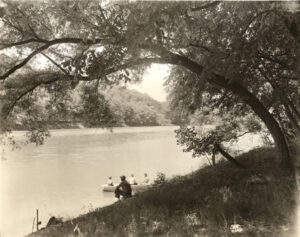
Thirty-thousand years ago, the streams and rivers in this area flowed north. A ridge extended across what is today the Muskingum-Morgan County line about seven miles south of the Philo Lock. When the Wisconsin Glacier moved down from Canada 25,000 years ago, the glacier blocked the north flowing streams. A large lake formed in Muskingum County. Eventually the water spilled over the ridge and flowed to the Ohio River, carving the Muskingum River Valley. When the glaciers retreated, the drainage divide moved north to an east-west line 30 to 50 miles south of Lake Erie. The Tuscarawas, Walhonding, Scioto, Muskingum and other area rivers and streams have continued to flow south ever since.
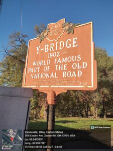
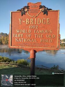
Muskingum River Parkway, S of the Putnam Avenue/6th Street Bridge
Zanesville
, OH
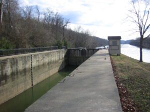
The Zanesville lock, canal, and dam were part of a series of eleven such built on the Muskingum River from Marietta to Ellis, north of Zanesville, from 1836 to 1841. The improvements made the shallow river navigable by steamboats. The State of Ohio funded the project as part of the Ohio Canal System. The locks are approximately 35 feet wide and 160 feet long. The river improvements spurred the development of industry in Zanesville, including pottery manufacture, shipbuilding, and grain milling. From Zanesville, goods could be shipped north to the Ohio Canal and Lake Erie. Products could also be sent south to Marietta and then east to Pittsburgh or southwest to New Orleans. Steamboats brought in manufactured goods, staples, mail, and entertainment. After 1880, competition from railroads caused a gradual decline in the river traffic. Today the locks remain in operation for the enjoyment of pleasure boaters.