

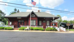
, OH
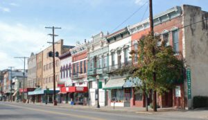
Seba Bronson Jr. left Columbia Township in early 1810 and followed the Rocky River to an area one and a half miles north of here. He built a cabin and planted a crop and thus started what became known as the village of Hardscrabble in Liverpool Township. The village was centered around the Columbia/Grafton Road area, and the township is the oldest continuously inhabited township in Medina County. The Potawatami Indians occupied this area and camped annually along the Rocky River. For five silver dollars, they showed Seba and a partner a hidden salt springs which they sought to exploit. Other men also scrabbled to own it and Justus Warner succeeded. Seba was turned out. Warner operated the Liverpool Salt Works beginning in 1811. The first industry in the county, salt was a necessity and eagerly sought by setters in the area.
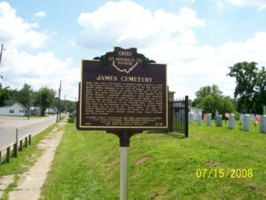
, OH
Major John James (1772-1854) established James Cemetery in 1828 on and around a Native American mound that is the only significant ancient mound remaining in the city of Jackson. The mound is about 70 feet in diameter and nearly six feet tall. In the late 1800s, this mound comprised one point of three ancient mound groups forming a triangular configuration along East Broadway Street, formerly known as James Street. One group was a few hundred feet northeast of here on the Watson farm and a second was just to the northwest on the Warnicke farm. These mounds were built by the Hopewell Culture, prominent in southern Ohio from about 100 BC to 400 AD. Major James, his wife, and several immediate family members are buried on the mound including Jackson County pioneers Andrew Long, Daniel Hoffman, and David Mitchell.
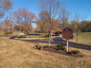
, OH
Clinton County was a major center of activity for the Shawnee, Miami, and Delaware Indians. Early traces and trails developed as Indians traveled from village to village; gathered flint, salt and gold; traded furs, mica, and feldspar; and hunted bear, deer, otters, raccoons, foxes, wild cats, turkeys, and other wildlife. Trails throughout the county connected to other trails and villages in Ohio such as Lower Shawnee Town (now Portsmouth), Hurricane Tom’s Town (now Piketon), Chillicothe, Old Town (near Xenia), and Miami Town (now Dayton). Major trails or traces in Clinton County included the Bullskin, Wayne, Chillicothe, Delaware, Fort Ancient, Kanawha, Kenton and Todds Fork Traces. These routes were the avenues the first white settlers followed. (continued on other side)
, OH
Alexander Sutherland (1767-1845) and his wife Sarah (1768-1836) were the first settlers in Newton Township, Trumbull County, Ohio. Coming from Westmoreland County, Pennsylvania, the Sutherlands acquired 205 acres of land along Duck Creek southward from this site. Alexander was an influential person in the area after the settlement was made at Duck Creek. He was the second Recorder and the first elected Surveyor for Trumbull County. He was an early Mason with Old Erie Lodge, Warren schoolteacher, postmaster at Newton, Newton Township Trustee and Clerk, and Justice of the Peace. Sutherland, along with Ezekiel Hover, marked the first path from this Duck Creek settlement to Youngstown to reach the nearest mill.
, OH
Since it was formed in 1819, Meigs County was fostered by its location on 57 miles of the Ohio River, named by the Indians”Oyo,” meaning beautiful river. Pomeroy, the county seat, was named for Samuel Wyllys Pomeroy, an early landholder. His company, Pomeroy, Sons & Company, and his son-in-law, Valentine B. Horton (1802-1888), were influential in developing the coal, salt, and iron industries of the region. Horton pioneered the transportation of coal by river, building the world’s first coal barges and, in 1835, the first coal-fueled towboat, the Condor. Coal, salt, and iron, in addition to other local products, were shipped from Pomeroy’s 125′ x 40′ wharf to ports from Pittsburgh to Cincinnati. Excursion, passenger, shanty and showboats also visited Pomeroy’s port. Today, the Ohio River continues to be a busy waterway carrying commodities such as coal, petroleum, chemicals, steel, sand, and gravel. It is also a busy haven for recreational crafts as well as stern wheel boats.
, OH
A salt spring, located about a mile west of this site, was the primary attraction for immigrants to the Western Reserve territory in the mid-1700s. Prior to European-American settlement, Indians used the springs, boiling the water to extract the salt and using it for preserving meat among other uses. In 1755, surveyor Lewis Evans underscored the importance of the springs by noting it on his “General Map of the Middle British Colonies in America.” This enticed immigrants from western Pennsylvania to the region. In addition to the salt itself, the abundance of wildlife near the spring ensured good hunting in the area. (Continued on other side)

, OH
In 1931, the France Stone Company ceased operations. Robert Burge leased 19 acres of the site for recreational swimming and opened Centennial Quarry in 1934. Five years later, Burge and associates opened Centennial Terrace, whose centerpiece was “Dancing Under the Stars,” an outdoor, 10,000 square-foot Terrazzo dance floor. Centennial Terrace was a regular stop for many big bands of the 1940s and ’50s. In 1969, the complex was donated to Lucas County and local band leaders kept the people dancing from 1971 to 1993. In 1994, the City of Sylvania leased the facility and renovated and reopened the quarry. The Sylvania Area Joint Recreation District purchased the complex in 2007 and made further improvements to insure that Centennial Terrace and Quarry remains a popular recreation destination.