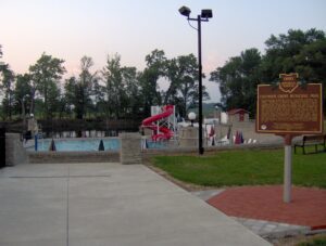
The construction of Putnam County’s first public swimming pool helped Columbus Grove weather the Great Depression of the 1930s. President Franklin D. Roosevelt’s Works Progress Administration (WPA) and the Village of Columbus Grove planned the pool to provide much-needed jobs and recreational facilities for the residents of Putnam County. Between the fall of 1935 and 1936, local men (and two women) built the pool and shelter house by hand from rock quarried on site. The workers were not trained stone masons or cutters. Befitting their limited skills, the pool was built in a simplified Norman Revival/Rustic architectural style. Wages ranged from $.33 to $.55 per hour. The pool’s grand opening was July 1, 1937. That first year, adults paid $.25 to swim, and children were charged $.10. The Columbus Grove Municipal Pool was listed on the National Register of Historic Places in 1997.
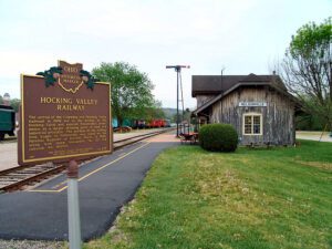
The arrival of the Columbus and Hocking Valley Railroad in 1869 led to the decline of the Hocking Canal and assured Nelsonville’s prominence as a major shipping point of coal and industrial products. The portion of the railway from Logan in Nelsonville was listed on the National Register of Historic Places in 1988, along with steam locomotive #33 and caboose #90704.
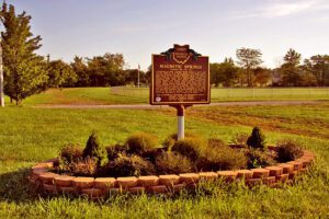
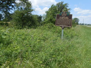
Near this site in 1879, J.E. Newhouse discovered a magnetic spring in his park, Green Bend Gardens. It was found that a knife blade dipped in the water could pick up small metal objects like a magnet. The spring became known for its curative powers and was advertised as a treatment for ailments including rheumatism, gout, insomnia, and diseases of the kidneys, bladder, and nerves. To share the health-giving water, Mr. Newhouse opened the Magnetic Bath House, which became famous for its water cures. To reach a larger market, the magnetic water was sterilized and bottled and sold under the Magnetic Springs label. Advances in medicine after World War II led to the decline in the popularity of mineral baths.
Described as a Columbus “institution” when he died in 1969, Emerson C. Burkhart was born on a farm in Union Township, Putnam County in 1905. The son of Albert and Nora Burkhart, Emerson graduated from Kalida High School in 1924 and from Ohio Wesleyan University in 1927. After studying art in Provincetown, Massachusetts and in New York City, he settled in Columbus and, in 1937, married Mary Ann Martin, an artists’ model who devoted herself to his career. Burkhart was a prolific painter and completed an estimated 3,000 pictures during his 40-year career, including street scenes, rural landscapes, and more than 250 self-portraits, once noting his face was “cheaper than a model’s and always there.”
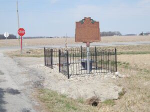
One of Ohio’s greatest manhunts ended here on the morning of July 23, 1948. Robert M. Daniels and John C. West, parolees from the state prison in Mansfield, had gone on a killing spree that left six people dead. Driving west on U.S. Route 224 in a stolen auto transport truck, the pair approached this intersection and encountered a roadblock. It was manned by Van Wert County Sheriff Roy Shaffer, Frank Friemoth, the county game warden, and Sergeant Leonard Conn of the Van Wert city police. West was driving the truck; Daniels was asleep in a car overhead. As Sheriff Shaffer climbed onto the truck and apprehended Daniels, West leaped from the cab and shot Conn in the chest and Friemoth in the arm. Conn returned fire and killed West. The officers survived their wounds. Daniels was convicted, sentenced to die, and electrocuted at the Ohio Penitentiary in Columbus on January 3, 1949. This marker pays tribute to all law enforcement officers who risk their lives to protect the citizens of their communities.
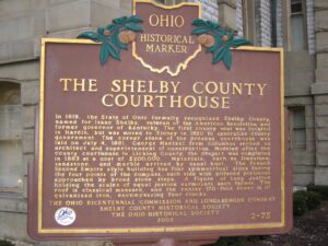
In 1819, the State of Ohio formally recognized Shelby County, named for Isaac Shelby, veteran of the American Revolution and former governor of Kentucky. The first county seat was located in Hardin, but was moved to Sidney in 1820 to centralize county government. The corner stone of the present courthouse was laid on July 4, 1881. George Maetzel from Columbus served as architect and superintendent of construction. Modeled after the county courthouse in Licking County, the project was completed in 1883 at a cost of $200,000. Materials, such as limestone, sandstone, and marble arrived by canal boat. The French Second Empire style building has four symmetrical sides facing the four points of the compass, each side with pillared porticoes approached by broad stone steps. A figure of Lady Justice holding the scales of equal justice surmounts each facade. The roof is classical mansard, and the center170-foot tower is of galvanized iron, encompassing four clocks.
Three-way intersection of David Brown Road, Mechanicsburg-Sanford Road, and Becker Road.
Mechanicsburg
, OH
The W. Pearl King Prairie Savanna is a mostly undisturbed remnant of the once expansive Darby Plains Prairies. Prior to European settlement more than two centuries ago, the Darby Plains covered an area of more than 380 square miles west of Columbus. These prairies were an eastward extension of the Great Plains Prairie that Ohio State Professor Edgar Transeau termed the Prairie Peninsula in 1935. The W. Pearl King Prairie Savanna is a 20-acre vestige of a once large and varied habitat of native tallgrass prairie and oak groves. The prairie contains bur oaks, one of Ohio’s largest stands of prairie dropseed grass, and several other native prairie plants. Named for a former landowner, William Pearl King (1891-1960), the site has been owned and managed by Columbus and Franklin County Metro Parks since 2006.
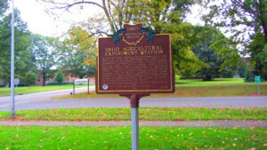
The Ohio General Assembly established the Ohio Agricultural Experiment Station in 1882. From its inception until 1892, the Station occupied 17 acres on the Columbus campus of The Ohio State University before relocating to 470 acres in Wayne County. In 1965, the Station changed its name to the Ohio Agricultural Research and Development Center (OARDC) to more accurately reflect its mission and programs. In 1982, the Center formally merged with The Ohio State University. Today, the Center encompasses nearly 2,100 acres in Wayne County with 10 branches located across the state for a total of approximately 7,100 acres dedicated to agricultural research.