 Skip to content

6-17 Knisley Springs Farm
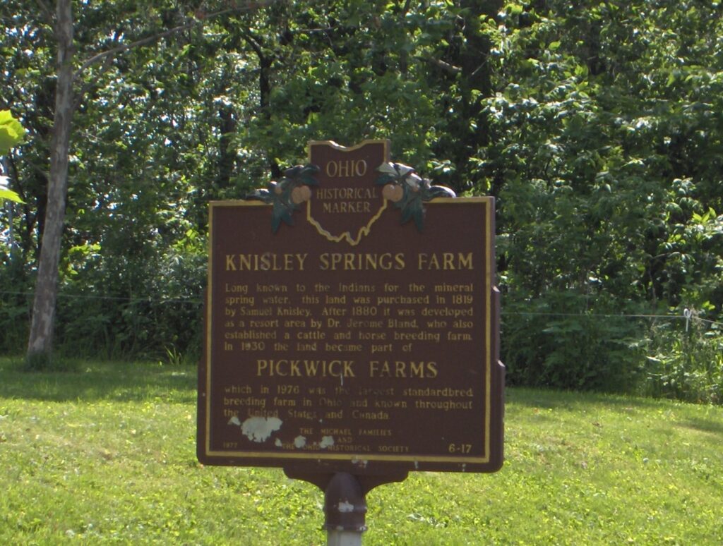
Long known to the Indians for the mineral spring water, this land was purchased in 1819 by Samuel Knisley. After 1880 it was developed as a resort area by Dr. Jerome Bland, who also established a cattle and horse breeding farm. In 1930 the land became part of PICKWICK FARMS which in 1976 was the […]
5-17 The Sandusky Plains
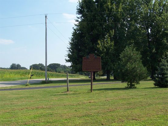
The Plains lay south and west of the Sandusky River, bounded by the Olentangy River on the east and Tymochtee Creek on the west. The local black prairie soils mark the extent of the grasslands, which were uncommon in the dense eastern forests. Bur Oak trees, from the period of the Wyandot Indians, have survived […]
4-17 Seccaium
On the banks of the Olentangy River, at the bend where the stream turns southwest, is the legendary site of Seccaium. This 17th century village was located on the portage to the Sandusky River, and was recognized by the Indians as a neutral ground for tribal councils where claims to hunting territories could be peacefully […]
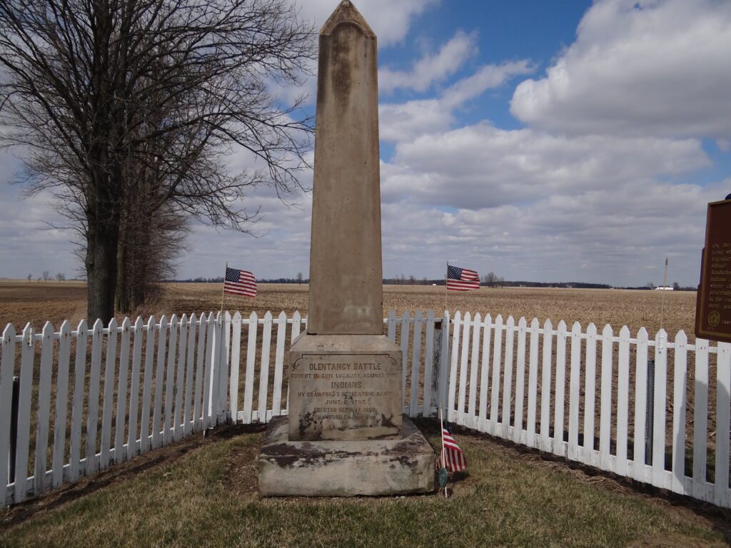
3-17 Crawford’s Expedition, 1782
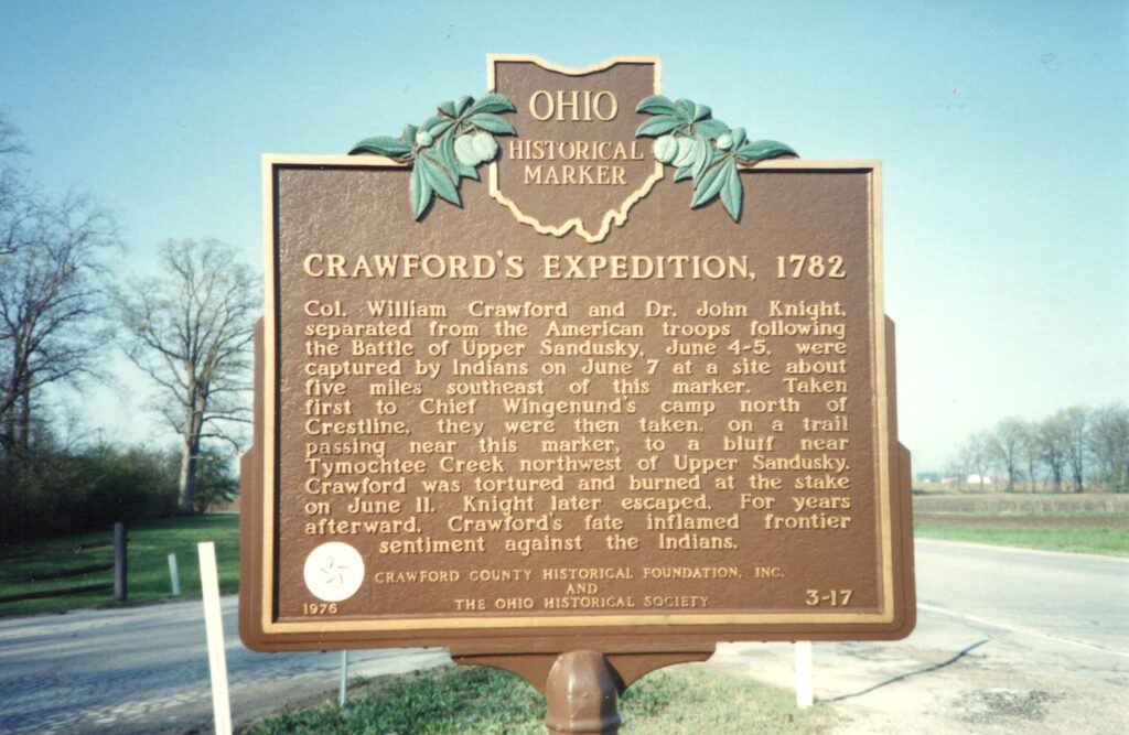
Col. William Crawford’s army of 480 Pennsylvania volunteers passed near this site on June 3 to attack the Indians near Upper Sandusky. On June 4-5 they encountered a combined force of Shawnees, Delawares, Wyandots, and, unexpectedly, Butler’s Rangers, a British unit from Detroit. The expedition was a disaster; about 300 Americans escaped. On June 6, […]
1-17 Village of Chatfield
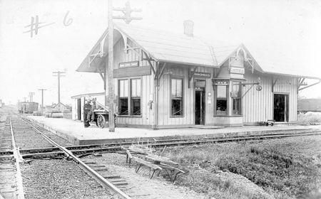
For centuries this area was used by Indian tribes as a hunting ground. Vast swamp forests of elm, ash, beech, pin oak, and maple lay on all sides. To the east, a large cranberry bog was covered by water most of the year. Indian hunting camps on the headwaters of Sycamore Creek were the scene […]
9-16 North Appalachian Experimental Watershed
Agricultural development and cultivation on steep lands led to severe soil erosion in the nation in the 1920s and 1930s. In response, the United States Department of Agriculture established the Soil Conservation Service (SCS) in 1935. The SCS established the North Appalachian Experimental Watershed (NAEW) in the hills of Coshocton County to study and develop […]
7-16 Muskingum River Underground Railroad Corridor / Underground Railroad Agents in Coshocton County
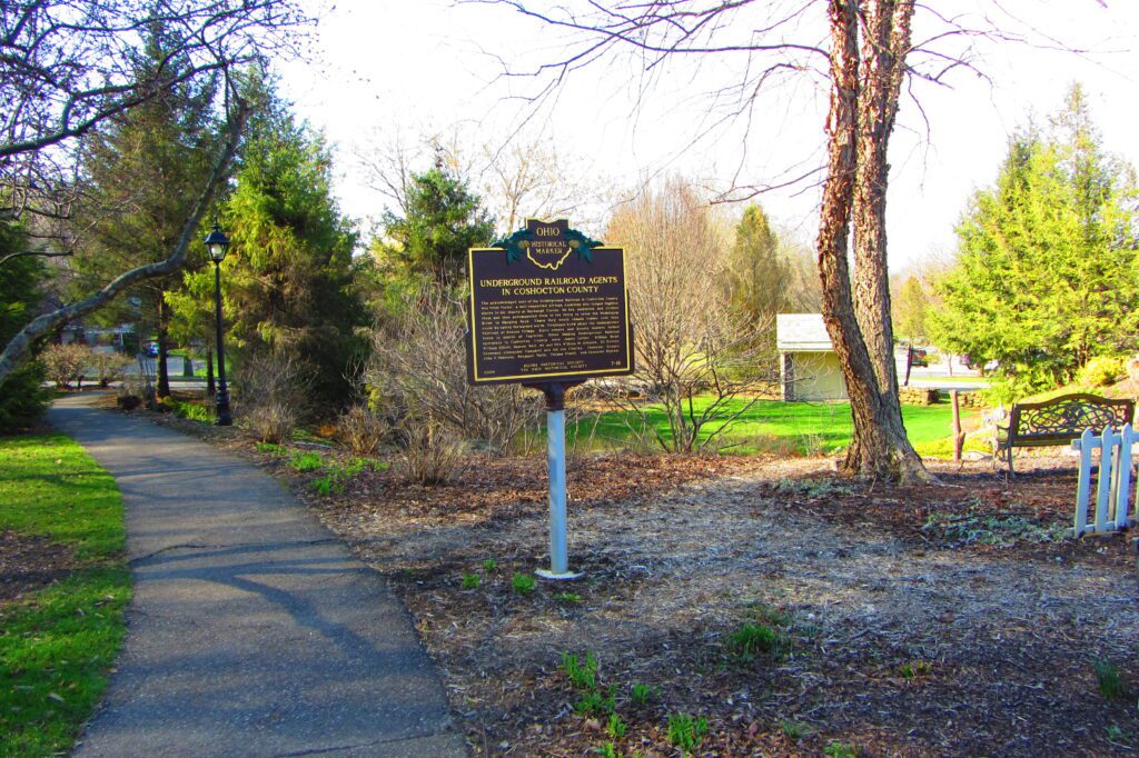
The Muskingum River forms at the confluence of the Tuscarawas and Walhoning rivers at Roscoe Village and flows south approximately 100 miles to the Ohio River at Marietta. During the first half of the nineteenth century, fugitive slaves from Virginia crossed the Ohio River and followed the Underground Railroad lines north toward Canada. Four Underground […]
5-16 The Coshocton County Courthouse
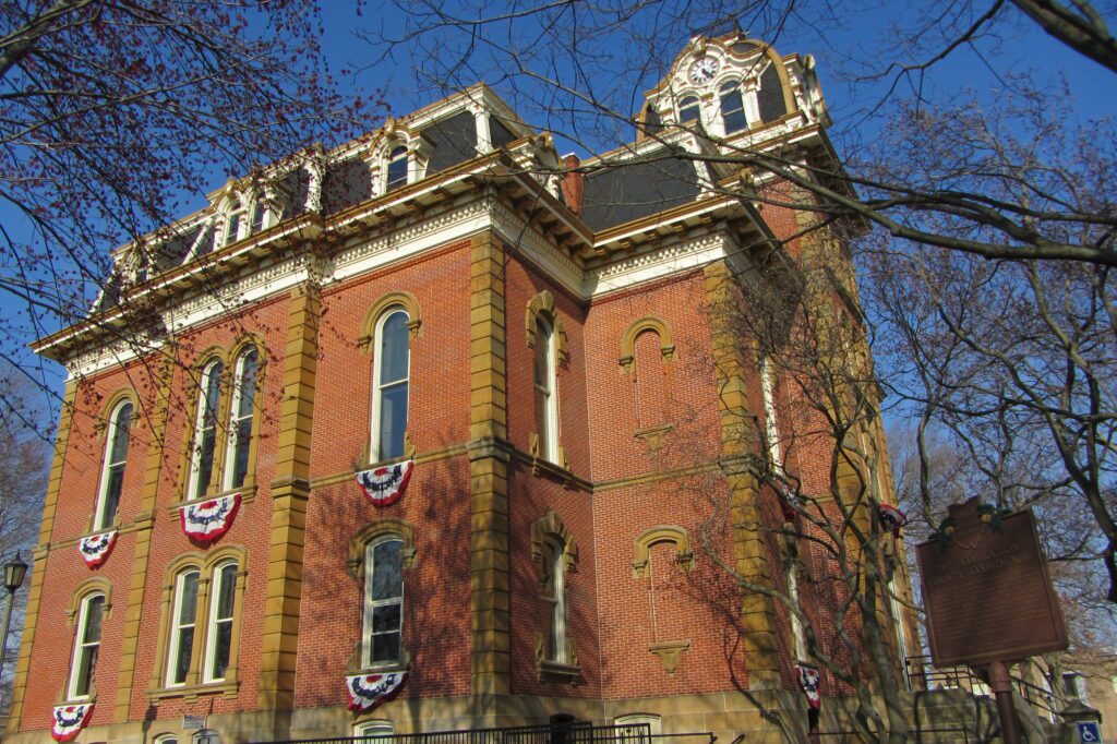
In 1764, Colonel Henry Bouquet established the site of what is now Coshocton. In 1811, the county was founded and the town incorporated as the county seat. The Coshocton County Courthouse, the third on this site, was built between 1873 and 1875 by contractors Carpenter and Williams of Meadville, Pennsylvania. The Second Empire structure features […]
4-16 Plainfield Cemetery
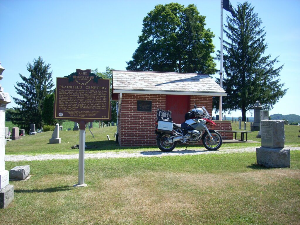
This cemetery, established in 1810, is the final resting place of many of the founders of Plainfield and Linton Township. Besides the early date of its founding, it is notable for the number of armed forces veterans interred here, who represent every major conflict since the Revolutionary War. The graves of eighty-nine Civil War soldiers-a […]
3-16 George W. Crile, M.D. (1864-1943)
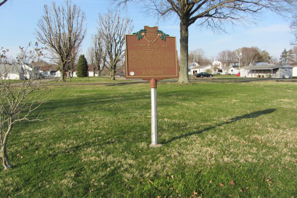
George Washington Crile was born in 1864 at Chili, in Crawford Township, Coshocton County. Before embarking on his notable medical career, he graduated from Northwestern Ohio Normal School (now Ohio Northern University) at Ada, teaching for two years before becoming principal at Plainfield School. Crile first studied medicine under village physician Dr. A.E. Walker, who […]