Ervin George Bailey, who was born in Damascus, Ohio, invented the revolutionary “Bailey Boiler Meter,” a major contribution to the science of automation and the efficient burning of fuels. In 1916, he founded the Bailey Meter Company of Wickliffe, Ohio – a world supplier of industrial instrumentation and controls. Considered the “Dean of Combustion Engineers,” Mr. Bailey held more than 100 patents in the fields of meters, automatic controls, furnaces, boilers, and fuel burning equipment.
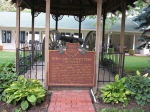
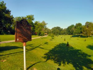
The 103rd O.V.I. was recruited for Civil War service from Cuyahoga, Lorain, and Medina counties. The Regiment was organized at Cleveland in August, 1862, and served until 1865 in campaigns at Cincinnati, Knoxville, Atlanta, Franklin, Nashville, and the Carolinas.103rd O.V.I. veterans and their descendants have held continuous, annual reunions since 1867. The organization is believed to be unique in the nation. Descendants live on these grounds today.
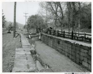
The twelfth lock on the Hocking Canal, the Sheep Pen lock underscores Southeast Ohioans’ efforts to open their region to the world during the mid-nineteenth century. Built as a guard lock, it was intended to permit slackwater navigation of the Hocking River by regulating water depths where river and canal met. Those plans were later abandoned and the mechanism was converted to a lift lock, which raised and lowered boats as required by changes in the canal’s elevation. (Continued on other side)
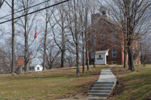
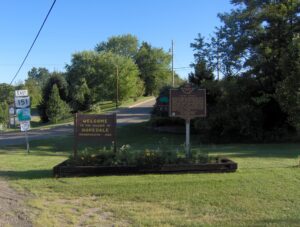
Platted by educator and abolitionist Cyrus McNeely in 1849, Hopedale was the site of McNeely Normal School, later Hopedale Normal College, the first coeducational college for teachers in eastern Ohio. It operated from 1849 to 1902. Among its graduates was George Armstrong Custer in 1856. Hopedale served as an important stop on the Underground Railroad for slaves fleeing bondage in the southern states. Local tradition notes several “stations” in the village, three at private homes and one at a hotel.
Intersection of S. Sandusky Street & Olentangy Avenue
Delaware
, OH
Near this site, the Union army established two camps on either side of the Olentangy River during the Civil War. Both were known as Camp Delaware. The first camp, situated on the west side of the river in the summer of 1862, was where the white recruits of the 96th and 121st regiments of Ohio Volunteer Infantry were mustered into service. A second camp, on the east side of the Olentangy, was established in the summer of 1863 and became the rendezvous point for most African-American Ohioans joining the army. The 127th Regiment of Ohio Volunteer Infantry-later renamed the 5th Regiment United States Colored Troops, the 27th U.S. Colored Troops, and members of other African-American units were mustered into service at Camp Delaware.
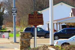
Colonel William Simmons (1757-1823) served in the Continental Army under the command of General Washington. Appointed as Accountant of the War Department by Washington and served under Presidents Adams, Jefferson and Madison. For his services in the Continental Army, received a land grant in the northeast section of Jefferson Township in Coshocton County.
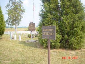
Descendants of Lemuel Garrison Sr., a Revolutionary War soldier, were among the first Europeans to own and settle land at Garrison Corner (intersection of State Route 123 and Shawnee Trace) . Garrison Cemetery burials took place from ca. 1837 to 1936. The cemetery has 327 lots. Eighty-six burials are documented including veterans John J. Garrsion, Benjamin Garritson, James Knicely, Nicodemus Rude, and William Rude. (continued on other side)
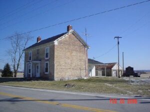
The inn was built 1800-01 by Peter Wickerham, a Revolutionary War veteran. It was used as an overnight stagecoach stop and tavern on Zane’s Trace until ca. 1850. Runaway slaves were hidden here when the “Underground Railroad” was in operation. Confederate soldiers, commanded by General John Hunt Morgan, slept in the inn on the night of July 15, 1863, when “Morgan’s Raiders” passed through Adams County.