Originally belonging to the William Henry Harrison family, this cemetery was known as “The Pasture Graveyard” until the Civil War era. It became the final resting place of many members of the Harrison and Symmes families as well as other early settlers to the North Bend area. It was in use until 1884 when Maple Grove Cemetery opened as the official township cemetery.
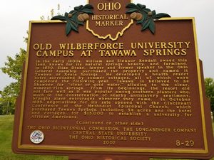
In the early 1800s, William and Eleanor Kendall owned this land, known for its natural springs, beauty, and farmland. In 1850, Elias Drake, lawyer and former speaker in the Ohio General Assembly, purchased the property and named it Tawana or Xenia Springs. He developed a health resort hotel surrounded by summer cottages, all of which were completed the following year. “Tawana” is believed to be Shawnee for “clear or gold water,” alluding to the clear, mineral-rich springs. From its beginnings, the resort did not fare well as it was popular among southern planters who, much to the consternation of nearby antislavery sentiment, brought slave entourages whenever they came. In October 1855, negotiations for its sale opened with the Cincinnati Conference of the Methodist Episcopal Church, which purchased Tawana Springs, including 54 acres and the hotel and cottages, for $13,000 to establish a university for African Americans. (Continued on other side)
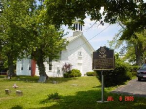
The Mount Zion Chapel of the Christian Church was built in 1872 on this hill adjacent to the members’ cemetery outside of Clermontville. The site was part of a two-acre parcel that had been secured from the farm of William R. Clark, Sr. for church and cemetery purposes. The Mount Zion Chapel replaced the Boat Run Christian Church that was organized in 1842 by a sect called the Christians, or the New Lights. Their first meeting house in Clermontville was dedicated on June 4, 1843 and damaged by floods in 1871. Worship was first held in the new frame church with the new name on October 6, 1872 and the church remains active today.
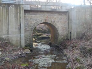
Listed on the National Register of Historic Places in 2009, the span is the oldest in Clark County a traveler can cross. It is also one of the oldest stone bridges in use in Ohio. Stone mason Samuel S. Taylor (1837-1930) built the culvert from locally quarried limestone in 1871, his first public works project. A Civil War veteran, Taylor worked on several projects, including the Mill Run underground sewer (1877), Champion’s East Street shops (1883), and the foundation for Springfield’s city hall (1890).
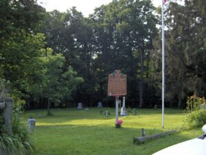
This cemetery stands as evidence of a once thriving African American farming community established in the 1820s. With the aid of community leader, Alexander “Sandy” Harper (c.1804-1889), Captina, originally called Guinea, became a stop on the Underground Railroad, a national network, shrouded in secrecy, of volunteers who directed slaves northward. Harper is buried in this cemetery, along with Benjamin Oliver McMichael (1865-1941), an educator who taught for twelve years in Captina/ Flatrock at a segregated schoolhouse. There are 113 known burials in the cemetery, including nine Civil War veterans. At this site in 1825, an African Methodist Episcopal Church was established to serve the community. Many of its members left Captina to work in cities, but the church continued services until 1962. The building then fell into disrepair and collapsed during a windstorm in 1978.
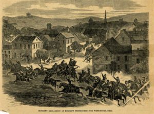
General John Hunt Morgan led a force of 2,000 Confederate calvalrymen into Meigs County during a raid north of the Ohio River. More than 50,000 Union troops and militia pursued Morgan across Ohio. Colonel Basil Duke wrote that while passing near Pomeroy on July 18, 1863, there was a continual fight for nearly five miles through a ravine. Led by Colonel J.W. Grisby and the 6th Kentucky, with Major T.C. Webber and the 2nd Kentucky in the rear, the Confederate calvarymen fought local militia who felled trees and fired upon the calvarymen from the hills and roads. After suffering losses at Buffington Island, Morgan surrendered eight days later near West Point in Columbiana County. The surrender field was the northernmost point ever reached by Confederate forces during the Civil War.
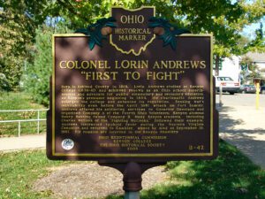
Born in Ashland County in 1819, Lorin Andrews studied at Kenyon College (1838-41) and achieved renown as an Ohio school superintendent and advocate for public elementary and secondary education. As Kenyon’s president beginning in 1854, the charismatic Andrews enlarged the college and enhanced its reputation. Sensing war’s inevitability even before the April 1861 attack on Fort Sumter, Andrews offered his soldiering services to Governor Dennison and organized Company A of the Fourth Ohio Volunteers; Kenyon alumnus Henry Banning raised Company B. Many Kenyon students, including Charles McCook of the “Fighting McCooks,” followed their example. Andrews contracted typhoid fever during the Western Virginia Campaign and returned to Gambier, where he died on September 18, 1861. His remains are interred in the Kenyon cemetery.
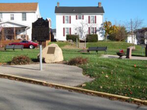
William McKinley was the 25th President of the United States. Following McKinley’s assassination in 1901, the Village of Jackson dedicated this triangle of land as a park in his honor. Earlier in the nineteenth century, a small school had occupied the plot. In 1902, a local commission was appointed to oversee the development of a park. It was not, however, until 2012 that the Jackson Garden Lovers Club finished the commission’s long overdue work. The park was dedicated in 2013, 111 years after it began.