Agricultural development and cultivation on steep lands led to severe soil erosion in the nation in the 1920s and 1930s. In response, the United States Department of Agriculture established the Soil Conservation Service (SCS) in 1935. The SCS established the North Appalachian Experimental Watershed (NAEW) in the hills of Coshocton County to study and develop methods of conserving soil and water resources. The Federal government and Coshocton County purchased 1,047 acres of land for the program and, in 1936, field research equipment was installed and buildings constructed. The Works Progress Administration (WPA) and Civilian Conservation Corps (CCC) provided labor near the program’s inception, as did the Civilian Public Service Agency during World War II. (Continued on other side)
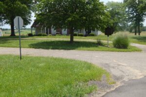
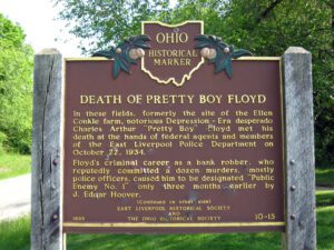
In these fields, formerly the site of the Ellen Conkle farm, notorious Depression-Era desperado Charles Arthur “Pretty Boy” Floyd met his death at the hands of federal agents and members of the East Liverpool Police Department on October 22, 1934. Floyd’s criminal career as a bank robber, who reputedly committed a dozen murders, mostly police officers, caused him to be designated “Public Enemy #1” only three months earlier by J. Edgar Hoover. (Continued on other side)
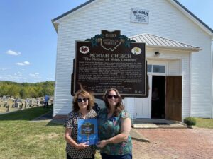
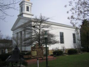
Moriah Calvinistic Methodist Church was organized on November 23, 1835, in the home of Daniel Edwards, Brynele. Although Welsh settled Gallia County in 1818, they did not build a church until more families arrived during the 1830s Welsh tide of immigration into Gallia and Jackson counties. They named their new church Moriah, meaning “appearance of Jehovah” in the Bible. Joshua Parry built the original log church in 1836 in the northwest corner of Moriah Cemetery. This was enlarged the following year and Enoch Thomas built the present church in 1846. Moriah Church, centrally located in the growing Welsh settlements, was the first in what became a circuit of 12 Welsh Calvinistic Methodist churches. For this, Moriah Church is known as Ein Mam ni oll or “the Mother of Us All.” (Continued on other side)
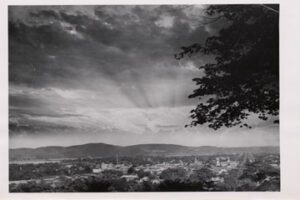
The hills before you were inspiration for the design of The Great Seal of the State of Ohio. The seal, first depicted in 1803, was often reconfigured until the present image was sanctioned by the Ohio General Assembly in 1967 and modified in 1996. In 1803 the law prescribed the sheaf of wheat to represent Ohio’s agricultural roots and the bundle of seventeen arrows to symbolize Ohio’s place as the seventeenth state in the Union. In the background is a range of hills, including Mount Logan, as viewed from Thomas Worthington’s estate, Adena, now a state memorial. (continued from other side)
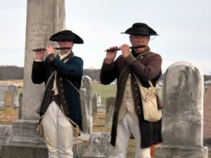
Field Musician Richard W. Thompson. Tunes played on fife and drum regulated a soldier’s life in camp and his actions on the battlefield. Heard over the roar of battle and through the haze of smoke, fifes and drums – field music – communicated orders to massed troops quickly. Richard Willoughby Thompson (c. 1742-1837), buried in Fancher Cemetery, was a field musician during the American Revolution and the War of 1812. According to his grandson Henry’s recollections from the 1920s, Thompson was born in Dublin, Ireland, and enlisted in the British army, where his service culminated in his capture while picking blackberries. He switched allegiances, joined the colonials, and was sent to Virginia. Thompson was appointed the Fife Major of the 5th Virginia Regiment and remained a Fife Major as Virginia units organized during the war. (Continued on other side)
In 1804 a group of neighbors in Granville, Massachusetts and Granby, Connecticut formed The Licking Company for the purpose of moving to “Newlands” in Ohio. Inspired and informed by the settlement of Worthington in 1803, the Company purchased 29,040 acres in the U.S. Military District. Advance parties surveyed and mapped a site, established a mill, and planted grain. The Company planned a public square, a school, library, quarry, burying ground, and property for the support of churches. In November and December 1805, some 150 emigrants in ox-drawn wagons arrived in their new home and built temporary shelters on the designated public square. On December 9 through 12 1805, Company members selected their Granville lots in an auction that was described as peaceable and honest.
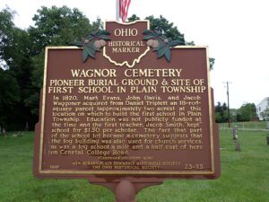
In 1820, Mark Evans, John Davis, and Jacob Waggoner acquired from Daniel Triplett an 18-rod-square parcel (approximately two acres) at this location on which to build the first school in Plain Township. Education was not publicly funded at the time and the first teacher, Jacob Smith, “kept” school for $1.50 per scholar. The fact that part of the school lot became a cemetery suggests that the log building was also used for church services, as was a log school a mile and a half east of here on Central College Road. (continued on other side)
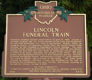
President Abraham Lincoln’s assassination on April 14, 1865, created a national tragedy, and the nation mourned as his body was transported by rail from Washington D.C. back to Springfield, Illinois, where he would be buried. In Champaign County, Ohio, the train passed through Urbana and Westville late at night April 29 and traveled through the Blue Hills for eight miles of dangerous curves and hills to arrive in St. Paris. Reaching the summit in St. Paris, the train paused near Springfield Street for a brief memorial service. Christian McMorran and Rachel Furrow, representing a crowd of local residents who stood in silence, laid a wreath on the coffin. The train would continue to Conover, Fletcher, Piqua, and Bradford on its way to Richmond and Indianapolis and then Chicago, finally arriving in Springfield, Illinois, on May 3, 1865.