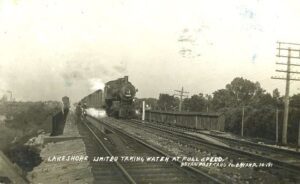
Like many nineteenth century communities in Ohio, Stryker owes its birth and early growth to the railroad industry. Stryker, named for Rome, New York, attorney and railroad executive John Stryker, was surveyed on September 19, 1853, beside the proposed Northern Indiana Railroad. For more than fifty years, “track pans” at Stryker allowed steam locomotives to take on 5,000 gallons of water while traveling at forty to fifty miles per hour, saving valuable time, “the principal enemy of railroad schedules.” On July 23, 1966, the U.S. rail speed record of 183.85 miles per hour was set through Williams County, including through Stryker. The Stryker depot was constructed in 1900 and placed on the National Register of Historic Places on August 7, 1989. (continued on other side)
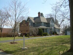
Harold Hart Crane was born at this site on July 21, 1899, to Grace Hart Crane and Clarence A. Crane, the inventor of Lifesaver Candies, and lived here until the age of three. “A born poet,” according to e.e. cummings, Crane dropped out of high school in 1916 and moved from Cleveland to New York City to focus on a literary career. Mainly self-educated, Crane drew his influence from the writings of Walt Whitman and Emily Dickinson. His major work, The Bridge (1930), uses the Brooklyn Bridge as the perfect metaphor to celebrate contemporary urban life. Uniquely lyrical in structure and full of imagery, it is considered one of the three major poetic sequences of the first half of the twentieth century along with T.S. Eliot’s The Waste Land and William Carlos Williams’ Paterson. Crane died on April 26, 1932.
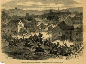
General John Hunt Morgan of Kentucky led a force of Confederate calvarymen into Meigs County during a forty-six day raid north of the Ohio River. The advance forces burned Benjamin Knight’s carding mill and sawmill, the Shade River Bridge, and pillaged local businesses in Chester on July 18, 1863, while waiting for the rest of the column to catch up. This two-hour halt delayed General Morgan’s arrival at the ford at Buffington Island until after dark, allowing Union troops to arrive before he could make his escape. General Morgan surrendered eight days later near West Point in Columbiana County, the northernmost point ever reached by Confederate forces during the Civil War.
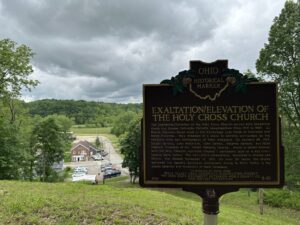
The Exaltation/Elevation of the Holy Cross Church served both Byzantine Greek and Russian Orthodox Catholic congregations from 1915 to 1967. As Slovak migrants found work in the Cambridge coal fields of Guernsey and Noble Counties, they dreamed of a place to worship surrounded by the religious rites and iconography of their homeland. On January 26, 1914, Daniel Varhola, John Fetkovich, John Demko, Stephen Varhola, and Mike Zeleznik (trustees of the “Greek Catholic Church, which is united forever with the Holy Catholic Apostolic Church”) purchased land on a hill overlooking Belle Valley. The two-sided cornerstone, inscribed in Russian and Slovak, was blessed November 15, 1915. For over 50 years, the church anchored the Eastern European immigrants living in Belle Valley to the ethnic identity and traditions of their homeland. (Continued on other side)
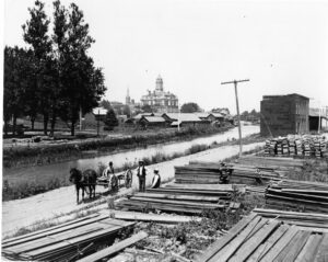
Miami & Erie Canal and Napoleon’s First Cemetery. The Miami & Erie Canal stretched approximately 250 miles from Cincinnati to Toledo. Napoleon and other towns on the Maumee River’s banks were on a slackwater section of the canal. Between 1825 and 1845, laborers constructed the canal using shovels, picks, wheelbarrows, and horse and mule-drawn carts. In Henry County, Napoleon, and elsewhere, German and Irish immigrants and area farmers did the work and were paid around 30 cents a day. As the canal brought more people and business to the area, villages such as Florida, Damascus, and Texas flourished and the county seat of Napoleon boomed. The canal and consequent growth took their tolls, however. Sickness and disease such as “ague” (malaria) and cholera spread and carried off many. Napoleon’s first cemetery was located in the vicinity of 500 East Clinton Street, near the route of the canal.
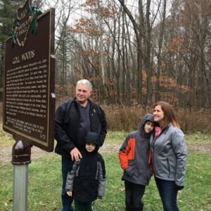
Two Deputy U.S. General Land Office Surveyors traversed Goll Woods: Benjamin Hough in 1815 and Captain James Riley in 1821. Hough (1772-1819) established the Michigan Meridian in 1815 and was county and state office holder in Ohio. Riley’s life was more tumultuous. Riley (1777-1840) captained the merchant ship Commerce, which wrecked off the Saharan coast in 1815. Riley and crew were enslaved for four months until ransomed by British diplomat William Willshire. In 1817, Riley published a famous account of his time in North Africa, and, in 1819, was appointed a surveyor by Surveyor General Edward Tiffin. Moving to Northwest Ohio, Riley named the village he founded in 1822, Willshire, for his deliverer. Riley returned to New York in 1826 and to the sea, where he died. Riley’s book went through more than twenty editions by 1860 and Abraham Lincoln credited the account as one that influenced him deeply.
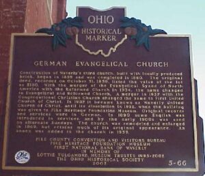
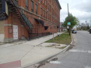
Construction of Waverly’s third church, built with locally produced brick, began in 1859 and was completed in 1860. The original deed, recorded on October 31, 1859, listed the value of the lot as $180. With the merger of the Evangelical Synod of North America with the Reformed Church in 1934, the name changed to Evangelical and Reformed Church. A merger in 1957 with the Congregational Christian Church changed the name to First United Church of Christ. In 1987 it became known as Waverly United Church of Christ, until its dissolution in 1992, when the building was given to Pike Heritage Foundation Museum. Original records and services were in German. In 1890 some English was introduced in services, and by the early 1900s was used on alternate Sundays. The church was remodeled and enlarged in 1869, but retains much of its original appearance. An annex was added to the church in 1959.
The pioneer village of Vistula is now bounded by Walnut, Champlain, Chestnut, Magnolia, and Summit streets. Established in 1833 by Benjamin F. Stickney and Edward Bissell, Vistula was merged with its rival, Port Lawrence, and in 1837 both villages were incorporated as Toledo. The Vistula Historic District, Toledo’s oldest neighborhood, was listed on the National Register of Historic Places in 1978.