, OH
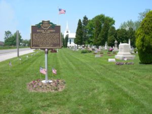
According to fellow World War II veteran and U.S. Senator Bob Dole, Roger T. Durbin was “the public persona—the beacon—of the drive to build a National World War II Memorial in our nation’s capital.” It started with a conversation between Mr. Durbin and Congresswoman Marcy Kaptur at a local fish fry in February 1987. Enlisting Kaptur’s support, the work to create the memorial began. Described as a “gentleman with a square jaw, twinkling eyes, and churlish grin,” Mr. Durbin committed himself to serving others. He was a rural letter carrier, Richfield Township trustee, and coached Little League baseball. He was a veteran of the Tenth Armored (Tiger) Division and saw action at the Battle of the Bulge. The National WWII Memorial was dedicated May 29, 2004. Although Mr. Durbin did not live to see that day, his determination is the reason it stands.
, OH
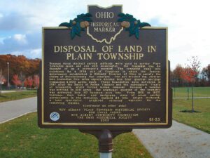
Because three distinct survey methods were used to survey Plain Township lands and are still meaningful, the township can be thought of as a surveyor’s museum. The township came into existence by a 1796 act of Congress in which the federal government established a Military District of Ohio to satisfy the claims of Revolutionary War veterans. The act divided the district into townships five miles square divided into four quarter-sections containing 4,000 acres each. These boundaries were surveyed in 1797 after the Battle of Fallen Timbers and the subsequent Treaty of Greenville, which forced Indian removal. Because a veteran was entitled to 100 acres, the southeast quarter of the township was surveyed into 40 hundred-acre lots. From 1801 to 1805, veterans, their heirs, and assignees, none of whom settled permanently in the township, claimed 24 lots. Abijah Holbrook, a land speculator, acquired veterans’ warrants for the remaining sixteen. (continued on other side)
, OH
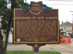
A tavern and inn, for which Noble Landon (1783-1866) obtained a liquor license in 1835, formerly occupied the southeast corner of High and Main streets. In 1837 Landon and William Yantis laid out the town of New Albany in 50-by-100-foot lots, with Landon’s lots lying on the east side and Yantis’ on the west side of High Street. Landon was born in Litchfield, Connecticut, lived as a young man in St. Albans, Vermont, and migrated to Licking County, Ohio, in 1810. He was the first clerk and first Justice of the Peace in St. Albans Township and first postmaster in Johnstown and later in New Albany. In addition to contributions as a builder-developer, Landon gave to the village lore the story of a remarkable conversion. Long known as a heavy drinker, he suddenly ordered kegs of whiskey he owned to be carried into the street and broken. He then attended church regularly. (continued on other side)
, OH
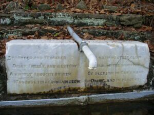
This spring fed watering trough was erected by Giles Richards (1792-1876) in 1867 and has provided water to travelers and livestock ever since. Richards owned and operated a number of enterprises in Colerain Township starting in the early 1800s. Upon the marble slab just above the iron trough is engraved: Stranger and traveler Drink freely and bestow A kindly thought on him Who bade this fountain flow Yet hath no other claim Than as the minister Of blessings in God’s name Drink and in peace go
, OH
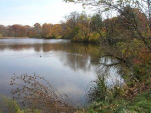
In 1822, Ralph Russell, a Connecticut pioneer who had settled in Warrensville Township ten years earlier, founded the North Union Shaker Community. The Shakers created Horseshoe Lake in 1852 when they built a dam across Doan Brook and harnessed its waterpower to operate a woolen mill near Lee Road and South Park Boulevard. The community disbanded in 1889; its 1,366 acres were eventually sold to a real estate syndicate from Buffalo, New York, the Shaker Heights Land Company. In 1896, this group deeded the Shaker Lakes Parklands to the City of Cleveland to preserve the green space in perpetuity. Ten years later, the Van Sweringen Company began to develop Shaker Heights Village as a Garden City suburb where William J. Van Aken served as mayor from 1915 until 1950. In the 1960s local residents successfully fought the proposed Clark Freeway, saving Horseshoe Lake and the Parklands from destruction.
, OH
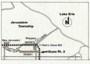
To utilize the area’s rich timber stands, Detroit industrialist Eber Brock Ward (1811-1875) built a canal around 1870 in what was then Oregon Township, Lucas County. Known as Ward’s Canal, it stretched approximately 2-3/4 miles through wetlands to Lake Erie. Through the canal passed timber sawn at Ward’s mills and ships from his boatyards. Two settlements formed to house workers: Shepherdsville, renamed Bono in 1898, and New Jerusalem. (Continued on other side)
, OH
In 1915, real estate developers William B. Welles and Badger C. Bowen formed the Ottawa Park Realty Company and in 1917 platted 323 residential lots near Toledo, Ohio. Named “Westmoreland” for the similarities with the rolling landscapes of Westmoreland County, Virginia, the neighborhood was placed on the National Register of Historic Places in 1986. Westmoreland features 215 original homes, most representing architectural Revival styles of the early 20th century including those of the Colonial, Jacobethan/Tudor, Italianate, French, and Spanish Revivals. This marker commemorates the centennial of the founding of Westmoreland. (Continued on other side)
, OH
Opened in July 1862, the 35 1/2-acre site here in Brooklyn Township’s University Heights served as the largest Civil War army camp of rendezvous, organization, and training in northeast Ohio. It was bordered by Hershel (now West 5th) and University (now West 7th) streets and Railway and Marquard avenues. A wartime high of 4,151 volunteers occupied the barracks here on December 5, 1862. Lieutenant William Dustin of the 19th Ohio Volunteer Artillery wrote, “It was a table land above the city and admirably suited to the use of a camp of instruction. It was as level as a floor and carpeted with grass. The capacious pine barracks held about 25 each of the battery’s men.” A total of 15,230 men trained here during the war–4.9 percent of the 310,646 enlistments in Ohio. More than 11,000 soldiers were discharged here at war’s end. It closed in August 1865. (continued on other side)


