, OH
The Village of Tadmor is significant as being the location of one of the most important centers of transportation in early Ohio history. As early as 1809, keelboats were poled up river from Dayton to load and unload freight in the village. By 1837, the Miami and Erie Canal had reached Tadmor, connecting it to the Ohio River in the south and Lake Erie in the north. In the 1830s, the National Road was constructed through Tadmor, connecting it to points east and west. In 1851, the Dayton & Michigan Railroad established freight and passenger service to the growing town. Residents hoped that Tadmor’s strategic location would help it prosper, however, successive flooding on the Great Miami River stifled growth. Tadmor was finally abandoned when a dam constructed by the Miami Conservancy District in 1922 to retain water during flooding made the site uninhabitable.
, OH
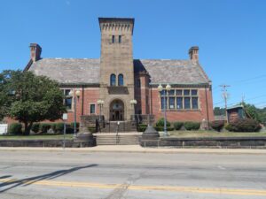
Andrew Carnegie was born in Dunfermline, Scotland. He immigrated to Allegheny City Pennsylvania with his family when he was 13. While operating the telegraphs for the Pennsylvania Railroad, Carnegie perceived the great need for steel in the railroad industry. With this insight, he founded the Carnegie Steel Corporation which operated for 35 years before he sold it to J.P. Morgan in 1901. Andrew Carnegie wrote the article, “Wealth” in 1889 in which he said that a responsible person of wealth should help his fellow man. Carnegie’s philanthropy provided 2,509 libraries throughout the world. Carnegie was already familiar with the city when he wrote a letter to offer funds to build the Steubenville library on June 30, 1899.(Continued on other side)
, OH
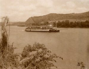
Captain Gordon C. Greene, a veteran riverman, was born in Newport, Ohio, on September 8, 1862. In 1890 he started the “Greene Line” with the “Henry K. Bedford,” a small shallow draft steamer; he owned twenty-five packets in his lifetime. The “Greene Line” later became the “Greene Steamboat Line” then the “Delta Queen Steamboat Company,” with the original port at the Newport Landing. The Greene family launched packets for tours on the Ohio River and its tributaries. Captain Greene died in 1927 at Hyde Park, Cincinnati, and is buried in Newport Cemetery. (continued on other side)
, OH
In recognition of its noteworthy representation of the history, culture, and architecture of the Western Reserve, Burton Village’s Historic District was placed on the National Register of Historic Places in 1974. The Historic District, an area of approximately 20 acres surrounding the Village Green and along streets at the north end of the Green, includes 15 buildings of historical significance built between 1815 and 1891. Preserved within the District are commercial and public buildings and private dwellings that reflect the cultural and architectural development of a village of the Western Reserve of Ohio during the 19th century. Buildings in the predominant architectural styles of the 19th century are all represented in the Historic District, including Western Reserve, Greek Revival, Second Empire, Italianate, and Queen Anne. [Continued on other side]
, OH
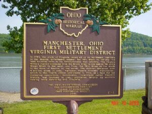
In 1784, the state of Virginia ceded all of its Northwest Territory to the federal government except for this tract to satisfy the land bounties owed to its Revolutionary War soldiers. The Virginia Military District extended from the Scioto River in the east to the Little Miami River in the west, and from the Ohio River on the south to the town of Kenton in the north. The District contained over 4 million acres of land. Nathaniel Massie founded Manchester, which is the fourth oldest settlement in Ohio, as a base for his surveying operations. Manchester, sometimes called Massie’s Station, was founded in 1791, populated largely by settlers coming from Kentucky and Virginia.
, OH
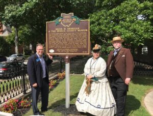
The Seneca County Museum is the former home of local businessman Rezin W. Shawhan. Born in 1811, Shawhan arrived in Tiffin in 1832 and opened a store with his brother Lorenzo. The store’s success enabled Rezin to expand his interests into real estate and banking. Upon his death in 1887, his estate was valued in excess of $1 million. Much of it was bequeathed to his second wife, Della Watson Shawhan. He also left bequests to Heidelberg College, the library, and Tiffin’s churches. The Greek Revival-style house, built in 1853, was passed down through the family, ending with Lynn Troxel who, in 1941, donated it to the county for use as a museum. The house is a part of the Fort Ball-Railroad Historic District, listed on the National Register of Historic Places in 1979.
, OH
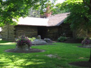
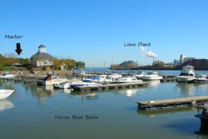
In the early 1800s, Jabez Wright, an early Huron County judge, purchased a large tract of lakeside land on the north side of what is now Cleveland Road. There Wright built an eight-room farmhouse that later served as a “station” on the fabled Underground Railroad, playing a vital role in aiding fugitive African-American slaves to freedom. Beneath Wright’s farmhouse was a sixteen foot-wide and ninety foot-long tunnel. Escaped slaves entered the passage through a trap door in the home’s basement and exited into a corn crib located a mere one hundred feet from Lake Erie. There the slaves awaited the arrival of rowboats transporting them to vessels heading north to Canada. (Continued on side two)
, OH
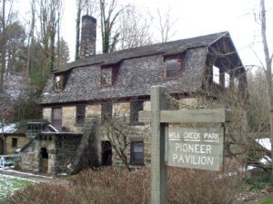
Pioneer Pavilion, one of the oldest structures in Youngstown, is a rare surviving example of early nineteenth-century industry. James Heaton constructed this sandstone building in 1821 as a mill for carding and fulling wool. A millrace from Mill Creek and a waterwheel on the west side supplied the power. In the 1830s and 1840s, the woolen mill was converted to a storage facility for the nearby Mill Creek Furnace and later served as a cattle barn. In 1891, Youngstown attorney Volney Rogers purchased the property for Mill Creek Park, renovating the building in 1893 as a dining and dancing facility, and naming it Pioneer Pavilion. Generations of area residents spanning three centuries have celebrated social events in this historic landmark.


